• Hello, please take a minute to check out our awesome content, contributed by the wonderful members of our community. We hope you'll add your own thoughts and opinions by making a free account!

Pattern December Doldrums 2025 🎄 ❄️

An important thing to note about this January compared to 2022:

This January honestly looks quite a bit different, big thing being there isn’t a coherent Pacific MJO event & forthcoming +EAMT to give us a more +PNA/+TNH/-NAO type pattern.

Yeah it looks like I picked up on Jan 2022’s progression right on Christmas thereabout.


Did see a few very early hints of Jan 2022 being good as far back as mid-December
 
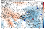
We’re currently watching an S2S tug-of-war play out between the +AAMa/anomalous westerly flow in the tropical Pacific trying to extend the Pacific Jet vs -EAMT & beta advection from the ridge itself trying to constantly retract the jet and shift the Aleutian high westward.

These 2 things competing against each other plus La Nina is why we have a stationary wave pattern w/ Aleutian ridging in the North Pacific

We honestly need to extend the Pacific Jet again to break this stalemate, because those +AAMa aren’t going anywhere. Hence, retracting the jet doesn’t fix the issue.
IMG_6951.jpeg
IMG_6953.png

IMG_6952.png
 
You made your point 10 posts ago.

You've always been one of my favorite posters, but I am tired of logging on and seeing passive aggressive strawman-type posts.

This isn't just you. But we're going to put a stop to that. It just makes everybody mad. I'm going to call out every post where I see it from now on.

If you or anyone else has a beef with how someone responds to a post of yours when you are providing good analysis, then PM them and work it out or let the staff know that it's bothering you. Or I can set up a winter battle thread and we can have a free for all.

I am so sick of the constant passive aggressive stuff every time the weather turns bad. It is like clockwork every winter. The staff is going to start muting posters if we don't get that under control.


I don't care if you don't like my posts....that's a you problem. Piss off with your passive aggressive attacks on me...just because you are red tagged doesn't give you the right to directly attack people. I didn't directly attack you or anyone else...

But I get it...sarcasm is lost on the stupid.
 
We’re currently watching an S2S tug-of-war play out between the +AAMa/anomalous westerly flow in the tropical Pacific trying to extend the Pacific Jet vs -EAMT & beta advection from the ridge itself trying to constantly retract the jet and shift the Aleutian high westward.

These 2 things competing against each other plus La Nina is why we have a stationary wave pattern w/ Aleutian ridging in the North Pacific

We honestly need to extend the Pacific Jet again to break this stalemate, because those +AAMa aren’t going anywhere. Hence, retracting the jet doesn’t fix the issue.
View attachment 179144
View attachment 179142

View attachment 179143
Do you think it will extend enough?
 
We’re currently watching an S2S tug-of-war play out between the +AAMa/anomalous westerly flow in the tropical Pacific trying to extend the Pacific Jet vs -EAMT & beta advection from the ridge itself trying to constantly retract the jet and shift the Aleutian high westward.

These 2 things competing against each other plus La Nina is why we have a stationary wave pattern w/ Aleutian ridging in the North Pacific

We honestly need to extend the Pacific Jet again to break this stalemate, because those +AAMa aren’t going anywhere. Hence, retracting the jet doesn’t fix the issue.

View attachment 179144
View attachment 179142

View attachment 179143
Could you come in here with some good news for once lol.
 
I don't care if you don't like my posts....that's a you problem. Piss off with your passive aggressive attacks on me...just because you are red tagged doesn't give you the right to directly attack people. I didn't directly attack you or anyone else...

But I get it...sarcasm is lost on the stupid.
🤦‍♂️ 👍
 

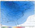
The 12Z GFS -NAO for week 2 remained strong:
IMG_6205.png


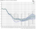
Per the maps, below, it looks like the 12Z GEFS likely has about as strong a -NAO as the prior 3 runs, if not a little stronger:

Classic NAO calc. is based on pressure anoms diff between Iceland and Azores: I see ~-2.2 std devs:
IMG_6203.png

H5:
IMG_6204.png
 
for those who care (me)

christmas afternoon wedge/chilly/not AN:
00z EPS --18/50 (36%)
06z AIFS-ENS -- 11/50 (22%)
00z GEFS -- 8/30 (27%)
06z GEFS -- 9/30 (30%)
12z GEFS -- 8/30 (27%)
12z AI-GEFS -- 0/30 (frown %)

side note, welcome to the party, AIGFS and AIGEFS. looks like no snow products from those yet.
55-60 is a W for Christmas to me at this point
 
If we can get a shortwave to eject east on the heels of a 50/50 low around December 30/31… we might have a tiny window to score. That’s what the 06z euro AI was showing and 12z euro shows it, but need the shortwave to speed up a little. Other models hinting at the same thing around the same timeframe. Something to watch for at least.
 
Last edited:
note my numbers are fairly generalized and not everyone within wedge zones was wedged in the ones i counted. a notable number of members had the idea but didn't execute very far south.
We are inching closer and closer to turning the entire week next week into a foggy insitu mess
 
12Z GEFS strong -NAO that starts in just 5 days and is the strongest -NAO for days 5-16 averaged out on any GEFS run back to at least Oct 31st:
View attachment 179153
I’m sure the MJO will go into phase 5 or something, to counteract this beautiful-NAO
 
It looks like Christmas might not be sitting by the pool weather for the RDU area after all. Temperatures on the Euro and GFS look to be about normal with highs in the mid 50s. It looks like it will be a boring day weather wise.
 
The model consensus is currently forecasting the strongest -NAO on Christmas as well as surrounding days since way back in 2010! In stark contrast, these 6 had a strong +NAO: 2011, 13, 15, 16, 23, and 24.
 
Natural gas closed up nearly 4%, easily its best day since Dec 5th. This is largely based on today’s forecast speculation that the forecasted dominant warmth may not be as widespread, intense, and/or long lasting in the E US as thought yesterday.
 
It looks like Christmas might not be sitting by the pool weather for the RDU area after all. Temperatures on the Euro and GFS look to be about normal with highs in the mid 50s. It looks like it will be a boring day weather wise.
You sit by the pool in the mid 50s F?
 
Natural gas closed up nearly 4%, easily its best day since Dec 5th. This is largely based on today’s forecast speculation that the forecasted dominant warmth may not be as widespread, intense, and/or long lasting in the E US as thought yesterday.
Just heard opposite during lunch time . Guess there basing this off NOAA s winter forecast
 
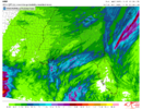
12z HREF for thursday rain. def had a few EPS members going for a decently widespread 0.6-0.7"+ up this way. decent signal from the NC/SC/GA tripoint back towards central AL as well

qpf_048h_pmm.se.f04800.png
 
So if we all come on here and post that we wish for 70 degrees in January, does that mean we will get cold?
 
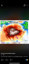
Euro weeklies starting to look a bit more realistic in early January with a break between the southern plains ridge & -NAO

Once again, nearly copy & pasting the most recent 30-year Nina mean pattern

IMG_6954.png

IMG_6955.jpeg
 
Back
Top