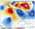
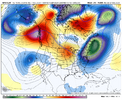
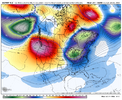
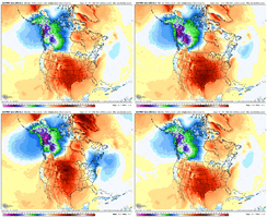
• Hello, please take a minute to check out our awesome content, contributed by the wonderful members of our community. We hope you'll add your own thoughts and opinions by making a free account!

Pattern December Doldrums 2025 🎄 ❄️

So what Jwall just shared does give me some hope hopefully we can get things to work out!!


Sent from my iPhone using Tapatalk

This scenario seems like a needle in a haystack to me. The end of the GFS had pretty much all of those main features in those locations and the 850s are boiling hot. And so are surface temps...at least as it relates to snow.
 
With the abnormally warm air locked in until through the New Year, at least, I would not be surprised if some of us will be chasing severe weather instead of winter weather if we can get the right atmospheric dynamics. It wouldn't be the first time this has happened.
 
Greensboro: Multiple nickel/dime events Jan 1985

Climatological Data for Greensboro Area, NC (ThreadEx) - January 1985
Click column heading to sort ascending, click again to sort descending.
1985-01-01754660.520.4400.000.00
1985-01-02654856.516.5800.700.00
1985-01-03483240.00.02501.370.00
1985-01-04383235.0-4.93000.600.00
1985-01-05422634.0-5.8310TT0
1985-01-06462234.0-5.73100.000.00
1985-01-07533242.52.82200.000.00
1985-01-08453037.5-2.12700.000.00
1985-01-09402432.0-7.53300.000.00
1985-01-10302728.5-11.0360TT0
1985-01-11472536.0-3.52900.000.00
1985-01-12372229.5-9.93500.000.00
1985-01-13462234.0-5.43100.000.00
1985-01-14462033.0-6.43200.000.00
1985-01-15361927.5-11.93700.000.00
1985-01-16411528.0-11.4370TT0
1985-01-17362832.0-7.43300.200.5T
1985-01-18442434.0-5.43100.000.00
1985-01-19493240.51.12400.000.00
1985-01-2036-615.0-24.55000.060.5T
1985-01-2121-86.5-33.05800.000.0T
1985-01-2235419.5-20.14500.000.0T
1985-01-23401226.0-13.63900.000.00
1985-01-24471832.5-7.23200.000.00
1985-01-25502437.0-2.82800.000.00
1985-01-26331725.0-14.84000.000.00
1985-01-27391326.0-13.93900.05T0
1985-01-28333031.5-8.53300.314.1T
1985-01-29362430.0-10.13500.000.04
1985-01-30402834.0-6.33100.000.02
1985-01-31433438.5-1.92601.050.0T
Sum1317716--99204.345.1-
Average42.523.132.8-6.9----0.2
Normal49.330.139.7-78403.392.9
Geeze -8 and -6 that must have been when we set our record up here. I remember my Mach1 fuel line froze twice on the way to college one of those days. Lots of water lines were breaking too. Let's not do quite that again.
 
This is a forecast in the Carrollton area. But now they took snow out of the forecast.
There was some crazy aggressive single GEFS member showing 6 inches in Atlanta from that storm yesterday, but obviously a substantial outlier. Not sure how that ended up transferring into local weather data/forecasts as that was the only indication that I saw.
 
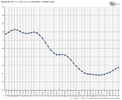
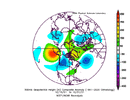
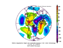
I didn’t see anyone talk about the -NAO on steroids on the 18Z GFS for 12/23+, which is understandable since it’s just a GFS run. But look at how much the NAO plunged on it:

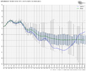
12/16 18Z GFS NAO: plunges 12/23
IMG_6172.png

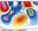
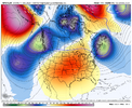
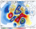
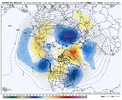
18Z GFS H5 for 12/23:
IMG_6173.png

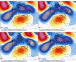
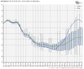
But what makes this more interesting is the NAO drop on the last few GEFS for the same time: keep in mind this is only 7 days out!

Last 3 GEFS for 12/23:
IMG_6174.gif

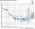
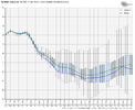
18Z GEFS NAO: green line is mean
IMG_6170.png

Compare that to the 6Z GEFS NAO: follow the green line (mean)
IMG_6175.png
 
Kudos to cfs catching 1st glimpse of this. Just had a monster 935mb storm roll up through the greenland, scandonavian region yesterday. Shook it all up imo. Good times ahead? Should see the ensemble means start catching on to this over next day or two

Edit: Kudos was to yesterday 12z cfs run. The 0z cfs last night very LR waffled around and doesn't have the ridge bridge like previous run. But as FRO and Gawx posted some other ops caught the -NAO potential. Hopefully it comes to pass, as its the only life preserver we have next 10-15 days to shake up the pattern. Our Friend over near Alaska isnt gonna budge for a while, so maybe we can bridge over to him, negate some of the neg influence.
 
Last edited:
This scenario seems like a needle in a haystack to me. The end of the GFS had pretty much all of those main features in those locations and the 850s are boiling hot. And so are surface temps...at least as it relates to snow.

I agree. We can point to all the examples we want to see verify, but it’s gonna be tough to pull off here.

The only way we get something substantial in this sort of pattern is to shorten the wavelengths appreciably and force something to cut off underneath a west-based -NAO block that retrogrades west of Greenland or so.

It’s a lot easier to pull this kind of solution off in the “shoulder” part of the winter/February or March when the mean wavelengths are shorter vs the dead of winter
 
Yes, I agree with you.
Its sofrustrating at the amount of posts telling people to move somewhere else if they expect cold. Even average temperatures across the south are mild to cool during december... not 70 degrees. Chastising people for not being excited about AN or MAN temps when its supposed to be in the 50s is unreasonable. Same could be said for those who enjoy warmth. You want warm in december ? Move to Miami. Just spent this past week there and it was in the mid 80s and raining. No thanks.

We get hot 70% of the year, hot is fine in summer, i want heat in summer. But in winter I want it to be what its supposed to be; which generally speaking is not 70 degrees on christmas for most of our forum.

In the end, none of us can control it, but those posters telling people to move is unhelpful discussion.
Late to this conversation lol but I think it’s funny to point out to those who say “if you want cold move north”… with the warmup that’s coming you’re gonna need to move reaaally far north 🤪
 
The last time we had 2nd half of Dec with a stout aleutian ridge was Dec 2021...and Jan 2022 flipped and was quite wintery.

Fingers crossed...🤞

View attachment 179128

View attachment 179127

Still the biggest snowstorm I've seen here to start February... It snowed for 2 days straight

Some of the events lately have been like 2 hours haha
 
For many years now I've kept my thinking simple and have pinned my hopes on a positive PNA. We've just had a very cold first half of December, but the PNA has been negative the whole time. But to start up the month, we've had a negative NAO and initially a negative AO which has gone strongly positive -->As others have noted, we still have some cold air in NW North America.

The future of the indices are looking like:
PNA - Will continue to stay negative into the LR. Usually bad, but so far hasn't hurt us much; maybe for gulf storms...etc.
AO - Was initially negative in early December but has gone strongly positive. This is supposed to go negative in the LR. GOOD
NAO - Initially negative in early December but has gone positive. Looks to go back negative to end the month. GOOD

So, I guess I can take more favor in the NAO, if it gets cold


The last time we had 2nd half of Dec with a stout aleutian ridge was Dec 2021...and Jan 2022 flipped and was quite wintery.

Fingers crossed...🤞

View attachment 179128

View attachment 179127

The PNA flipped from -2.6 in Dec of 2021, the most -PNA Dec back at least to 1950, to +1.0 in January of 2022. That rise of 3.6 is the largest Dec to Jan on record. The 2nd largest rise from Dec to Jan is 3.2 (-1.6 to +1.6) in 1984-5 while the 3rd largest rise is 3.1 (-1.8 to +1.3) in 2010-1. All three of these were during La Niña. Currently, the GEFS is forecasting Dec as a whole to end up near -1.7.

IMG_6195.png

 
The PNA flipped from -2.6 in Dec of 2021, the most -PNA Dec back at least to 1950, to +1.0 in January of 2022. That rise of 3.6 is the largest Dec to Jan on record. The 2nd largest rise from Dec to Jan is 3.2 (-1.6 to +1.6) in 1984-5 while the 3rd largest rise is 3.1 (-1.8 to +1.3) in 2010-1. All three of these were during La Niña. Currently, the GEFS is forecasting Dec as a whole to end up near -1.7.

View attachment 179133

Do you know if it was forecasted to flip back in December 2021 and if so how early in December was it forecasted? Just curious if this can flip suddenly without much notice.
 
Do you know if it was forecasted to flip back in December 2021 and if so how early in December was it forecasted? Just curious if this can flip suddenly without much notice.
I remember Webb was on here calling that pattern progression spot on starting about Christmas and others starting picking up on it a week later
 
Do you know if it was forecasted to flip back in December 2021 and if so how early in December was it forecasted? Just curious if this can flip suddenly without much notice.

I remember Webb was on here calling that pattern progression spot on starting about Christmas and others starting picking up on it a week later

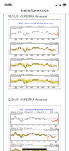
At first I was thinking that would be tough to locate. But then I checked my pics and luckily I have several GEFS PNA forecasts from Dec 21-Jan 22!

Here were the 12/15/21 and 12/26/21 PNA forecasts. Note the 12/26/21 forecast, which went through 1/9/22. All members were 0 to -2. But the actual 1/9/22 ended up being +0.2. So, it was too slow in predicting the turn to a +PNA:
IMG_6198.png


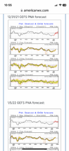
Here were the 12/31/21 and 1/5/22 forecasts, which go through 1/14/22 and 1/19/22, respectively. They had finally turned to +PNA but weren’t positive enough as 1/14 was actually +0.7 and 1/19 was actually +1.0 vs these forecasts of ~+0.4 and ~+0.1, respectively:IMG_6199.png

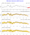
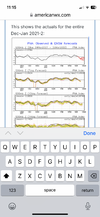
This final image shows the actuals for the entire Dec-Jan 2021-2:
IMG_6202.png

@Webberweather53

**Edited for correcting final image
 
Last edited:
I remember Webb was on here calling that pattern progression spot on starting about Christmas and others starting picking up on it a week later

Yeah it looks like I picked up on Jan 2022’s progression right on Christmas thereabout.

January phase 7 trying to make some magic happen.

View attachment 99123
View attachment 99122

Did see a few very early hints of Jan 2022 being good as far back as mid-December
Here's an animation of this same composite at -5 thru +20 lag. It's not perfect by any means, but I believe the overall idea here is correct. Lots of ups and downs the next couple weeks or so, a small warm-up at positive lag in response to the retrograding -EPO, but then the pattern turns very favorable for cold/snow about a week or two after that (which translates to early-mid January here).

View attachment 97869

January phase 7 trying to make some magic happen.

View attachment 99123
View attachment 99122

The more I’ve looked at the extended today, the more I think a real pattern change is around the proverbial corner (subseasonally speaking) in the N Pacific. Mountain torque events are a critical component to meridionally flux momentum between the tropics and mid-latitudes on subseasonal/week-to-week time scales. The one that’s currently ongoing over E Asia is timed pretty ideally to provide us with a pattern change in the N Pacific during early January. The positive angular momentum anomalies that have been building up in the tropics the last several weeks are probably going to move into the extratropical Pacific, favoring an extended/strong Pacific Jet, a stronger Aleutian low, & less negative &/or positive PNA through mid month


View attachment 99193View attachment 99192
 
Back
Top