• Hello, please take a minute to check out our awesome content, contributed by the wonderful members of our community. We hope you'll add your own thoughts and opinions by making a free account!

Pattern December Doldrums 2025 🎄 ❄️

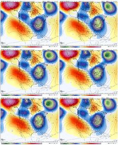
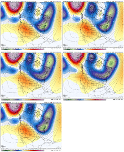
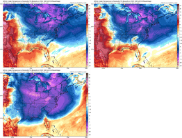
I'm not sure what to think at this point. I've come to the conclusion that this pattern we're in with the -EPO/-PNA is not good for mby and snow chances (Alaskan block is too far north/west). This results in a trajectory of the cold, shortwaves and the PV too far NE IMO. I've had enough of the cold/cold rains for a while, and the below isn't really that unwelcome to me at this point.

But yeah, the models may correct, and the trough may still push back to SE Canada, and squash the ridge our way a bit, but I'm not sure that gets us any closer to a snow event in the SE (more snow for VA/north though probably). The pacific jet actually looks like it moves east at this time to a good location, so while still in phase 8, I'm not sure what we need to root for. Just looking for a pattern change to mix things up at this point.
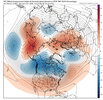
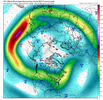
1765201034599.png1765201198908.png
 
Nothing spells loosing like a monster LP parked up off the coast of Alaska / swallowing The NE Pacific, sitting there spinning its wheels. a Positive PNA, monster ridge up the west coast of US/Canada is always Numero UNO. Everything else, mjo, nao etc is fodder without proper ridging out there. Hope the models are off LR this a.m. in how they place, align everything. If not, are goose gets cooked from next weekend through Christmas.

Trof just anchors in place off Alaska on every ensemble and op. What a 180.
Tread carefully. Winter may be showing its real hand this week.
 
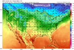
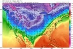
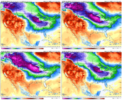
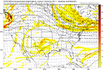
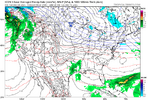
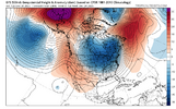
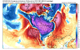
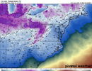
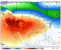
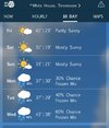
We have had some changes over the last 36 hours with our Arctic air potential for the end of the week into early next week. We have trended the first trough dig more to the South, which means we have ticked a little colder for the end of the work week. Regarding the Arctic blast with the second cold front, we have trended towards less digging of the trough. This was the trough that was showing very cold Arctic air for the weekend into early next week. We now have warming trend with this..

Sucks. Hopefully we start reversing this timeframe today.
ecmwf-ensemble-avg-namer-z500_anom-1765173600-1765422000-1765422000-20.gifecmwf-ensemble-avg-conus-t2m_f_anom-1765173600-1765486800-1765486800-20.gifecmwf-ensemble-avg-namer-z500_anom-1765173600-1765648800-1765648800-20.gifecmwf-ensemble-avg-conus-t2m_f_anom-1765173600-1765670400-1765670400-20.gif
 
We have had some changes over the last 36 hours with our Arctic air potential for the end of the week into early next week. We have trended the first trough dig more to the South, which means we have ticked a little colder for the end of the work week. Regarding the Arctic blast with the second cold front, we have trended towards less digging of the trough. This was the trough that was showing very cold Arctic air for the weekend into early next week. We now have warming trend with this..

Sucks. Hopefully we start reversing this timeframe today.
View attachment 178504View attachment 178506View attachment 178507View attachment 178509
As one who enjoys intense cold, I hate it. That said, absent the previously forecasted deep eastern trough that suppressed everything to Central America, perhaps this glancing blow will leave room for a currently unseen disturbance to cause some mischief for some of us early next week.
 
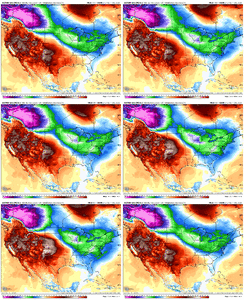
I’m not sold on anything past 180 hours or so on any of the operationals or ensembles, but also not so sure a pattern reshuffle would be a bad thing, especially for those of us south of I-40, heading into prime climo in early January. We may have to sacrifice a warm week or two to get back in the hunt, and hopefully things turn back around between Christmas and New Years, if not sooner.

Coincidentally, that 180 hour time frame on the EPS is when we begin losing a decent look and the entire lower 48 gets flooded with mild Pacific air for the remainder of the run, with the coldest air on the planet focused in NW Canada and Alaska. With the amount of moving pieces I doubt we get stuck in that configuration for very long.
1765209344328.gif
 
This goes back to what @griteater mentioned about the mjo, that even though the RMM charts show we're in phase 8, convection anomalies, kelvin waves etc show we're functionally in a more of a phase 6, thus the issue in the pacific and why the pattern is trying to ridge the conus. I've heard that in a few different places....seems like even when we're winning, we're losing.
 
This goes back to what @griteater mentioned about the mjo, that even though the RMM charts show we're in phase 8, convection anomalies, kelvin waves etc show we're functionally in a more of a phase 6, thus the issue in the pacific and why the pattern is trying to ridge the conus. I've heard that in a few different places....seems like even when we're winning, we're losing.
It's hard to know what to attribute the pattern to at times, but some of us enjoy trying at least. Things could change, but at the moment, the models are pretty consistent in showing us getting out of this unfavorable MJO slowdown over the next 10 days. Can see here the flip from unfavorable to favorable with the 2 images for Dec 12 and 18

Dec 8 VP Loop.gif


That's just the MJO which is of course just one element in the pattern. But it's a catch-22...the slowdown is there, but on the other hand, we wouldn't want to see the MJO rocket thru 8-1-2-3 and back into the MC. In the big picture, I still see the MJO as a positive influence post this slowdown and into mid-Jan

I definitely would like to see the long-range modeling look better though (Extended Ensembles / Weeklies etc)
 
It's hard to know what to attribute the pattern to at times, but some of us enjoy trying at least. Things could change, but at the moment, the models are pretty consistent in showing us getting out of this unfavorable MJO slowdown over the next 10 days. Can see here the flip from unfavorable to favorable with the 2 images for Dec 12 and 18

View attachment 178536


That's just the MJO which is of course just one element in the pattern. But it's a catch-22...the slowdown is there, but on the other hand, we wouldn't want to see the MJO rocket thru 8-1-2-3 and back into the MC. In the big picture, I still see the MJO as a positive influence post this slowdown and into mid-Jan

I definitely would like to see the long-range modeling look better though (Extended Ensembles / Weeklies etc)
A guy that posts at american weather mentioned the mjo is actually in phase 6, which is attributed to this KW. I hope it don't last long there, if true. RMM charts are not the most accurate
 
8aecf559629f985571b8ccdad71453c5.jpg

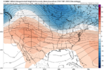
RTR change 7-14 day, a little colder for the SE than previous


Sent from my iPhone using Tapatalk
 
A guy that posts at american weather mentioned the mjo is actually in phase 6, which is attributed to this KW. I hope it don't last long there, if true. RMM charts are not the most accurate

Kevin,
The MJO is in phase 8 per RMM, the most widely followed/analyzed MJO charts and which also has 50 years of historical stats to analyze. In addition, the daily model MJO progs that are widely followed and posted at wx forums are of these RMM charts.

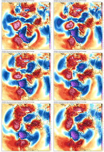
Phase 8 per RMM started on Dec 3rd. RDU had -8 F anomalies 12/3-7. In addition, the latest runs of the EPS have -8 for Dec 8th-17th. If that verifies, that would mean -8 anomalies for RDU for the 15 days Dec 3-17. That would tie it with 2002 for the 3rd coldest Dec 3-17th of the last 50 years with only 2010 (-13) and 1989 (-9) colder than 2025!

So, based on the last couple of EPS runs, RDU and much of the E part of the US will end up with one of the coldest periods on record for Dec 3-17, which is consistent in Dec with phase 8 more than any other phase:
IMG_5610.png
 
Kevin,
The MJO is in phase 8 per RMM, the most widely followed/analyzed MJO charts and which also has 50 years of historical stats to analyze. In addition, the daily model MJO progs that are widely followed and posted at wx forums are of these RMM charts.

Phase 8 per RMM started on Dec 3rd. RDU had -8 F anomalies 12/3-7. In addition, the latest runs of the EPS have -8 for Dec 8th-17th. If that verifies, that would mean -8 anomalies for RDU for the 15 days Dec 3-17. That would tie it with 2002 for the 3rd coldest Dec 3-17th of the last 50 years with only 2010 (-13) and 1989 (-9) colder than 2025!

So, based on the last couple of EPS runs, RDU and much of the E part of the US will end up with one of the coldest periods on record for Dec 3-17, which is consistent in Dec with phase 8 more than any other phase:
View attachment 178563
Amazing. And yet somehow Orlando is running +5 for December ?
 
If social media existed in December of 95, many would've been cliff-diving over and over because of numerous torch head-fakes the models were portraying in the mid-long range only to correct cold as we got closer. Grit mentioned earlier that the best analog to the current MJO/CCKW/ERW predigament is the Winter of 95/96 and I agree!

 
Yes, out of the entire E US, C and S FL have been warm and N FL NN. But overwhelmingly the E US has been quite cold.
My location hasn't been at or above 50 degrees since November. Warmest we have been this December is 49. We may come close on Dec 11th and again Dec 13. Remarkable and never happened before.
 
If social media existed in December of 95, many would've been cliff-diving over and over because of numerous torch head-fakes the models were portraying in the mid-long range only to correct cold as we got closer. Grit mentioned earlier that the best analog to the current MJO/CCKW/ERW predigament is the Winter of 95/96 and I agree!


This is the ultimate hope here and where I thought we would go. I always get nervous when this pattern breaks down that it's not coming back. We will see
 
Back
Top