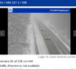
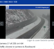
Rain/snow mix at NC State!
-
Hello, please take a minute to check out our awesome content, contributed by the wonderful members of our community. We hope you'll add your own thoughts and opinions by making a free account!
You are using an out of date browser. It may not display this or other websites correctly.
You should upgrade or use an alternative browser.
You should upgrade or use an alternative browser.
12/8/2025 Event - Repeat of Last Week?
- Thread starter packfan98
- Start date
my Falls Lake buddy. hoping we switch to full snow soonSnow mix here as well
Rain 42
BrickTamland
Member
Tsappfrog20
Member
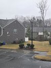
Rain and snow mix in Raleigh near Glenwood Avenue!
Sent from my iPhone using Tapatalk
Sent from my iPhone using Tapatalk
RDUHeatIsland
Member
I'm not seeing anything in Cary either. Just drizzleFlakes at Duke and State but none in Morrisville, that's strange
No, I live near that spot and there is just light rain here
Webberweather53
Meteorologist
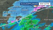
Makes sense we’re starting to see a rain/snow mix over parts of the Triangle where legit precip rates are occurring.
According to the 15z HRRR 2 hr forecast, our wet bulb zero heights have fallen to ~400m AGL now, supportive of some wet snow
According to the 15z HRRR 2 hr forecast, our wet bulb zero heights have fallen to ~400m AGL now, supportive of some wet snow
Tsappfrog20
Member
Kat Campbell just shared this
Sent from my iPhone using Tapatalk
Sent from my iPhone using Tapatalk
BrickTamland
Member
No precip at all here.
I almost switched over to all snow a few minutes back during heaver rates. Back to light mix. My temp is down to 34.
it's doing a funny thing in NE Durham right now where for a couple mins it is a sad little rain/snow mix then will suddenly shift to much more and bigger flakes...then go back to the puny mix. currently ive got solid wet flakes falling though without much rain mixed in, so im hoping this could be the final transition and will now stay to snow for the rest of precip time
ha, jinx -- wrote basically the exact same thing as you, posted within seconds of yours. im seeing the biggest flakes now that i have so far though, so hopefully that'll come your way down 98 soon!I almost switched over to all snow a few minutes back during heaver rates. Back to light mix. My temp is down to 34.
We need higher precip rates.it's doing a funny thing in NE Durham right now where for a couple mins it is a sad little rain/snow mix then will suddenly shift to much more and bigger flakes...then go back to the puny mix. currently ive got solid wet flakes falling though without much rain mixed in, so im hoping this could be the final transition and will now stay to snow for the rest of precip time
NorthHillsWx
Member
Started as a rain snow mix in north hills by millbrook but has since switched to all rain. Temps have fallen from 40.2 to 37.9. Don’t think it’s gonna get cold enough to stick here unfortunately. Latest HRRR wraps moisture in late and produces more snow here but that is TBD if it actually happens. Still looks like CC line is collapsing through Wake so expect mostly snow soon
the atmosphere is funny- the rain snow interface is rarely clean. It's interlaced with bubbles and perforations and pockets of rain on the cold side and bursts of snow on the warm side. mainly rates driven, which on the microscale level, is luck driven.
31.9 here. once we crossed 32.5ish we quickly transitioned from slush to fine pixie dust. once the surface got solved this was going to be a cold storm for us
31.9 here. once we crossed 32.5ish we quickly transitioned from slush to fine pixie dust. once the surface got solved this was going to be a cold storm for us
Mostly light snow now.
BrickTamland
Member
Hope that means it is close to starting here.Mostly light snow now.
that we do. at this rate, i dont necessarily anticipate ANYthing stickingWe need higher precip rates.
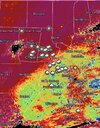
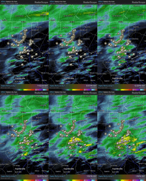
switching over to the more nw flow side of this system for the mountains now, with streamers working out into the sc border counties. can see brightbanding over rdu now as well as radar filling in to the northeast of the triangle
NorthHillsWx
Member
CC line right over my house now and just like that snow is mixing back in.
It's 38 at the house and after a brief period of light rain with a flake or two of snow mixed in the precipitation has stopped. Let's hope that heavier precipitation rates than are being advertised kick in and we can get at least a coating out of this. It would be nice to have that coastal low form closer to us. The milk and bread rush is on at our local grocery stores. (I don't know why for a storm like this or any storm for that matter)
Downeastnc
Member
Finally starting to see the dp drop lower than the temp, don't expect to see snow mixing here till near dark. Still hoping for a solid dusting....
each time i look at the window and see more ample snow falling, i think "ah, there we go!" ... and a few minutes later, i turn and look to see barely anything falling. it is somewhat amusing but also of course rather frustrating.
NorthHillsWx
Member
For the first time today, it is mostly snow now. Big mangled flakes
JP152
Member
blueheronNC
Member
For the first time today, it is mostly snow now. Big mangled flakes
Still haven't seen anything other than one or two minuscule frizzle flakes mixed into the rain here in Raleigh near NC State. Not a single big snowflake yet.
hey jimmy, peep the nw flow streamers getting out over the upstate. man if we had the temps for it, those are about as beefy of "escaped containment" NWF showers as i've seen around hereNice backbuilding west of RAL. Need to see a flip. Precip looks moderate in radar. Do itView attachment 178544
lexxnchloe
Member
Im going big for NE NC. 2-3 inches
BrickTamland
Member
Still nothing here in Wake Forest but snowing in Durham and Raleigh.
Nothing in Chapel Hill, saw 2 flakes and a little drizzle.Still nothing here in Wake Forest but snowing in Durham and Raleigh.
Flakes mixing in now
ehhhh it was for a very small period of time mostly light snow but now back to a rain/snow mix that is super light and ummm....the sun is trying to peek out. absolute disaster hahaStill nothing here in Wake Forest but snowing in Durham and Raleigh.
I don’t think I’ve seen a single snowflake yet IMBY.
Tsappfrog20
Member
Still nothing here in Wake Forest but snowing in Durham and Raleigh.
I just heard it’s snowing in Wake Forest from my roommate
Sent from my iPhone using Tapatalk

