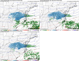
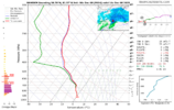
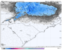
It does seem odd that with the location of the H5 features in the modeling that there isn’t more of a QPF response for your area and mine. Maybe Webb or one of the other mets on here can speak to more to thatcold air isn’t the issue this time. Dynamic cooling will do its job. Problem is you need enough moisture to saturate the column which could eat up about 0.25” of QPF to do it which is about the max you’re seeing south of the Va/NC line outside of the high country and extreme NW foothills. Like you said, I looked at the soundings and I could easily get in on the action if it wasn’t for the lack of moisture.
-
Hello, please take a minute to check out our awesome content, contributed by the wonderful members of our community. We hope you'll add your own thoughts and opinions by making a free account!
You are using an out of date browser. It may not display this or other websites correctly.
You should upgrade or use an alternative browser.
You should upgrade or use an alternative browser.
12/8/2025 Event - Repeat of Last Week?
- Thread starter packfan98
- Start date
1-7” north of Boone is an all time forecast
bogus moisture sourceIt does seem odd that with the location of the H5 features in the modeling that there isn’t more of a QPF response for your area and mine. Maybe Webb or one of the other mets on here can speak to more to that
Ross don't you think once this system gets off the land a bit it may tap into more moisture? I know it's an upper level low, but the last shot of snow tomorrow night might be legit.bogus moisture source
Tsappfrog20
Member
Seems like a small improvement on the 00z HRRR. Slightly more precip in NC and further south
Definitely more moisture further south on this run
Sent from my iPhone using Tapatalk
I'm expecting 0-12" here at Beech Mountain
Bigedd09
Member
This is encouraging for areas in the western piedmont. I think this is our best chance of snow showers

Sent from my iPhone using Tapatalk

Sent from my iPhone using Tapatalk
NWG_WX14
Member
RAP trended south at 00z as well.
Tsappfrog20
Member
DT’s Final Call

Sent from my iPhone using Tapatalk

Sent from my iPhone using Tapatalk
Cad Wedge NC
Member
We are at our forecasted low already (35 with dense fog). Curious to see what the temp will be when the precip moves in tomorrow morning.
maybe, i dont think it benefits anybody outside of the inner banks/tidewater though. cyclogenesis doesn't happen fast enough or close enough to the coastRoss don't you think once this system gets off the land a bit it may tap into more moisture? I know it's an upper level low, but the last shot of snow tomorrow night might be legit.
packfan98
Moderator
Anyone have access to an in house graf model, or seen a meteorologist post one lately? I’m desperate to see some better returns over NC, and it can sometimes pick up details missed in other models. (Grasping at Straws)
Bigedd09
Member
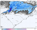
I’ll take this and call it a day

Sent from my iPhone using Tapatalk

Sent from my iPhone using Tapatalk
SimeonNC
Member
Is that the 3k NAMI’ll take this and call it a day
Sent from my iPhone using Tapatalk
35 and Clear via WRAL(That's pretty quick for it only to be 9pm)We are at our forecasted low already (35 with dense fog). Curious to see what the temp will be when the precip moves in tomorrow morning.
Sent from my SM-S156V using Tapatalk
Bigedd09
Member
Is that the 3k NAM
Nope 12k . 3k is much worse for snow lovers
Sent from my iPhone using Tapatalk
29 degrees. Dense fog advisory just issued. Gone look like it snowed by sunrise with or without real snow
Anyone have access to an in house graf model, or seen a meteorologist post one lately? I’m desperate to see some better returns over NC, and it can sometimes pick up details missed in other models. (Grasping at Straws)

241K views · 96 reactions | Meteorologist Claire Fry on Reels
 www.facebook.com
Sent from my iPhone using Tapatalk
SimeonNC
Member
How tf is the 12k and 3k that different?Nope 12k . 3k is much worse for snow lovers
Sent from my iPhone using Tapatalk
LukeBarrette
im north of 90% of people on here so yeah
Meteorology Student
Member
2024 Supporter
2017-2023 Supporter
blueheronNC
Member
3z NAM is storm cancel for all of NC. Onto January.
JP152
Member
That's a great spot for snow.View attachment 178442
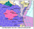
Quite the thump expected in the Whitetop/Mt. Rogers region
NWG_WX14
Member
For what it’s worth The FV3 is a nice hit for the majority on NC
Stars galore outside still fyi
SimeonNC
Member
Someone mentioned earlier that there was more moisture in MS than it depicted on the HRRR, how does it look now?
That was easier on the eyes
241K views · 96 reactions | Meteorologist Claire Fry on Reels
www.facebook.com
Sent from my iPhone using Tapatalk
Webberweather53
Meteorologist
There's some large-scale low-level warm advection here. Should at least be some light precipitation in the morning.
12-18 hours before last week's event, i admittedly wasn't tracking NC much since I was up in DC/VA area so i was naturally looking more at the footprint for that leading up to commencement. but i feel like things werent THIS uncertain so soon before it started, right? by 12 hours before start time, NC basically knew things had changed negatively?
Tsappfrog20
Member
Someone mentioned earlier that there was more moisture in MS than it depicted on the HRRR, how does it look now?
Here they are


Sent from my iPhone using Tapatalk
That was easier on the eyes
Just hope it’s on to something!
Sent from my iPhone using Tapatalk
This is the latest scans from Jackson, Columbus AFB, and Birmingham radars. I'm not sure what the HRRR had for these areas rn in relation to what's out there currentlySomeone mentioned earlier that there was more moisture in MS than it depicted on the HRRR, how does it look now?


Sent from my SM-S156V using Tapatalk
JP152
Member
Nam takes forever to erode the dry layer between 850 and about 925. With best lift and convergence across the nc/va border into va the virga storm on the NAMs makes sense. The fv3 may be closer to reality where the dry layer gets eroded faster so we start seeing precip hitting the ground here around noon or so.
BrickTamland
Member
3z NAM is storm cancel for all of NC. Onto January.

NBAcentel
Member
CNCsnwfan1210
Member
I know tracking winter storms are tough around here, we win some and we lose some. This one falls right in line with being aggravating for most of us. Frankly, if I see a few flakes tomorrow I’ll consider it a win and if a little does accumulate, it’s a bonus especially in early December. Good luck everyone and maybe we get some favorable surprises tomorrow.
Sent from my iPhone using Tapatalk
Sent from my iPhone using Tapatalk
It's always something. Warm layer, dry layer, no forcing, something.... if there's a way to fail, we shall find itNam takes forever to erode the dry layer between 850 and about 925. With best lift and convergence across the nc/va border into va the virga storm on the NAMs makes sense. The fv3 may be closer to reality where the dry layer gets eroded faster so we start seeing precip hitting the ground here around noon or so.

