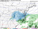
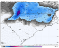
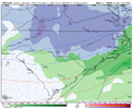
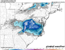
38 cloudy in driveway 330pm. Winston to HP, sun out 46. Wouldnt mind radiational cooling in a couple hours
-
Hello, please take a minute to check out our awesome content, contributed by the wonderful members of our community. We hope you'll add your own thoughts and opinions by making a free account!
You are using an out of date browser. It may not display this or other websites correctly.
You should upgrade or use an alternative browser.
You should upgrade or use an alternative browser.
12/8/2025 Event - Repeat of Last Week?
- Thread starter packfan98
- Start date
38 cloudy in driveway 330pm. Winston to HP, sun out 46. Wouldnt mind radiational cooling in a couple hours
47° here in footheaters!
Sent from my iPhone using Tapatalk
You'll get you some flakes tomorrow! CR moved to Morganton so I got his snow shields to worry about lol47° here in footheaters!
Sent from my iPhone using Tapatalk
The DC weenies are going to get hammered while we get sunshine at this rate.
You'll get you some flakes tomorrow! CR moved to Morganton so I got his snow shields to worry about lol
lol. His shields are in full force, huh?
Sent from my iPhone using Tapatalk
I need to move to the coastal plain for snow after these last couple winters. Looking at real estate in Moyock as we speak.Congratulations Virginia!
View attachment 178404
LukeBarrette
im north of 90% of people on here so yeah
Meteorology Student
Member
2024 Supporter
2017-2023 Supporter
Unfortunately but maybe there will be a glitch lol. I do think your area has a better chance of getting colder than the southern foothills. A dusting to an inch may be possible. Good luck my friend! I'm rooting for ya.lol. His shields are in full force, huh?
Sent from my iPhone using Tapatalk
Facts living in the lee causes me constant pain! I mean yeah I can drive to Avery County in 30 minutes but 181 is a tall grade! Very dangerous in winter conditions.I need to move to the coastal plain for snow after these last couple winters. Looking at real estate in Moyock as we speak.
BrickTamland
Member
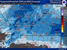
Felt confident for a decent 1 to 2 inches here until the last NAM run. Not sure what to expect now. Euro doesn't show much but has been trending better. GFS and the short range models have been looking great the last two days, but then the last NAM run did a complete 180. Could be anything from a dusting to 2 inches here. It's always a roller coaster ride when it comes to snow chances here.
Unfortunately but maybe there will be a glitch lol. I do think your area has a better chance of getting colder than the southern foothills. A dusting to an inch may be possible. Good luck my friend! I'm rooting for ya.
Thanks, I wish it would work out for everybody, but we know it never does.
This right here simply amazes me the models always put a minimum right here over Surry Wilkes Yadkin Counties. I live right at the black dot.

Sent from my iPhone using Tapatalk
I hope the NAM is a one off glitch and not a reversal of the good trends that we have seen today. I'm going to be honest, I've seen the rug pulled out from underneath us too many times to not be concerned.
rburrel2
Member
Short range models starting to line up with the euro? I’m shocked
RDPS .
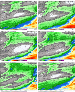
RGEM still looks decent, much better qpf than the NAMs and HRRR
Tsappfrog20
Member
WolfpackHomer91
Member
Not that it was ever ours in the slightest.... Catawba/Iredell/Rowan are out of this one I think. I didnt think it would make it to Meck/Cabarrus/Gaston but yea not even us now jmo
When you cross va/nc line on 85. Va leaves trees hanging over interstate practically. Will be rough sledding. Just drove it friday morning eventI’m driving from the upstate to Richmond Virginia tomorrow afternoon for work, is traffic going to be really bad at the NC/VA line if it ends up doing what the models are showing?
Dang when I see it like that, I'm about one more tick away from a significant event
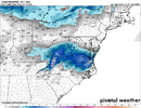
Oh wow. It even gives Jimmy a dusting.Let's play skip Big Frosty's! lol Congrats, Va. and Ne NC.
View attachment 178409
beating a dead horse a bit here but I think you (or someone in in your general neck of the woods) are probably in the best non-high country spot in nc for tomorrowDang when I see it like that, I'm about one more tick away from a significant event
Bigedd09
Member
Let's play skip Big Frosty's! lol Congrats, Va. and Ne NC.
View attachment 178409
NE NC has been cooking lately
Sent from my iPhone using Tapatalk
Don't jinx itbeating a dead horse a bit here but I think you (or someone in in your general neck of the woods) are probably in the best non-high country spot in nc for tomorrow
Not a cloud in the sky here, 45 degrees should be some quick cooling when the sun goes down.
rburrel2
Member
This is a pretty tough forecast for Raleigh. Could be nothing, could be 3 inches. Sorta feels like a coin flip right now and a good chance there’s not many in-between scenarios.
BrickTamland
Member
roads holding heat should keep roads in good shape unless 29-30 degrees is reachedNot a cloud in the sky here, 45 degrees should be some quick cooling when the sun goes down.
Bigedd09
Member
With all due respect the gfs is very pointless right now
Sent from my iPhone using Tapatalk
BrickTamland
Member
At this point we should focus on the NBM, NAM, RGEM, and HRRR. GFS and EURO aren’t really going to help
NBAcentel
Member
BrickTamland
Member
packfan98
Moderator
NBAcentel
Member
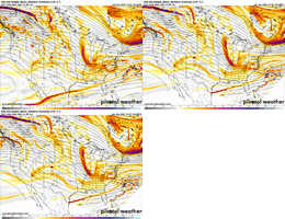
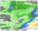
Yeah that strip in VA has the best intercept of everything, the front, forcing, dynamicsGFS did step towards the other models with more precip in VA and less in NC this run.
View attachment 178416
At this point we should focus on the NBM, NAM, RGEM, and HRRR. GFS and EURO aren’t really going to help
At this point, the short range models you mentioned are probably your best bet in determining what will happen. I'll cling to the dose of hopeium that the GFS has been giving and I'll keep my fingers crossed that it can be right for once.
HRRR still concerning to me. Va looks like a lock
Bigedd09
Member
21z RAP is super dry. Wow. We’ve lost the storm in NC. Lack of moisture has been crazy this year
Sent from my iPhone using Tapatalk
Sent from my iPhone using Tapatalk

