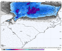
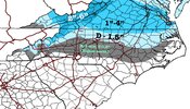
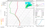
RAP too...HRRR still concerning to me. Va looks like a lock
-
Hello, please take a minute to check out our awesome content, contributed by the wonderful members of our community. We hope you'll add your own thoughts and opinions by making a free account!
You are using an out of date browser. It may not display this or other websites correctly.
You should upgrade or use an alternative browser.
You should upgrade or use an alternative browser.
12/8/2025 Event - Repeat of Last Week?
- Thread starter packfan98
- Start date
NWG_WX14
Member
21z Rap is bone dry for almost all of NC.
Bigedd09
Member
When’s the last time we up-trended before an event? This is ridiculous
Sent from my iPhone using Tapatalk
Sent from my iPhone using Tapatalk
Bigedd09
Member
Didn’t that storm always look decent for them? I’m talking clt area though
Sent from my iPhone using Tapatalk
WolfpackHomer91
Member
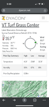
Anyone got data on HRRR/RAP ect current conditions ? Im at 38 currently and im grasping at straws to stay interested. Who initiated closest ect
Yes, but trended up here big time in the Triangle in the late going, with only the GFS being consistently good for us.Didn’t that storm always look decent for them? I’m talking clt area though
Sent from my iPhone using Tapatalk
To be clear, I’m not super hopeful with this one, though.
NCHighCountryWX
Member
- Joined
- Dec 28, 2016
- Messages
- 697
- Reaction score
- 1,914
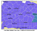
Pro tip for official guidance at your specific high resolution forecast grid:
Input your specific location here via several search methods. The grids update frequently as new data comes in.
It will answer a lot of your questions
Input your specific location here via several search methods. The grids update frequently as new data comes in.
It will answer a lot of your questions
Bigedd09
Member
Anyone got data on HRRR/RAP ect current conditions ? Im at 38 currently and im grasping at straws to stay interested. Who initiated closest ect
In all honesty I don’t think temperature will be the biggest issue tomorrow. It’ll be QPF.
Sent from my iPhone using Tapatalk
I'm hoping that the models are not picking up on development over NC. The RGEM and GFS continue to show the development. But I would have to bet the dryer solutions will win out..... I'll be focused on nowcasting later tonight to see if the development starts to build. All we can do...
iGRXY
Member
Climo lolShort range models starting to line up with the euro? I’m shocked
NWG_WX14
Member
I am surprised to not see some development of the preceip shield over NC on some of the short range modeling. In fact on the latest RAP the precipitation actually fizzled out over the I-77 corridor.
LukeBarrette
im north of 90% of people on here so yeah
Meteorology Student
Member
2024 Supporter
2017-2023 Supporter
It’s completely clear in Blacksburg right now. Radiational cooling could be better than advertised. Most models have us with a brief hour or two of rain. Perhaps it’s only snow with solid cooling…
blueheronNC
Member
Drought begets drought21z RAP is super dry. Wow. We’ve lost the storm in NC. Lack of moisture has been crazy this year
Sent from my iPhone using Tapatalk
LukeBarrette
im north of 90% of people on here so yeah
Meteorology Student
Member
2024 Supporter
2017-2023 Supporter
FoothillsWX
Member
Always a real risk in a good way. Models get a bit too happy with the expanse of cloud cover they expect. All clear here in western NC. Not a cloud in sight as far as the eyes can see.
Bigedd09
Member

Sent from my iPhone using Tapatalk
the line between snow and virga is razor thin. not a lot of moisture with this one.
only change i could spot is that the 18z cam suite dug the trough to the southwest some. sounds positive, but the full trough broadened in response and lessened vorticity at the trough base (swings through nc). less lift.
it's such a minute detail. it could swing back with the 00zs.
only change i could spot is that the 18z cam suite dug the trough to the southwest some. sounds positive, but the full trough broadened in response and lessened vorticity at the trough base (swings through nc). less lift.
it's such a minute detail. it could swing back with the 00zs.
I think we will see a slight swing back. The QPF drop off is too steep to freak out over. I'll start getting worried after the next NAM 3k and HRRR run.
JP152
Member
NBAcentel
Member
That’s actually been my thinking with this all weekend. Just looking at soundings, a saturated column would really support snow down into northern SC. It’s just a a matter of getting enough QPF, which right just doesn’t look like it’s gonna get thereIn all honesty I don’t think temperature will be the biggest issue tomorrow. It’ll be QPF.
Sent from my iPhone using Tapatalk
Tsappfrog20
Member
Final call here…. View attachment 178428
I would gladly take this. Getting snow in NC especially in the Triangle area is hard so for it to happen in December I would be very satisfied!
Sent from my iPhone using Tapatalk
BrickTamland
Member
RAP has all the precip north of NC.
CNCsnwfan1210
Member


22z/18z HRRR is that good?
Sent from my iPhone using Tapatalk
CNCsnwfan1210
Member


22z/18z HRRR is that good?
Sent from my iPhone using Tapatalk
In terms of NC, maybe better moisture response?
Sent from my iPhone using Tapatalk
Tsappfrog20
Member
I will say looking at the radar compared to the hrrr there is more moisture in Southern Mississippi than what the hrrr was showing at 22 & 23
Sent from my iPhone using Tapatalk
Sent from my iPhone using Tapatalk
LukeBarrette
im north of 90% of people on here so yeah
Meteorology Student
Member
2024 Supporter
2017-2023 Supporter
Bigedd09
Member

At this point it’s gonna be a cloudy cool day for clt lol
Sent from my iPhone using Tapatalk
SimeonNC
Member
Do low temps being lower than forecast matter at all for this set up or no?
Bigedd09
Member
Do low temps being lower than forecast matter at all for this set up or no?
Temps aren’t gonna be the issue. QPF QPF QPF
Sent from my iPhone using Tapatalk
BrickTamland
Member
HRRR is north of NC, too. Hardly any precip at all in NC. What's causing the lack of precip in NC now?
Bigedd09
Member
HRRR is north of NC, too. Hardly any precip at all in NC. What's causing the lack of precip in NC now?
It’s been a trend the last couple years
Sent from my iPhone using Tapatalk
NCHighCountryWX
Member
- Joined
- Dec 28, 2016
- Messages
- 697
- Reaction score
- 1,914
GSP Guidance Update
TEMPERATURES SHOULD REMAIN ABOVE FREEZING ACROSS THE REST OF THE
MOUNTAIN VALLEYS AND AREAS EAST OF THE MOUNTAINS SO MAINLY A COLD
RAIN CAN BE EXPECTED FOR THESE LOCATIONS. HOWEVER, SOME LIGHT SNOW
MAY BLOW DOWN THE VALLEYS AND/OR SOME WET-BULBING MAY OCCUR EAST OF
THE MOUNTAINS (MAINLY IN THE NORTH CAROLINA FOOTHILLS/PIEDMONT ALONG
AND NORTH OF I-40) WHICH COULD ALLOW SOME BRIEF SNOW TO MIX IN WITH
RAIN AT TIMES. IT'S NOT ENTIRELY OUT OF THE QUESTION FOR WET-BULBING
TO OCCUR SOUTH OF I-40 IN THE NORTH CAROLINA FOOTHILLS/PIEDMONT AS
SOME OF THE CAMS AND GLOBAL GUIDANCE DEPICT THIS SCENARIO. HOWEVER,
WITH THE COLD AIR CHASING THE MOISTURE EAST OF THE MOUNTAINS
CONFIDENCE ON SNOW MAKING IT THAT FAR SOUTH REMAINS VERY LOW AT
THIS TIME. NO SIGNIFICANT SNOWFALL ACCUMS ARE EXPECTED EAST OF
THE MOUNTAINS IF WET-BULBING DOES OCCUR SO OPTED NOT TO ISSUE A
WINTER WEATHER ADVISORY AT THIS TIME AS ANY SNOW THAT FALLS WILL
BE WELL BELOW ADVISORY CRITERIA (LESS THAN AN INCH). WITH CLOUD
COVER LINGERING THROUGH DAYBREAK MONDAY, LOWS WILL END UP A FEW
DEGREES ABOVE NORMAL. HIGHS MONDAY WILL BE COOLER THANKS TO BOTH
CLOUD COVER AND PRECIP, ENDING UP ~10-15 DEGREES BELOW NORMAL.
Bleow freezing already. Stars out. Deck table, cars already iced up
iGRXY
Member
cold air isn’t the issue this time. Dynamic cooling will do its job. Problem is you need enough moisture to saturate the column which could eat up about 0.25” of QPF to do it which is about the max you’re seeing south of the Va/NC line outside of the high country and extreme NW foothills. Like you said, I looked at the soundings and I could easily get in on the action if it wasn’t for the lack of moisture.That’s actually been my thinking with this all weekend. Just looking at soundings, a saturated column would really support snow down into northern SC. It’s just a a matter of getting enough QPF, which right just doesn’t look like it’s gonna get there
Nomanslandva
Member
Yea, the 00z HRRR at 11Z tomorrow shows a green map for me but is totally a snow sounding. 36/30 now. just give us NAM qpf!View attachment 178429
I will set my alarm for this
NWG_WX14
Member
Seems like a small improvement on the 00z HRRR. Slightly more precip in NC and further south

