Webberweather53
Meteorologist
Low-level forced ascent from a crashing Arctic frontal boundary combined with DPVA aloft should be enough to get the job done on Monday w/ at least some scattered light snow showers across NC and VA.
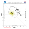
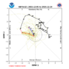
There’s definitely adequate forcing for ascent here on Monday and it’s really cold aloft, so anything that legitimately falls even outside the mtns would largely be in the form of snow even if there’s maybe a little rain mixed in here or there
View attachment 178068
View attachment 178069
Yall need to start a weather forecast bust thread lol
Yall need to start a weather forecast bust thread lol

Today’s 2 week ensemble MJO forecasts:
-12/5 EPS steady as a rock with a 17+ day long phase 8, second (back to 1974-5) only to the 18 days of 1975-6: a cold E US weenie couldn’t place it any better though keep in mind that the MJO, itself, is only one index of many despite it having notable tendencies:
View attachment 178070
12/5 GEFS: though not steady like EPS with only a 5 day phase 8 followed by 3 days of weak phase 1 (which also is often cold in Dec) followed by 5 more days in phase 8 and then 4 days barely in phase 7, this is on the whole still favoring dominating cold in the E US:
View attachment 178071
Related to the very cold Dec forecasts, natural gas is up a whopping 6% today, alone! Knowledgeable NG investors don’t normally go long NG in winter unless the forecast is for a cold E US.
Also had a little snow in sc/nc at the endIcon with the absolute HEATER into Alaska.
View attachment 178072
Just rainWhat did the GFS show for Mondays system?
Well there’s no indication at all that it would go to 4-5I think Mondays system will be extremely light and will likely turn out much like this one did. My interest is more into the latter part of the week and weekend next week. My biggest fear is that the MJO may be in 8 for a little while and then jump straight into phases 4-5 which is no bueno for the SE.
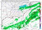
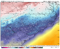
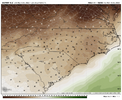
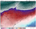
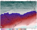

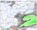

12z GEFS trying to pick up some steam with the Monday system, seems a little better than the 6z
Sent from my iPhone using Tapatalk
thoughts here exactly, temps are the issue againI'm not sure how we can get the Monday system to come back to life....it looks like we might be trending better moisture-wise, but it sure seems reminiscent of this system with no cold air feed until late, surface temps baking and dews in the 30s.
This frame is going to be one we see a lot this winter.
@LukeBarrette gonna need a calculator to tally up his snow this year. Fingers and toes ain’t gonna do
Probably a more favored area and closer proximity to the surface lowFro can we get it to work out for CNC
Sent from my iPhone using Tapatalk
Lets shift this one south for the boys
I can already feel the NAM bomb coming in tomorrows runs
