NBAcentel
Member
Yeh the long range on the AI & EPS are just cold reload after cold reload.
I've noticed something is off with the AIFS ens guidance over the last several weeks. It's glitchy.
Includes ice and sleet as snow I believe
It’s been off for months, not sure what the deal is. It had members dropping snow in the Atlantic while we were tracking a hurricaneI've noticed something is off with the AIFS ens guidance over the last several weeks. It's glitchy.
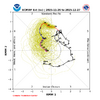
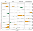


12z EPS has most of the SE below normal the next 15 days.
Sent from my iPhone using Tapatalk
View attachment 177375View attachment 177376View attachment 177377
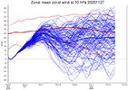
New weeklies hint at another weakness in the SPV around mid to late December, roughly around the same time period, the MJO finally reaches phase 8. The key here is that -NAO events have a high correlation MJO phases 7/8/1, which when coupled with another SPV weakness, could mean we see a high latitude blocking event heading into January. I also think this could reinforce the -EPO but I'm less certain about that. Let me know what y'all think about it.

View attachment 177345
So we will be phase 8 around this time here…
Should we expect this trough on the WC to shift east over time?
There seems to always be a push toward climo with the NWS out at range. I get it, the models are usually not reliable 10+ days out. So some kind of a weighting toward climo seems like a reasonable way to forecast. I'm just guessing that's what's going on here.Must got the turkeys working the shift today because ain't no way I am buying this.
View attachment 177380
I don't like seeing Alaska below normal.Must got the turkeys working the shift today because ain't no way I am buying this.
View attachment 177380

I especially like seeing that deep snow pack building over SE Canada especially with how we keep seeing the TPV setting up over the same area
This is what we need to see, building snowpack in Canada for these HP’s to work with.
Sent from my iPhone using Tapatalk
This will really augment the weak HPs later on that get any blocking up there still pump the freezer south
This is what we need to see, building snowpack in Canada for these HP’s to work with.
Sent from my iPhone using Tapatalk
Exactly. This is how you see winter storms with weaker HPs. A 1030 high in right spot to pump that cold air down over snow cover will get the job done.This will really augment the weak HPs later on that get any blocking up there still pump the freezer south
Must got the turkeys working the shift today because ain't no way I am buying this.
View attachment 177380
I don't like seeing Alaska below normal.
A southern winter day in queue for sure.Been a long time since the last cold rain, Tuesday is going to be wonderfully ugly

GOOOOD LAWWD
View attachment 177396
This is the way! I’d imagine that it will correct into phase one as well. I was hoping that the loop would occur in phase 8 (if there was going to actually be a loop).GOOOOD LAWWD
View attachment 177396
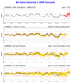
Have we ever spent 20+ days in phase 8 during winter? Curious to know what the record is. Anyway, if we spend the entire month of December in phase 8 and don't get a southern winter storm, I'll be very surprised. Somebody down south will get snow, if this comes to fruition. Maybe another gulf coast storm or a good ole fashioned southern slider. Stay tuned....GOOOOD LAWWD
View attachment 177396
Have we ever spent 20+ days in phase 8 during winter? Curious to know what the record is. Anyway, if we spend the entire month of December in phase 8 and don't get a southern winter storm, I'll be very surprised. Somebody down south will get snow, if this comes to fruition. Maybe another gulf coast storm or a good ole fashioned southern slider. Stay tuned....
The big difference compared to several days ago why the models push this into phase 8 more quickly is because this secondary Kelvin Wave that orbits into the Western Hemisphere mid-late month is no longer in the forecast
Latest Euro weeklies
View attachment 177399
Weeklies from 4 days ago
View attachment 177400
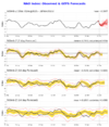
Correct me if I’m wrong Eric, but was there a little bit of a Pacific jet extension on the 00z EPS?
Sent from my iPhone using Tapatalk
