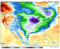
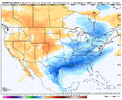
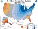
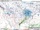
-
Hello, please take a minute to check out our awesome content, contributed by the wonderful members of our community. We hope you'll add your own thoughts and opinions by making a free account!
You are using an out of date browser. It may not display this or other websites correctly.
You should upgrade or use an alternative browser.
You should upgrade or use an alternative browser.
Pattern December Doldrums 2025 🎄 ❄️
- Thread starter SD
- Start date
euro close for 
 tuesday
NBAcentel
Member
Amazing how much that same timeframe is changed compared to 3 days ago
Webberweather53
Meteorologist
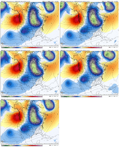
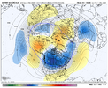
I know @griteater talked about this a while back, but this is a classic wave-2 (PV split) look on the ensembles later in week 2 with a pair of ridges over Scandinavia & the Bering Sea.

CNCsnwfan1210
Member
I know @griteater talked about this a while back, but this is a classic wave-2 (PV split) look on the ensembles later in week 2 with a pair of ridges over Scandinavia & the Bering Sea.
View attachment 177289

CFS AO forecast looks promising, hopefully this blocking episode will boost the AO and NAO into the negative phases.
Sent from my iPhone using Tapatalk
Took the words right out of my mouth. Lets get this thing stuck in 8 and we can ignore 6-10 day outlooks.Amazing how much that same timeframe is changed compared to 3 days ago
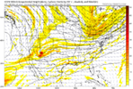
RAH mentioned this potential for the NW piedmont, which is part of their forecast zone.If I'm in the mtns/ foothills, I wouldn't be sleeping on Sunday pm' ish. Onset novelty potential at the least
View attachment 177290
View attachment 177291
LukeBarrette
im north of 90% of people on here so yeah
Meteorology Student
Member
2024 Supporter
2017-2023 Supporter
NBAcentel
Member
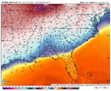
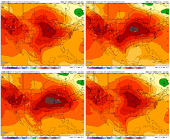
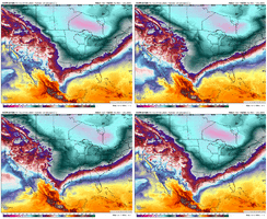
Willing to bet that icon run was about to be a CAD winter storm and colder then last run. The trough associated with the TPV was further south, with a stronger high pressure, and a weaker, slower wave. This gives more time to establish a wedge as well. Notice how were are loading up the NE US with colder temps in the low levels. That translates to a stronger wedge as the high moves east 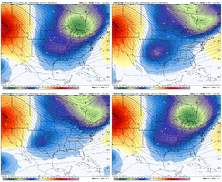


LukeBarrette
im north of 90% of people on here so yeah
Meteorology Student
Member
2024 Supporter
2017-2023 Supporter
U and I saw the same thing, really good run there. GFS will be interesting to see because it doesn’t look similar in the slightest to thisWilling to bet that icon run was about to be a CAD winter storm and colder then last run. The trough associated with the TPV was further south, with a stronger high pressure, and a weaker, slower wave. This gives more time to establish a wedge as well. Notice how were are loading up the NE US with colder temps in the low levels. That translates to a stronger wedge as the high moves east View attachment 177298View attachment 177299View attachment 177300
rburrel2
Member
that 120hr ICON output is interesting fo sho. There may be a narrow path to victory here.
wow
Member
Willing to bet that icon run was about to be a CAD winter storm and colder then last run. The trough associated with the TPV was further south, with a stronger high pressure, and a weaker, slower wave. This gives more time to establish a wedge as well. Notice how were are loading up the NE US with colder temps in the low levels. That translates to a stronger wedge as the high moves east
Got hooked in on a couple of those looks last winter before crapping out. Avoid the phase, artic boundary pushes south, overrunning moisture under a sprawling HP. One of these days...
NBAcentel
Member
I didn’t see a post about today’s Euro Weeklies, but today’s run was the most bullish (i.e., colder changes vs prior run) overall in a long time in the SE.I’m not saying they’re cold, but they are colder than they were/not as mild or not mild overall. I don’t have time to post details right now, but y’all check it out!
Edit: Every one of the 5 weeks is colder and/or less mild in both the NE and SE US vs yesterday’s run including one dramatically colder week.
Edit: Every one of the 5 weeks is colder and/or less mild in both the NE and SE US vs yesterday’s run including one dramatically colder week.
Last edited:
LukeBarrette
im north of 90% of people on here so yeah
Meteorology Student
Member
2024 Supporter
2017-2023 Supporter
View attachment 177292
This but with a colder airmass around would be bigly
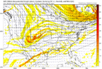
Not even in the same stratosphere
rburrel2
Member
Gfs isn’t even close to the euro ai, euro, or icon so it can be 100% tossed. My two cents. Let’s not forget the gfs is absolutely for entertainment purposes only in the medium range these days.GFS is heading the right direction with the wave seperation but not the TPV trough, we need that thing to be sunken in the NE US to deliver a good cold feed View attachment 177302
HailCore
Member
I always get frustrated looking at the ups and downs of the GFS only to remember the way it handled the early November event. I feel like it used to be better at med to long range but has certainly gone downhill over the past few years.Gfs isn’t even close to the euro ai, euro, or icon so it can be 100% tossed. My two cents. Let’s not forget the gfs is absolutely for entertainment purposes only in the medium range these days.
It has been especially bad this year. But what an eye candy run the 6z was!Gfs isn’t even close to the euro ai, euro, or icon so it can be 100% tossed. My two cents. Let’s not forget the gfs is absolutely for entertainment purposes only in the medium range these days.
Believe it’s verifying worse than the cmc lately. Somebody check me thoughIt has been especially bad this year. But what an eye candy run the 6z was!
That is a defeat you might never come back from. Like a season-altering loss of utter humiliation.Believe it’s verifying worse than the cmc lately. Somebody check me though
NBAcentel
Member
The University of Miami recently studied the forecast accuracy of the major weather models in use. The Google AI model, the new kid on the block, came in first. The GFS was in the basement. That says enough about the GFS even though it can be entertaining at times as you mentioned.Gfs isn’t even close to the euro ai, euro, or icon so it can be 100% tossed. My two cents. Let’s not forget the gfs is absolutely for entertainment purposes only in the medium range these days.

Sent from my iPhone using Tapatalk
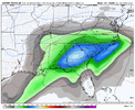
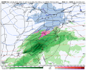
Talk about a cold cold rain View attachment 177308View attachment 177309
That gonna be close for a bit of ice in northern NC foothills/piedmont

Sent from my iPhone using Tapatalk
turbo wudge pattern congrats nc foothills on your onset ice events
Brent
Member
Coldest day since March here
trackersacker
Member
CNCsnwfan1210
Member

Euro EPS ext 12/2-1/1. To have the big cold pool in eastern NA is nice to have in the tool bag.
Sent from my iPhone using Tapatalk
wow
Member
Nothing good happens on Dec 2. Ask the year 2000.
The worst bust I’ve ever experiencedNothing good happens on Dec 2. Ask the year 2000.
Hard to really complain man. This was supposed to be a torch timeframe. We working with house money.The 18z Euro has a textbook track for the storm next week for just about all of us, and there’s practically no substantial cold air around. As Mitch would say “what an idiot” View attachment 177310
Brent
Member
November 30 2006 here
I mean it was a good storm but it never snowed again haha
I mean it was a good storm but it never snowed again haha
BrickTamland
Member
If Goofy is showing snow and the Euro and AI aren't showing it...Gfs isn’t even close to the euro ai, euro, or icon so it can be 100% tossed. My two cents. Let’s not forget the gfs is absolutely for entertainment purposes only in the medium range these days.

CNCsnwfan1210
Member
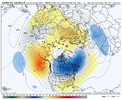
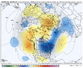
Look at how much colder H5 on the Euro Weeklies is compared to yesterday’s: that’s a big change for a 30 day period!
Yesterday:
View attachment 177313
Today (what you posted):
View attachment 177314
Looks much better, like the blocking over top and the biggest cold pool on the globe is over eastern NA. I don’t have many complaints about that look.
Sent from my iPhone using Tapatalk
CNCsnwfan1210
Member
I wonder if the new AI GEFS looks any better, because that’s not even close to agreeing with the AIFS.
Sent from my iPhone using Tapatalk
Sent from my iPhone using Tapatalk

