• Hello, please take a minute to check out our awesome content, contributed by the wonderful members of our community. We hope you'll add your own thoughts and opinions by making a free account!

Wintry Winter 25-26 Winter Battle Zone

That's not very good for us. But it doesn't really have to be. A perfect pattern 2 weeks from now is not all that helpful anyway. Mid-December on into January is when we should be hoping things evolve correctly for us.

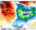
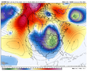
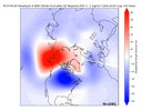
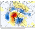
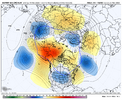
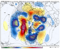
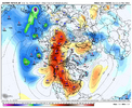
One thing of note on @Myfrotho704_ 's images is that the arctic looks good. I don't really like how far the ridging signal is out west (off the west coast). That usually looks good in the means, but if we are seeing a ridge off the west as we get closer in, I guarantee you those light blue colors over the Southeast will turn yellow and red UNLESS blocking is favorably located and of adequate strength up in eastern Canada. That is my hope. Either that or the ridge out west slides east. I thing both of those things happen with time.

These look better today to me, so I'm digging that.

View attachment 176623

View attachment 176624

Just about to say that about the western ridge, it looked too far west, likely causing the cold dump to texas. But that's way out there anyway and changes are 100%.

Step one looks pretty certain though, cold will be on our continent and to our north at least. = Win.
 
Really not liking the stout SE ridge late month into December. Those are tough to overcome
That's likely going to happen as we continue to get to & progress through phase 7. Cold is not going to drop East first. It's going to hammer down on the West. Just got to keep the progression going.
 
The 12/13 extended GEFS/EPS are both headed for phase 8 mid-Dec. For those wondering how often E US cold has been associated with phase 8 in Dec (whether well outside, just outside, near, or inside the circle), here’s the breakdown of 3+ day long phase 8 periods in Baltimore as a representative (centrally located) E US city:


For 3+ day long phase 8 (includes inside circle): 23 periods (* La Niña)

12/20-22/1974: +1

12/19-31/1975: -4*

12/14-17/1976: -2

12/10-15/1977: -6

12/16-18/1979: -5

12/26-28/1981: -2

12/8-10/1982: -6

12/19-23/1986: -3

12/2-6/1988: +1*

12/1-4/1989: -9

12/9-18/1989: -16

12/2-4/1990: +6

12/1-7/1991: +1

12/9-14/1991: +8

12/9-12/1992: 0

12/20-25/1995: -8*

12/15-17/2000: 0*

12/21-25/2001: -1

12/5-9/2002: -15

12/1-3/2007: -4*

12/6-9/2009: -4

12/20-22/2009: -7

12/21-24/2017: +5*

———


Before analyzing the temperatures, note how the frequency of 3+ day long Dec phase 8 periods has plunged since 2009:

-During 1974-2009, there were 22 three+ day long phase 8s through the 36 Decs or a frequency of 0.61/Dec.

-But during 2010-2024, there was only ONE 3+ day long period or a mere 0.07/Dec, which is a minuscule 1/9 as often as that for 1974-2008!

-The longest drought during 1974-2009 was a mere 4 Decs. But during 2010-24, there have been two 7 Dec droughts!

-So, based on this, although I’m hoping the latest extended EPS/GEFS are correct in projecting a 3++ day long phase 8 this Dec, I’m taking it with a grain for now.

——————

Now to analyze the Baltimore temps for the 23 three+ day Dec phase 8 periods 1974-2024:

-# of periods: MB 4 (17%), B 10 (43%), NN 6 (26%), A 2 (9%), MA 1 (4%)

-So, there have been nearly 5 times as many B/MB periods as A/MA periods!

-The average daily anomaly was -4 over the 112 days.
 
Last edited:
Question, when was the last time we had a SSW in general? Because I feel like one hasn't happened in a while.

No it has happened recently. During DJF there were several in 2023-4 and there also were two in Feb of 2023. 20-21 had 3.

But the last one on Dec or earlier was way back in 2001! The last one in Nov was way back in 1968!
 
Just about to say that about the western ridge, it looked too far west, likely causing the cold dump to texas. But that's way out there anyway and changes are 100%.

Step one looks pretty certain though, cold will be on our continent and to our north at least. = Win.

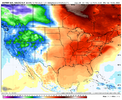
Yeah, the EPS has been jumping back and forth bigtime in week 2. After yesterday’s 0Z EPS/Weeklies came out supporting a stronger SE ridge in early Dec, the 12Z EPS was back to having a weak ridge. But then today’s 0Z EPS went right back to a stronger SE ridge.

This tells me two things:

-Today’s Euro Weeklies will probably have a significant SE ridge for Dec 1-7 similar to yesterday’s run

-The 12Z EPS could very well have a weaker one than today’s 0Z as the windshield wiper pattern continues
 
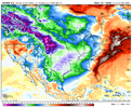
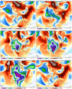
The dam breaks at the end of the Euro..
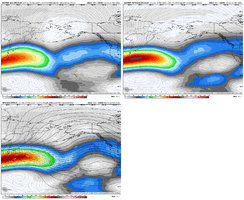
View attachment 176632View attachment 176633

lol, big ball of -EPO is let loose with the east coast and the SE still toasty. Still November so fine by me! Verbatim for craps and giggles I bet with that Atlantic we'd wedge cold pretty soon thereafter.

This seems to be a fine progression though as was mentioned. The trough needs to make its way east to push the SE/WAR east and that's not expected until after we can get into mjo phase 8, closer to mid December. As long as we don't see true signs of the MJO reversing or stalling I'm perfectly patient for mid December.
 
I’m really ready for some panhandle hookers! That’s what they call them out here.
 
Yeah, the EPS has been jumping back and forth bigtime in week 2. After yesterday’s 0Z EPS/Weeklies came out supporting a stronger SE ridge in early Dec, the 12Z EPS was back to having a weak ridge. But then today’s 0Z EPS went right back to a stronger SE ridge.

This tells me two things:

-Today’s Euro Weeklies will probably have a significant SE ridge for Dec 1-7 similar to yesterday’s run

-The 12Z EPS could very well have a weaker one than today’s 0Z as the windshield wiper pattern continues

Followup:

New Euro Weeklies are as expected similar to yesterday’s run in the SE US with a strong SE ridge early (mild again in the SE to lower Mid-Atlantic) that again slowly weakens through mid-Dec.

But keep in mind that yesterday’s extended EPS/GEFS were forecasting the MJO on 12/11-14 to reach phase 8, which is about the coldest phase on avg in the E US in Dec. with 60%/80% of them having been cold in Baltimore/RDU, for examples. Also, should an SSWE actually occur, the lagged cold may also start ~mid-Dec. So, should it actually get to phase 8 and the SSW occur in late Nov, I’d be looking for a very good chance for 12/15-21 and 12/22-28 to turn much colder in the E US on later runs as we get closer. That’s still a month out, an eternity for model accuracy and the ability to see things change.

*Edit: In semi-windshield washer form, the 12Z EPS did turn back a bit colder in the SE US the last few days of the run due to a weaker SE ridge though it doesn’t look nearly as good to me as yesterday’s 12Z.

Regardless, it is well after the end of the 2 week EPS that has the best prospects for cold for the 2 reasons I gave above. Patience will be needed.
 
Last edited:
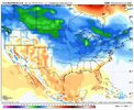
Looks like the entire eastern half of the country will be cold except for the Deep South. But I think this is NDJ not DJF.
You’re correct! But with the lag of these things, it will be FEBRUARY Bbefore the cold makes it to the SE
 
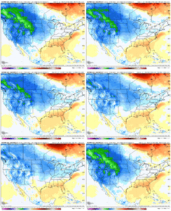
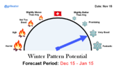
Predicting the future is hard in any business or hobby, but I have higher than normal confidence that the Dec 15 to Jan 15 period is going to be active and fun in here. Get the load testing done early boys!

View attachment 176660
I do believe 'very good' is the best I've seen on the Gritometer.
 
Back
Top