SimeonNC
Member
43.7 right now, lowest reading in about six months.
And it might be preceded by a widespread rain


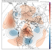
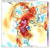
I think most will have a good idea for this winter this time next month imo. May take better timing than a better set up pattern, but it's still difficult in the south nonethelessThis isn’t a warm pattern at all. But the 2M anoms aren’t impressive. Looks like it’ll be a while before we can truly drag in colder temps into the pattern. The pacific jet flooding NA with mild air beforehand takes a while to reverse without a true AK block. Great setup for cool afternoons but nights that struggle to get into the 30s. Mountains probably see there first snow with this look showing up, especially given this is a favorable pattern for a strong/amplified upper level low/trough associated vorticity swinging down and slowing down. The pacific here though is showing signs of retraction, probably won’t be long before we see our first good look at our winter preview (+TNH). The bigger question is, can we like last winter keep the Alaskan ridging/western ridging more favorable for the EC or do we struggle with the position of the AK ridge like a typical Nina ? IMO December we probably have a decent pattern but everything beyond that is questionable. Gotta see how the warm pool in the pac progresses, how the SPV progresses (the Bering sea troughing certainly isn’t friendly to it). Both of these, esp the first point can destructively interfere with the way the MJO progresses. View attachment 175597View attachment 175596
I rather have the cold air in later December n January …. Better opportunity for snow…. Don’t see snow here until bout then anywaysI think most will have a good idea for this winter this time next month imo. May take better timing than a better set up pattern, but it's still difficult in the south nonetheless
I rather have the cold air in later December n January …. Better opportunity for snow…. Don’t see snow here until bout then anyways
NWS predicts a balmy 43 at RDUBelieve Saturday morning has a legitimate shot at ending the growing season for many locally. Should be widespread 32-36
The absence of Rain beat the frost to the punch lolBelieve Saturday morning has a legitimate shot at ending the growing season for many locally. Should be widespread 32-36
My h2o bill going to be a small fortune but the bermuda is still pumpingThe absence of Rain beat the frost to the punch lol
Them trees be mighty thirsty! We will recharge ground moisture nicely once the sap goes to the roots and winter rains ensue.Just picked up a cool .07" Giving me .51" for the month. It's funny how dry things can get even with my YTD being north of 70" already.
It’s too early for this but I guess you just take it when you can get it.View attachment 175623
Good gracious

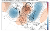
If we could dig a cutoff into that it would probably snow in some places outside of the mountains. Flow is probably too progressive though but it likely got a cold rain in it and I don't hate that tbh+PNA really starting to show up with the jet backing up some. Still not the coldest look given the lack of ridging around Alaska (+EPO) but any sign of warmth moving forward is basically gone. Mountains might start off hot this year given that look is favorable for digging energy/clippers and cold fronts which could support early NW flow snow events View attachment 175631
