Not doubting you. I am sure it is somewhere. This (see below) doesn't sound like that he is saying that it is going to be dry and warm all winter. He mainly focuses on the mid atlantic anyway. Would you mind posting where he says that? Thanks in advance!
SPECIAL STATEMENT … BEGINNING TO LOOK AT WINTER 2025-26
…. I talk about this more in the latest edition of the NEXT WEEKS NEWSLETTER which you can obtain on the website for only $5 a month…
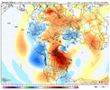
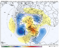
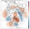
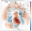
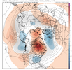
One of the things that experienced old timers forecasters claim is that the October Upper air or 500mb pattern (and to a lesser degree the surface features) can be a preview of the overall pattern for the winter. Research has shown that there is some truth to this. But there are limitations -- s. for example if there is a rapidly developing moderate or strong El Nino or La Nina event in the autumn, that can change the pattern for the winter. In that situation the October 500mb patterns really dont mean much.
Here we are at Mid-Autumn and looking at the winter it is clear that the La Nina event is very weak. It is going to fall apart by mid December so that the months of January, February, and March will feature Neutral ENSO conditions. This implies that the October 2025 jet stream patterns might actually be a clue with regard to what the winter is going to look like across the Central eastern CONUS.
I discussed in the new edition of the NEXT 3 WEEKS Newsletter, a strong significant Negative NAO has developed in northeast Canada /Greenland and it is going to last through the rest of the month and probably into November. If the October rule holds then it really implies that the winter is going to be pretty damn impressive.
Also here we are about to complete the second week of October and the snow cover build up in Siberia is jaw-dropping. It is deep…it is extensive and has reached further south of the 60° north latitude line. The western flank Siberian snow cover buildup has extended deep into Central Russia. For those of you who are Weather Geeks out there I am talking about SAI (Snow Advance Index) and the SCE (Snow Cover Extent) .
PRELIMINARY WINTER OUTLOOK OCT 25

