• Hello, please take a minute to check out our awesome content, contributed by the wonderful members of our community. We hope you'll add your own thoughts and opinions by making a free account!

Pattern Octoburn

Interesting that the highest October Temperature ever recorded at Greensboro was 85 degrees.

The year was 1954. That was the year Hurricane Hazel ( strongest NC LF Cane ever recorded ) slammed into the Brunswick County Beaches.

As of 10/14 We are dead even on temp departure. Gunning for a 3rd month in a row of Below Normal. Gonna be tough from here on out as our average daily high today is only 72 now, with 50 for the avg low. That avg ticks down every day, as we get latter into the month.

So far the GSO airport has received 0.008 rainfall for October.
 
Well, looks like the exciting weather is over for a while.

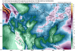
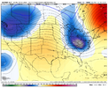
View attachment 175486

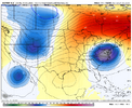
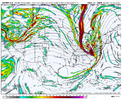
View attachment 175487

It’s making for gorgeous weather. Highs in the mid 70s, no humidity, sunny. And cool nights in the low 50s where you can smell the fireplaces and fire pits burning as you drive by. Perfect. My favorite time of year honestly.

Plus I want it as warm as possible to December one where the inevitable flip to cooler is timed where it has more chance to do work. ❄️
 
this hopefully will hold. looks to be back warm tuesday tho lol
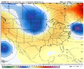
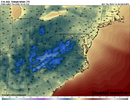
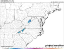
View attachment 175500
I showed that very same thing this morning. It's going to feel nice, wvwn if it is warm. Hopefully, we'll get a line of showers that moves through ahead of it. With the parent storm in the Lakes, we may do ok. We'll see.
 
Interesting that the highest October Temperature ever recorded at Greensboro was 85 degrees.

The year was 1954. That was the year Hurricane Hazel ( strongest NC LF Cane ever recorded ) slammed into the Brunswick County Beaches.

As of 10/14 We are dead even on temp departure. Gunning for a 3rd month in a row of Below Normal. Gonna be tough from here on out as our average daily high today is only 72 now, with 50 for the avg low. That avg ticks down every day, as we get latter into the month.

So far the GSO airport has received 0.008 rainfall for October.
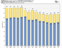
Some good info. I'm thinking you might have meant 95 for GSO? Looks like that's the Oct record set in 1954 (as you mentioned) and tied in 2019.

95 is still surprising considering RDU hit 100 in 2019. (CLT hit 98 that day as well) That was a miserable day around here in Oct.
 
kinda thinking ec-ai may have some warm bias past D5-7. obviously i haven't researched this, just something i've noticed.

12z euro came in very nice for a potential second front next tuesday. our quick hitter backdoor still looks good for tomorrow overnight. the fun one will be sunday, maybe our first real cold-front-day of the season
 
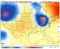
12z euro op took a jump north on the core of the up-lvl low/trough and dried up the sunday front a good bit vs 06z. not to mention another big swing on that second front being later next week thanks to it going from this:
1760551350482.png
to this:
1760551362076.png
save me eps. nothing really looks like it'll have much staying power for the next little bit
 
12z euro op took a jump north on the core of the up-lvl low/trough and dried up the sunday front a good bit vs 06z. not to mention another big swing on that second front being later next week thanks to it going from this:
View attachment 175514
to this:
View attachment 175515
save me eps. nothing really looks like it'll have much staying power for the next little bit
Dried up a lot for many
1760551743609.gif
 
Much less upper lvl help to get another sfc low going in the mid south. Womp
That seems like a very common trend. Energy weaker and farther north as we close in. We fight the same battle all winter every year.
 
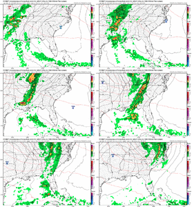
yeah better euro run this morning for Something To Happen with this front other than knock humidity back down. we went from this at 12z the 15th...
1760619523204.png


to this on this morning's run
1760619558233.png
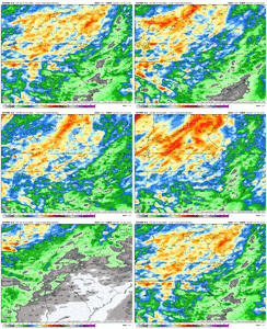
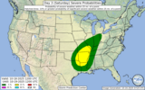
big ol slug of H5 vort swanging negative tilt over NC to squeeze out a line of storms Sunday evening for @SD. the resulting QPF map isn't especially impressive but its better than yesterday and introduces the idea of someone getting a jackpot thunderstorm. if we can trend some cape into this situation you'd have the SPC giving it a wind risk probably
1760619622862.png
 
Interesting that the highest October Temperature ever recorded at Greensboro was 85 degrees.

The year was 1954. That was the year Hurricane Hazel ( strongest NC LF Cane ever recorded ) slammed into the Brunswick County Beaches.

As of 10/14 We are dead even on temp departure. Gunning for a 3rd month in a row of Below Normal. Gonna be tough from here on out as our average daily high today is only 72 now, with 50 for the avg low. That avg ticks down every day, as we get latter into the month.

So far the GSO airport has received 0.008 rainfall for October.
Greensboro recorded 95 degrees in 2019.

EDIT: Oh, you had a typo and meant 95, which was also recorded in 1954! 1954’s record did occur a couple days later in the month, too.
 
yeah better euro run this morning for Something To Happen with this front other than knock humidity back down. we went from this at 12z the 15th...
View attachment 175523


to this on this morning's run
View attachment 175524
big ol slug of H5 vort swanging negative tilt over NC to squeeze out a line of storms Sunday evening for @SD. the resulting QPF map isn't especially impressive but its better than yesterday and introduces the idea of someone getting a jackpot thunderstorm. if we can trend some cape into this situation you'd have the SPC giving it a wind risk probably
View attachment 175525
That's a great look at h5 to me. It's probably good that we are lacking the thermodynamics here
 
My favorite phrase in the Fall: "...coldest air so far this season."

Lol we've been so warm here our cold front on Saturday drops us down to the bone chilling average for one whole day... And technically they aren't wrong

I'm pretty sure we've blown away the October record heat stretch at this point
 
No dice for rain on the 12z GFS through hour 282. This pattern is going nowhere fast and one pro met says this may last most of the winter.
 
Lol one pro met

Out of 11,000,000,000,000 pro mets

Good one, Shetley
 
Lol one pro met

Out of 11,000,000,000,000 pro mets

Good one, Shetley
A good one though who most of us have heard of. WXRISK.com. He posted his 1st idea about winter on Facebook and mentioned it there.

Edit: The NWS is also calling for a warmer and drier than normal Dec-Feb.
 
Last edited:
A good one though who most of us have heard of. WXRISK.com. He posted his 1st idea about winter on Facebook and mentioned it there.

Edit: The NWS is also calling for a warmer and drier than normal Dec-Feb.
Of course they are. Everyone is going pretty much straight Nina climo. I mean, I could go grab a standard Nina winter map, remove the watermarks, and label it Cold Rain Weather Winter Forecast 2925-2026 and fall right in line with 95% of what's out there.
 
A good one though who most of us have heard of. WXRISK.com. He posted his 1st idea about winter on Facebook and mentioned it there.

Edit: The NWS is also calling for a warmer and drier than normal Dec-Feb.
Not doubting you. I am sure it is somewhere. This (see below) doesn't sound like that he is saying that it is going to be dry and warm all winter. He mainly focuses on the mid atlantic anyway. Would you mind posting where he says that? Thanks in advance!

SPECIAL STATEMENT … BEGINNING TO LOOK AT WINTER 2025-26

…. I talk about this more in the latest edition of the NEXT WEEKS NEWSLETTER which you can obtain on the website for only $5 a month…

One of the things that experienced old timers forecasters claim is that the October Upper air or 500mb pattern (and to a lesser degree the surface features) can be a preview of the overall pattern for the winter. Research has shown that there is some truth to this. But there are limitations -- s. for example if there is a rapidly developing moderate or strong El Nino or La Nina event in the autumn, that can change the pattern for the winter. In that situation the October 500mb patterns really dont mean much.

Here we are at Mid-Autumn and looking at the winter it is clear that the La Nina event is very weak. It is going to fall apart by mid December so that the months of January, February, and March will feature Neutral ENSO conditions. This implies that the October 2025 jet stream patterns might actually be a clue with regard to what the winter is going to look like across the Central eastern CONUS.

I discussed in the new edition of the NEXT 3 WEEKS Newsletter, a strong significant Negative NAO has developed in northeast Canada /Greenland and it is going to last through the rest of the month and probably into November. If the October rule holds then it really implies that the winter is going to be pretty damn impressive.

Also here we are about to complete the second week of October and the snow cover build up in Siberia is jaw-dropping. It is deep…it is extensive and has reached further south of the 60° north latitude line. The western flank Siberian snow cover buildup has extended deep into Central Russia. For those of you who are Weather Geeks out there I am talking about SAI (Snow Advance Index) and the SCE (Snow Cover Extent) .

PRELIMINARY WINTER OUTLOOK OCT 25
He states since La Nina is likely to fall apart in December that the old rule of the Oct 500 mb pattern repeating all winter long might be true. Which wouldn't be what we want.

Then he goes on to say the -NAO is likely to persist and go into Nov. And using the Oct rule on that it would mean a -NAO winter and thats good.

But I thought @GaWx had research that said differently and the -NAO's in Oct more often than not meant +NAO was likely to dominate most of the winter. Which wouldn't be good. It's anyone's guess at this point. I'd lean above average with below average snowfall, not because of La Nina, but because that's all we can seem to get in the Carolina's anymore. Seems the rest of the south can do well here and there.

I didn’t say it that way. What I have said is that Octobers have had a tendency to be a -NAO dominated month for 15+ years. And -NAO winters have been rare since the 1980s with only 6 of them and all of them within ~2 years of a solar minimum. So, even if Oct NAO were +, I’d say good luck on getting it in winter unless it was within 2 years of a solar minimum, which would for whatever reason seemingly give it a better chance.
 
Of course they are. Everyone is going pretty much straight Nina climo. I mean, I could go grab a standard Nina winter map, remove the watermarks, and label it Cold Rain Weather Winter Forecast 2925-2026 and fall right in line with 95% of what's out there.

I feel like every year, NWS puts out a forecast that looks just like a cut and past Nina/Nino climo map. I don’t get it. So many variables and so many other possibilities that always affects different regions one way or another, and that’s all they put out. 🤷‍♂️
 
Back
Top