• Hello, please take a minute to check out our awesome content, contributed by the wonderful members of our community. We hope you'll add your own thoughts and opinions by making a free account!

Tropical 2025 Tropical Thread

It should come as no surprise that most eyes and ears are looking at the potential for heat ridges and tropical cyclone threats. Even a cursory look at the attached maps shows lots of excuses for hot weather in the lower 48 states. And the forecast models and respective analogs are opening up threats for both "home grown" and "Cape Verde" storms. The two trends in the weather summary may actually be interrelated. One thread that the viewer must understand is that when the subtropical highs are linked (as in the current Sonoran + Bermudan configuration), there is less of a chance for a storm to target the lower 48 states. You see, any impulse will need a break between anticyclones in which to recurve and gain latitude. As long as no polar jet stream systems are involved (more of a problem after the second week of October), the approach and landfall will not have difficulties with shearing wind profiles and dry intrusions that would kill convective circulations. Some incoming cold core disturbances can aid intensity if the warm-core entity encounters a neutral or negative tilt low center (difluence present in the upper levels that enables strengthening). But in August, the "possibles have to dodge the presence of the Saharan Air Layer (now weakening) and move into land areas in the early life stages of the cyclone. The waters in the western Atlantic Basin are warm enough (and getting warmer), so most of the parameters for a meaningful tropical event are appearing.

The questions are when, where, and how strong? On the idea that a longer term storm will enter a weakness, then Texas and Louisiana seem possible. Linkage on the Pacific Basin features indicates lots of heat ridging from the Southwest on into the St. Lawrence Valley and New England. The ECMWF weeklies have a gap emerging in the western and central Gulf Coast. That system would have to come from the Lesser Antilles through the Caribbean Sea after August 15. Low pressure in question is evident on most of the ensemble members either above or below the major islands, hitting its stride at a time when the ridging starts to cleave, just like it has done since June. You will note the very obvious gap in temperature and precipitation in the monthlies across western and central portions of the Lone Star State, which is where the vector wind anomalies in the analog set put the weakness this month. The West Coast may be cool, and the monsoonal moisture fetch may reform, thus keeping the Sonoran subtropical high in the Ozark Plateau. If so, the new month could be "one to talk about". Providing one of the ITCZ disturbances or diffuse frontal structure creates a candidate storm.


Prepared by Meteorologist LARRY COSGROVE on
Sunday, August 3, 2025 at _:__ P.M. CT
 
The jury is obviously far from a decision for 2025. Yes, YTD NATL ACE has been very low (1.5 vs 1951-2024 avg of ~9) through this morning with it at 64th highest out of the last 75 seasons. And being that low this far into the season does increase the chance for a quiet rest of season somewhat, which I’d love to see for a change. And yes, there are two new areas in the EPAC that may develop this week. However:


1. The EPAC is currently still at only 28 ACE vs a normal of 47 meaning it’s now ranked at only 39 of the last 55 seasons.

2. We have weak La Ninalike conditions, which are typically conducive for an active rest of season.


3. The following other relatively quiet through now NATL seasons (under 5 ACE vs normal of 9) were active the rest of the season:


Season and season’s NATL ACE listed below:

1969: 148 and that was El Niño (don’t have EPAC pre-1971); only 1 storm as of now (not an H) with 17 others still to come and not til Aug 10th+

2017: 225 and EPAC was then way up at 74 (12/54); no H yet with 10 H/6 MH still to come Aug 7th+

2019: 132 and EPAC ACE was then up at 45; only 2 storms as of now with 16 more to come and not til Aug 20th+

1980: 148

1999: 176; only 1 storm through now (not an H) with 11 others to come and not til Aug 18th+ including 5 MH

2004: 227 and that was El Niño; only 2 storms through now with 13 more to come Aug 9th+ including 9H/6 MH

1998: 181 and EPAC was then up at 55 (14/54); only one storm as of now (not an H) with 13 more to come, including 10 H and not til Aug 19+

1955: 158 (don’t have EPAC pre-1971); only 2 storms through now (no H yet) with 9H/4 MH still to come

1967: 125 (don’t have EPAC pre-1971); only 1 storm as of now with 12 more to come and not til Aug 28+

From this list: 1969, 2017, 2019, 2004, and 1998 should especially get one’s attention.


4. The Euro Weeklies, which overall did well last year with its several week out predictions, have been forecasting an active August for the last 5 days.

5. The various ensemble runs have been active both in the MDR as well as off of NC. The current TWO is already highlighting two areas.

6. The MJO is headed for phases 1 and 2, two often active phases during August.

—————————-
In summary, whereas the very low ACE as of this morning is typically a slightly bearish indicator the rest of the season as a whole, my points 1-6, above, suggest that an active rest of the season is at the very least still a reasonable possibility and may actually still be favored.
 
Last edited:
Gxce1q-XAAAZx60
 
This storm ends up going across the Florida peninsula and makes a second landfall on the Florida panhandle. It then turns northwest as it loses its tropical characteristics. If this were to happen, it would be at least a big rainmaker for Florida and the eastern Gulf states.
 
Well the GFS is known for Give Florida Something 🤣 🤣

Just have to wait and see it's too far out to say anything. Gotta have patience in this hobby. It easily could recurve though most of them do from far east. It takes a very special pattern to actually hit
 
Regarding the potential from the AEW over Africa:
After 5 full runs in a row with TCG from this (3 in MDR and the last 2 N of the MDR), the new UKMET (0Z) completely dropped this as a TC.
 
Tropical Weather Outlook
NWS National Hurricane Center Miami FL
200 AM EDT Mon Aug 4 2025

For the North Atlantic...Caribbean Sea and the Gulf of America:

Active Systems:
The National Hurricane Center is issuing advisories on newly formed
Tropical Storm Dexter, located over the western Atlantic Ocean.

1. Central Tropical Atlantic:
A tropical wave is forecast to move off the west coast of Africa
later today. Thereafter, some gradual development of the wave is
possible, and a tropical depression could form late this week while
it moves generally west-northwestward across the central tropical
Atlantic.
* Formation chance through 48 hours...low...near 0 percent.
* Formation chance through 7 days...medium...50 percent.

2. Off the Southeastern United States:
A broad area of low pressure is forecast to form in a couple of
days a few hundred miles off the coast of the southeastern United
States. Some gradual development of this system is possible during
the middle or latter part of the week as the system drifts to the
west or northwest.
* Formation chance through 48 hours...low...near 0 percent.
* Formation chance through 7 days...low...30 percent.
 
Azores HP is way far east on Brent map. If that's correct, which it's way to early to tell, it will be re-curve city.
I'm more interested in the H5 Pattern up top/ blocking etc for 2cnd week into mid August. The steering flow is what matters, regardless if you dealing with a tropical storm( Rainmaker) of Hurricane. It's all for naught if we can keep it out to sea. When I see blocking HPs forecasted in position in August/September, that's when I perk up/ pay attn.
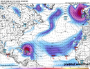
Euro, AI, and GFS all have a non-recurver. However, looking at satellite i cant figure out where any of these storms are supposed to form from. My guess is there will be nothing after a quickly dissipating dexter. Weakest first 4 in history all from non tropical origins.

1754309197055.png
 
Maybe. Ensembles have been showing activity in that time frame as well so the op isn't all alone

Yeah I'm just saying even if the gfs backs off there's clearly still a signal that's all we can ask for at this range

You can't get caught up in every run
 
some named flotsam in the subtropics and long range taking the bait on a few cape verde cruisers that are likely fish storms

textbook for early august

I said it yesterday even if something forms that far east it's very hard to actually make it across and hit

And again it's August 4th. Give it a few weeks. Floyd Florence Helene Ian Milton Matthew all in September and October. Not a single one in August
 
Last edited:
12 days out but that would be a Hugo 2.0 depending on forward speed, fruitless to guess until something if anything forms. Better than 30 days out though. I hope for a different solution!
i find long range fantasy hurricanes both:
1. even less likely and
2. more irritating
than fantasy snowstorms

florence was progged as a cat4/cat5 in wrightsville 3 days before landfall. i still have the screenshots on my phone. they were intense. florence was obviously still a menace but plenty of models suggested wrightsville beach would emerge from the storm a bald slab of sand and nothing else

euro ens are a fine north star to pay attention to and keep tabs on real threats if you don't want to get bogged down with doom-projecting hurricane products
 
Back
Top