packfan98
Moderator
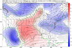
Best GEFS run yet. Mean low pressure is ever so slightly more progressive, but substantially colder run at 850.
Looks like a much different story for us across the mid/Deep South. This will be an extremely high impact event across northern MS and AL if it plays out like the model/met consensus is thinking.
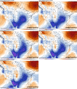
Models were coming in at 5 degrees warmer than what they should have been today
Watch the southern trend tonight into tomorrow
Sent from my iPhone using Tapatalk
I agree I think totals will only increase for south facing slopes up into the foothills.I wouldn’t be surprised if the GFS continues to increase amounts for those around Asheville to Boone. 6” could turn into 10-12” should the Gulf of America not rob in any moisture. Good overrunning and iso lift can do it for western NC.
18z GEFS once again slowing down the upper trough over me, which it has been doing for a couple days.
This flattens the wave out more and allows more cold air to get out in front of it. Hence, the slightly colder/suppressed shift on this run
View attachment 160988
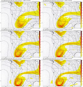
Incredible how many of those panels show basically the same precip type result! FFC here at mby showing snow at onset, mix, then rain.. pretty much what the consensus is here.mama cita..... only one member with the rain/mix line up in to Tennessee this time, good sign. The 12z run had 8 of 20 way up there.
View attachment 160982
Very possible.. I remember once we got within 60 hrs or so with the Feb 04 storm the CAD got stronger and stronger to push the r/s line well south of 85If you guys can make it 36-48 more hours until we get into short range models specialty, I think a lot of people are going to be happy. Models under estimating the cold already and that FGEN banding holding on longer than expected are going to make several of us happy.
View attachment 160989View attachment 160990With the GFS solution to, all that ZR likely isn’t true and is a issue it has, probably a lot more IP on the mid-northern fringe of that ZR footprint
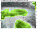
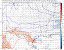
Yea, usually in these scenario's we won't lose the snow profile until the rates drop off from the initial burst. And what falls after that is almost always less than modeled and light.If you guys can make it 36-48 more hours until we get into short range models specialty, I think a lot of people are going to be happy. Models under estimating the cold already and that FGEN banding holding on longer than expected are going to make several of us happy.
Yeah, that will play
View attachment 160985

Yeah the GFS not only has problems with handling shallow cold air mass extent, but also usually underestimates the depth of said air mass.
The GFS is actually doing exactly that over me as we speak as this backdoor cold front moves across southern NM.
If we can overcome the deep sub-cloud dry layer here in NM, isentropic upglide and warm advection will favor some light snow showers overnight into early tomorrow before a bigger shot of mid-level warm advection moves in tomorrow afternoon.
View attachment 160992
View attachment 160993
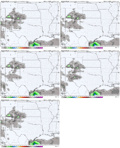
I wish the GEFS wouldn’t go so crazy on individual members that just aren’t going to happen all the time. Makes me wary of itGEFS Members Snow

18z GEFS once again slowing down the upper trough over me, which it has been doing for a couple days.
This flattens the wave out more and allows more cold air to get out in front of it. Hence, the slightly colder/suppressed shift on this run
View attachment 160988
Off that in house model someone just put up. I slowed it dimown and You an me stay clear all Thursday night and clouds roll in an thicken from 430am to just before sunrise Friday. We stay cloudy all day till precip arrives.Best GEFS run yet. Mean low pressure is ever so slightly more progressive, but substantially colder run at 850.
Was that the infamous Larry Cosgrove storm?Very possible.. I remember once we got within 60 hrs or so with the Feb 04 storm the CAD got stronger and stronger to push the r/s line well south of 85
I posted that scenario earlier or yesterday. It's near perfect for mby...clouds roll in 6-9am after max cooling. Limiting the warm up. Best case scenario when there's no real Cad hammering in. Will help the initial thump and hopefully delay the change over.Off that in house model someone just put up. I slowed it diwn abdYou an me stay clear all Thursday night and clouds roll in an thicken from 430am to just before sunrise Friday. We stay cloudy all day till precip arrives.
Please for the love of GOD can we keep this thread on topic. I will be banning people next! @packfan98 said so.I have a hard time believing there will be 4-6" south of Atlanta but I guess anything is possible !
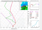
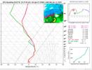
It has certainly happened before, you know when it snows in the Sahara Desert, we go, OK, The same can happen here, You know what I mean,,, This is a different winter, the last 9 years have been s%%%I have a hard time believing there will be 4-6" south of Atlanta but I guess anything is possible !
Woah... BIG dogs!!mama cita..... only one member with the rain/mix line up in to Tennessee this time, good sign. The 12z run had 8 of 20 way up there.
View attachment 160982
I bet that's why the euro is showing freezing rain for central/western NC at the end too.... they lost snow growth saturation. not b/c of a warmnose,(i'm guessing, don't have the soundings).
