RC, to answer your post awhile back about waiting for storm#1. imho, it is because we are not looking at a more or less open large set feature landscape. Lots of moving parts of which the smaller LP feature is moving through as well in the next couple days. Therefore the 5-7 forecast models are jumping around. Anyway, that's my very unscientific assessment on waiting for the field to clear out when it is currently relatively cluttered beforehand from a confidence standpoint
-
Hello, please take a minute to check out our awesome content, contributed by the wonderful members of our community. We hope you'll add your own thoughts and opinions by making a free account!
You are using an out of date browser. It may not display this or other websites correctly.
You should upgrade or use an alternative browser.
You should upgrade or use an alternative browser.
Wintry 1/9-12 Winter Potential Great Dane or Yorkie
- Thread starter SD
- Start date
accu35
Member
CNCsnwfan1210
Member
A blend of the Euro/CMC wouldn’t be bad
Sent from my iPhone using Tapatalk
Sent from my iPhone using Tapatalk
NWMSGuy
Member
Snowlover34
Member
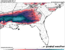
Yeah that’s a good look for us here in the midsouth just wish it wouldn’t change over to rainGood look for North MS until the rain moves in.
View attachment 159498
We are in a new pattern storms don’t deviate a whole lot. Similar to hurricane season you will notice hurricane landfalls are within close proximity to one another. Unless another pattern change occurs.RC, to answer your post awhile back about waiting for storm#1. imho, it is because we are not looking at a more or less open large set feature landscape. Lots of moving parts of which the smaller LP feature is moving through as well in the next couple days. Therefore the 5-7 forecast models are jumping around. Anyway, that's my very unscientific assessment on waiting for the field to clear out when it is currently relatively cluttered beforehand from a confidence standpoint
Stormlover
Member
But a few miles deviation makes a world of difference.We are in a new pattern storms don’t deviate a whole lot. Similar to hurricane season you will notice hurricane landfalls are within close proximity to one another. Unless another pattern change occurs.
Forevertothee
Member
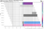
Because I was bored: 33.33% have snow or combo of snow and ice over Upstate SC. Of the 10: 1 Mod snow to rain, 1 Mod snow to ice, 1 snow to ice, 2 heavy snow with no mixing, 3 light snow events, 1 ICE storm, and 1 moderate snow with no mixing. Of the 20: 3 Rain only and 17 dry. So 13 precipitation and 17 dry. Of the events with precip, 77% yield frozen precip in Upstate.
It do but in retrospect cold rain will get cold rain and those who got the lions share will continue to do snow as snow lays for additional.But a few miles deviation makes a world of difference.
Stormlover
Member
Last comment, disagree, the area in the middle will fluctuate and isn't determined who gets what. The end. Carry on.It do but in retrospect cold rain will get cold rain and those who got the lions share will continue to do snow as snow lays for additional.
Forevertothee
Member
Overnight GSP discussion
As of 245 AM Saturday: Cold high pressure will slide SE across
the Plains and Midwest and spill into the Southeast Tuesday thru
Thursday. A reinforcing dry cold front will push thru the area
Wednesday night. An associated surge of NWLY 850 mb flow will impact
the Southern Appalachians, which combined with below normal temps
may result in apparent temps falling below zero in the high terrain
Wednesday night into Thursday morning. Overall, conditions should
be dry with perhaps a period of cloudiness and a few flurries along
the TN border in the wake of the reinforcing front. Temps will be
generally 5-10 degrees below normal, but 10-20 deg below normal
above 3500 ft. The coldest night looks to be Wednesday night,
with possibly a few single digit lows in the highest elevations,
while highs Thursday will struggle to get to 40 along the I-85
corridor and stay below freezing in much of the mountains.
Things could get interesting starting Friday, as both the 00z
GFS and ECMWF show a southern stream system possibly phasing
enough with an upper trough digging into the Midwest to spread
some moisture atop the forecast area. The air mass in place will
be cold enough that wintry precip types could be a concern. With
that said, most of the ensembles in the LREF keep our area dry
at least thru Friday night. So for now, just some slight chc Pops
creep into the forecast Friday night per the latest NBM.
tennessee storm
Member
I40 north in west tn looks great stillGood look for North MS until the rain moves in.
View attachment 159498
Forevertothee
Member
Peachtree City (ATL) discussion
The big story in the wake of the cold front will be the invasion of
more persistent colder temperatures through the coming week.
Temperatures will fall through the day Monday, and Arctic high
pressure will settle over the region through the week. While
temperatures will warm above freezing each day, highs will remain
mainly in the upper 30s to 40s areawide through the remainder of the
week with lows as cold as the teens in north Georgia on the coldest
mornings with widespread 20s otherwise.
We then continue to monitor the potential for a followup system by
late week (Friday to Saturday time frame) and any potential wintry
precipitation impacts given the cold airmass in place. As has been
oft repeated, uncertainty remains high at this juncture, though the
overall synoptic pattern by late week remains broadly supportive of
a possible winter precipitation threat. Further clarity regarding
late week forecast details will be ironed out in the days ahead.
Blue_Ridge_Escarpment
Member
That’s a good trend for NC too. If it’s accumulating in Dallas, it will snow in NC.
CNCsnwfan1210
Member
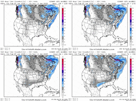
Anyone have the CMC ens?
Sent from my iPhone using Tapatalk
Sent from my iPhone using Tapatalk
Makeitsnow
Member
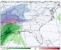
I can't recall any system that produced ice like that yet incredibly rain south of 85. It would incredibly unusualView attachment 159497Lights out
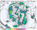
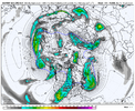
My take is the 12z GEFS is significantly different than the 06z EPS, but the ops generally are closer to matching the EPS thus far. We've already seen where the 12z ECMWF/GFS are going so we'll see how the EPS looks here shortly. While I'd like to see some streamers from the Baja low interact with the northern stream, a full phase is no longer going to produce a wintry solution for us IMO.Would love to get @1300m or any other Met input on ens vs ops at this range. I just got done hiking so haven’t looked hard at anything but sounds like the ens look a bit more promising? With higher variance run to run and between the ops, more credence to ens?
SimeonNC
Member
a 6-8 inch snow mean is insane
LickWx
Member
The NW trend will get themHow awesome is that look...2-3ft for PHL to BOS on this
View attachment 159449
View attachment 159450
iGRXY
Member
The EURO was a miller B with a transfer. While we don’t have a big HP sitting over top, there are higher pressures in the northeast with a nice 50/50 and fresh snow pack. History says we get an inland runner with that look but the Low likely doesn’t make it to the spin of the apps before transferring. Really just means CAD areas likely get an ice storm
SimeonNC
Member
Looks like the ole northwest trend to....the melted stuff eventually. Given this is still so far out.
At this rate Brent is golden.
Yeah we're on a train and it's all downhill from here. 12z GEFS is on an island compared to op GFS/Euro/EPS. 99% probability it folds IMO.
rburrel2
Member
It's definitely an ice storm with that look. That fact that it's even showing ice at this range is a flag that it's legit. The more fully phased and amped this storm is, while screwing our mid level profile, will aid in establishing a high pressure over the Northeast... and that air mass is plenty cold/dry.The EURO was a miller B with a transfer. While we don’t have a big HP sitting over top, there are higher pressures in the northeast with a nice 50/50 and fresh snow pack. History says we get an inland runner with that look but the Low likely doesn’t make it to the spin of the apps before transferring. Really just means CAD areas likely get an ice storm
Front end thump of snow is still on the table too even with the Euro-like solution. I'd be happy with a front end snow to ice situation.
iGRXY
Member
If I had to bet based on current trends and what likely happens, areas along and west of the Mississippi have a good shot at some snow. The CAD regions of Nc and SC get a front end thump before changing to ice while pretty much everybody else rains. This has lost the look of a snow potential outside of far western areas at this point. Still time to trend one way or another but history says for those of us east, this will be at best an ice event for the CAD regions or a cold rain along with everybody else
Honestly, the 12z GEFS is on an island. 99% probability it folds. Op GFS/ECMWF/EPS/UKMET all in pretty solid agreement.
Yeah we're on a train and it's all downhill from here. 12z GEFS is on an island compared to op GFS/Euro/EPS. 99% probability it folds IMO.
Same song, same dance as always. Get cold air, wave then gets buried in SW until cold is gone and here it comes.
clear how you can see stronger troughing in the southwest trigger stronger ridging downstream in the Caribbean. Better tilt induces a strong precip depiction. At the very least this is a pretty clear cut manifestation of what they teach in textbooks.
the thing is, what this run shows will not be what transpires. This is shifting and will continue to shift
- Joined
- Jan 5, 2017
- Messages
- 3,769
- Reaction score
- 5,966
I never want to see that much energy at 500mb in the southwest. It never works out for me. I need a diving short wave rounding the bend around Houston.
Stormlover
Member
You are no where close to losing this. You live in the area of the South that the atmosphere loves to throttle. You are fine.We’re all losing this one at a rapid pace. In just a few more runs we will have rain everywhere. Still fun to track tho isint it?
Agreed…nothing been decided except a whiff/dry scenario has been eliminated.You are no where close to losing this. You live in the area of the South that the atmosphere loves to throttle. You are fine.
NBAcentel
Member
For Gene Kelly maybeWe’re all losing this one at a rapid pace. In just a few more runs we will have rain everywhere. Still fun to track tho isint it?

