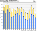
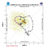
Probably hot maybe not bet we see a lot of purple and red maps with useless bickering
-
Hello, please take a minute to check out our awesome content, contributed by the wonderful members of our community. We hope you'll add your own thoughts and opinions by making a free account!
You are using an out of date browser. It may not display this or other websites correctly.
You should upgrade or use an alternative browser.
You should upgrade or use an alternative browser.
Pattern Mega March 2023
- Thread starter SD
- Start date
LukeBarrette
im north of 90% of people on here so yeah
Meteorology Student
Member
2024 Supporter
2017-2023 Supporter
Meaningless March Mayhem
You live in Roanoke ur going to be seeing snow in mayMeaningless March Mayhem
Avalanche
Member
Mega March, Muggy March, Mulching March, Mundane March, Marshy March, Myrtle Beach March, Ides of March…you name it.
One damn thing it won’t be is snowy March.
One damn thing it won’t be is snowy March.
Drizzle Snizzle
Member
Dang. Usually the next month's thread isnt created until at least the 25th. Why so early ?
Avalanche
Member
Cause there is just so much doom and gloom we need to get out of our systems.Dang. Usually the next month's thread isnt created until at least the 25th. Why so early ?
LukeBarrette
im north of 90% of people on here so yeah
Meteorology Student
Member
2024 Supporter
2017-2023 Supporter
Yeah ok lmaoYou live in Roanoke ur going to be seeing snow in may
Avalanche
Member
Yes, Virginia is further north thus gets snow more, and later, into the seasonYou live in Roanoke ur going to be seeing snow in may
ATLwxfan
Member
Yes, Virginia is further north thus gets snow more, and later, into the season
Virginia is very much in the mix with the negative NAO. That’s about it for us outside of the mountains, otherwise. Plus the positive EPO is going to flood us with more pacific air.
Sent from my iPhone using Tapatalk
March MADNESS!! ??
ATLwxfan
Member
The intriguing thing is where the storm track sets up as the -NAO and -PNA duke it out. Feast or famine for I-95 snow lovers.
GFS really cranking a -NAO as we get into early March. But, just when you think the ridge is getting subdued it cranks back up even stronger. It reminds me of the disconnect we had last year between the MJO and how the indices manifest. Even in the cold phases we did not get cold at times in the south. Different story for the northeast, they have some serious cold coming their way if the 0z GFS is to be believed.
Sent from my iPhone using Tapatalk
Last edited:
Roswellian
Member
Feel free to move this wherever it needs to go. Just got notification that my fixed rate with Gas South expires this month. Guaranteed cold on tap for Mega March now!
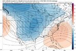
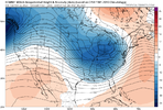
Whether you like it or not cold will come if these looks continue .. we will suffer through more heat and above average temps until maybe the 2nd week of march .. but when that trough out west breaks down and the -NAO ridge builds in and retrogrades west enough.. fun things will happen underneath. Enjoy the warmth now cause it will be cold again. 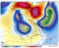
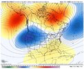
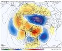


It might get cool even cold again, but I doubt we'll be having a lot of fun in it.Whether you like it or not cold will come if these looks continue .. we will suffer through more heat and above average temps until maybe the 2nd week of march .. but when that trough out west breaks down and the -NAO ridge builds in and retrogrades west enough.. fun things will happen underneath. Enjoy the warmth now cause it will be cold again. View attachment 133449View attachment 133450View attachment 133451
iGRXY
Member
Airmasses are moderating considerably. We will likely get some below average temps through March, but I think the winter is all but done now. We just don't have the cold available to work with. I expect 40 degree rains and for it to still have a winter feel through March, but I highly doubt we are getting anything frozen.It might get cool even cold again, but I doubt we'll be having a lot of fun in it.
Tarheelwx
Member
My thoughts are that by the time the trough out west shifts east (likely 3/10 or later), we will need exceptional cold outside the mountains to have a good winter storm. We'll see.
TW
TW
You need either an exceptionally cold air mass… which I just don’t see happening or you need a well timed ULL which is typically how you get snow outside the mountains in the southeast after 3/1. If I had to guess, I think we will see temperatures get back to below average as this blocking up top and -NAO takes hold in the next 10 days or so, but I just don’t think there’s cold enough air to work with to make something happen so late in season… maybe if the mid Atlantic and northeast could actually get a decent snowstorm and put some snow pack, something could get well timed right after to give northern areas of the southeast a chanceMy thoughts are that by the time the trough out west shifts east (likely 3/10 or later), we will need exceptional cold outside the mountains to have a good winter storm. We'll see.
TW
Flotown
Member
first week of march looks FAIRLY interesting
ATLwxfan
Member
ULL parks over us for a bit. Longest stretch of BN temps I’ve seen since Christmas. Should be gone by 0z run.
Sent from my iPhone using Tapatalk
Sent from my iPhone using Tapatalk
J1C1111
Member
That's what your praying and hoping for.ULL parks over us for a bit. Longest stretch of BN temps I’ve seen since Christmas. Should be gone by 0z run.
Sent from my iPhone using Tapatalk
accu35
Member
Past few runs on the gfs and gefs has been looking very interesting
BHAMWX
Member
I'm expecting another surprise Snowmaggedon for central Alabama.first week of march looks FAIRLY interesting
Ole JB has been talking about how cold is coming back in March since early January. Interestingly the models have now thrown hints of it. The old pattern forecaster
CMC continuing to trend colder later in its run. What happens in December winter will remember ??
ATLwxfan
Member
GFS more transient with the cold and the ridge builds back. Maybe the ridge gets beat down at the end of the run but who knows how that pans out.
Sent from my iPhone using Tapatalk
Sent from my iPhone using Tapatalk
Going to have to watch the system next Thursday through Saturday for severe weather. Think the cmc and gfs are too far SE with the low but even if it trends more toward the 0z euro its one to keep an eye on
Avalanche
Member
30 years ago this month we had no idea of what was about to hit us!!!
It's still hard to buy a long duration cold event with the pacific still in the toilet. The cmc gets cold but it rapidly pulls the nao west and traps the trough under the block. Possible? Sure. Likely? No. If you are looking for any long duration BN weather you have to wait until the nao retrograde well west and looking at the ensembles that still a way awayGFS more transient with the cold and the ridge builds back. Maybe the ridge gets beat down at the end of the run but who knows how that pans out.
Sent from my iPhone using Tapatalk
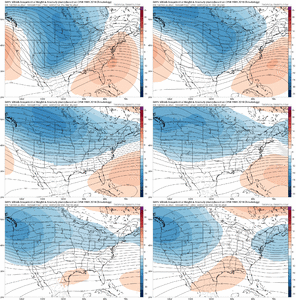
You can see centered around D10 how the gefs pulls the trough through but then the trough in the PNW starts to deepen and back west and the STR starts pushing north, can't do much more here than a 1-3 day slightly BN cold shot before 70s and 80s are knocking at the door again
Last edited:
Flotown
Member
canadia with a big winterstorm late in the run,albeitnorth
I see (what) you attempting to do there...30 years ago this month we had no idea of what was about to hit us!!!
To be fair..
I'm moving My post to the WAMBY Thread..
Avalanche
Member
North of you or north of the entire SE?canadia with a big winterstorm late in the run,albeitnorth
Cary_Snow95
Member
Lol euro slams the northeast
iGRXY
Member

You'll get your cold albeit transient, but if the Euro continued we were fixing to have a huge dump out west again so rinse and repeat. At least we have the -NAO to keep from getting this week part 2 more than likely. But if anyone is expecting winter weather, I'd damper those expectations considerably. The Pacific is just too wrecked to think we are going to get anything other than CAD right now at best.
And that was a catastrophic winter up to that point, too. You never know!30 years ago this month we had no idea of what was about to hit us!!!
Would be hilarious if they jackpot at the end of winter
It was in the high 70's Low 80's for DAYS up till, that Early afternoon.. (Here in SENC)..And that was a catastrophic winter up to that point, too. You never know!
Going from (Bolivia, NC to Wilmington, It was snowing when I left Bolivia, & then high 70's arriving in ILM.. (distance of roughly 30 miles).
With Hurricane force winds in between.

