-
Hello, please take a minute to check out our awesome content, contributed by the wonderful members of our community. We hope you'll add your own thoughts and opinions by making a free account!
You are using an out of date browser. It may not display this or other websites correctly.
You should upgrade or use an alternative browser.
You should upgrade or use an alternative browser.
Pattern Sweatember '22
- Thread starter Detective WX
- Start date
Drizzle Snizzle
Member
i guess technically 4th driest going by that, but 3.81 in April and 3.82 in Sept is virtually the same.September does look like the 3rd driest month, but that's like calling the Chattahoochee the third driest river, all months are relatively close in numbers. I want to know how the NOAA calculates the new normals, because they openly admit they throw some -------- in there. When I calculated Atlanta's new July average, it was 89.5F for 1990-2020. I can't remember what I calculated for January, 53. something.
View attachment 121212
Look like he’s better at fishing , than he is at forecasting@Tarheel1 Dale making the most out of Sweatember View attachment 121213
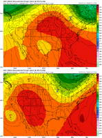
93 here. Pattern sucks ens look like summer right through D16 really disappointing
I see rain chances disappearing faster than my paycheck, in fact, any mention of it Monday is gone now.93 here. Pattern sucks ens look like summer right through D16 really disappointing
It's actually impressive how we are finding ways to suck. This upcoming pattern should be a slam dunk and at worst we walk out with avwidespread 1-2 inches but we are going to doink it off the front iron and fall flat on our face and knock out our front teeth.I see rain chances disappearing faster than my paycheck, in fact, any mention of it Monday is gone now.
Lol here comes the 18z gfs to change the mood
Of course lolLol here comes the 18z gfs to change the mood
JHS
Member
Going to be at least into October before we get any really cool air into the southeast. Will probably need a hurricane coming into the southeast to get the pattern to change. I would not be surprised to see 85+ into November if things stay like they are.
Drizzle Snizzle
Member
I'm not even concerned about cool air. I just want to know when we'll have consistent dewpoints 50s and lower. I feel like at this rate we'll have 70 dews in October.Going to be at least into October before we get any really cool air into the southeast. Will probably need a hurricane coming into the southeast to get the pattern to change. I would not be surprised to see 85+ into November if things stay like they are.
iGRXY
Member
The GFS continually shows these long range torches every run that drastically die off the closer we get.Let’s keep in mind the GFS was showing virtually the same thing for late next week at 354 hours out.
Man you are consistent.Going to be at least into October before we get any really cool air into the southeast. Will probably need a hurricane coming into the southeast to get the pattern to change. I would not be surprised to see 85+ into November if things stay like they are.
Been this way for years... maybe moreMan you are consistent.
BHS1975
Member
Yeah it's like the climate changed ?Been this way for years... maybe more
You are consistent too.Yeah it's like the climate changed ?
Bannerdude
Member
Not trying to flex on anyone, but I had .02" overnight. Now .78" since July 29th
BufordWX
Member
Atleast it’s a wet heat! Flood watches for the next 48 hours, and probably will be extended! So you’ve had to change your schtick to no cool air in sight! ????Going to be at least into October before we get any really cool air into the southeast. Will probably need a hurricane coming into the southeast to get the pattern to change. I would not be surprised to see 85+ into November if things stay like they are.
Currently 71 here!
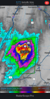
It was training all night last night. We are in the stretch here where we've been forecast everyday for the past several and its been sunny.Some incredible rainfall occurring over Chattooga county and a bit of Floyd county this morning. Radar is estimating over 10 inches of rain since midnight. FFC has a flash flood emergency as well for Lyerly and Summerville.View attachment 121225
JHS
Member
Union county is not in the watch and we are well east of the better moisture flow. Another story west of a Greenville to Greenwood line though. Too much rain in many areas west of there already and a very wet weak coming up.Atleast it’s a wet heat! Flood watches for the next 48 hours, and probably will be extended! So you’ve had to change your schtick to no cool air in sight! ????
Currently 71 here!
Mack telling someone to change their schtick, now that's funny right thereAtleast it’s a wet heat! Flood watches for the next 48 hours, and probably will be extended! So you’ve had to change your schtick to no cool air in sight! ????
Currently 71 here!
smast16
Member
Itryatgolf
Member
Fall can be warm as long as the winter is brutal ?Going to be at least into October before we get any really cool air into the southeast. Will probably need a hurricane coming into the southeast to get the pattern to change. I would not be surprised to see 85+ into November if things stay like they are.
This gradient on the 12z euro is amazing
Approaching an inch at the house now. Amazing that 20 minutes west of me has that. Some of the pictures on Facebook are crazy.It was training all night last night. We are in the stretch here where we've been forecast everyday for the past several and its been sunny.
Brutal. I remember those days when rain wasn't a big deal to get.This gradient on the 12z euro is amazing
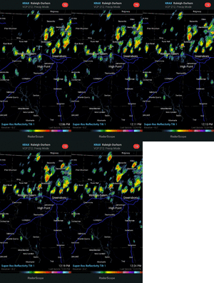
After sunny skies through early afternoon and highs in the mid 90s, just got smacked pretty good here with a severe thunderstorm. Addison airport gusted to 51 MPH.
Had an awesome-looking sheil cloud too.
Had an awesome-looking sheil cloud too.
It is nuts what they've had up there. I've had almost nothing here so far.Approaching an inch at the house now. Amazing that 20 minutes west of me has that. Some of the pictures on Facebook are crazy.
smast16
Member
My phone is showing a current temp of 69*F. If that's accurate, it will be the first time we've seen a temp below 70*F since May.
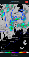
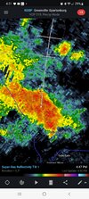
Me too. Complaining does work sometimesI squeaked, and I got the grease. I actually jackpotted.
View attachment 121233
Complain complain complain wen rain?
In Dec, Jan and Feb when rain is evil!Complain complain complain wen rain?
One more...
I lied. This is the last one...


