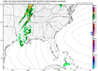
What about Oklahoma?Lapse rates to me look best overall for Wednesday… think I start over central Arkansas head either very Southern Missouri or even nw Mississippi… helicity off charts in these areas.
-
Hello, please take a minute to check out our awesome content, contributed by the wonderful members of our community. We hope you'll add your own thoughts and opinions by making a free account!
You are using an out of date browser. It may not display this or other websites correctly.
You should upgrade or use an alternative browser.
You should upgrade or use an alternative browser.
Severe 4/12 - (?) Severe Weather
- Thread starter Iceresistance
- Start date
-
- Tags
- severe
tennessee storm
Member
Like eastern Oklahoma especially , get well classic dry line established just off west
BufordWX
Member
Holding for storms in this severe outbreak to form some classic tornados but hopefully over bare population-less land so we can bask in the beauty of them without the damage and loss of life
What the actual Shrimp?!


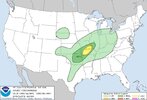
The SPC has a pretty large hatched 30% risk area for Tuesday, stretching from DFW northward to Des Moines / Omaha.
What the actual Shrimp?!
Where is this location?
tennessee storm
Member
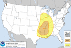
Even has a larger one for day 4 Wednesday…Where is this location?
NE WichitaWhere is this location?
Also, my Storm Shelter is ready
NWMSGuy
Member
HSVweather
Member
tennessee storm
Member
Yeah. Besides tornado threat , large to very large hail is starting become factory with nearly lapse rates off chart with this system .
Local met from KFOR
Z
Zander98al
Guest
That Mississippi Arkansas Louisiana border is intriguing for day 4.
tennessee storm
Member
Strong tornado or even a violent long tracker look s like area of nw mss / sw tenn se Arkansas where better shear meets up with cape values pushing 2000That Mississippi Arkansas Louisiana border is intriguing for day 4.
Z
Zander98al
Guest
Also that plains event not quite sure it's going to be a mega tornado event, your going to see some absolutely massive hail though but, I think the magnitude of the tornado threat is still in question. At this point, just glancing at Low level lapse rates. There pretty low again I don't know a whole lot about plains weather events but seen time and time again in the south where poor lapse rates really cut off tornado potential.
Color me stupid, but your higher confidence tornado event looks to be over the southeast on day 4. Higher ceiling is in the plains but your higher confidence tornado potential at this point is the southeast. But even so it's probably going to be messy and semi linear in the south with your typical prefrontal cells and your messy line producing some decent spinners.
Color me stupid, but your higher confidence tornado event looks to be over the southeast on day 4. Higher ceiling is in the plains but your higher confidence tornado potential at this point is the southeast. But even so it's probably going to be messy and semi linear in the south with your typical prefrontal cells and your messy line producing some decent spinners.
Z
Zander98al
Guest
NBAcentel
Member
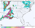
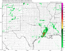
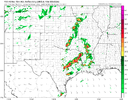
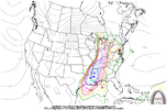
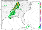
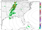
All depends on your cap, 3km nam is pretty solid on it FV3 (Supercell printer) is not. But you can kinda gauge your possibilities with those two.
View attachment 117070View attachment 117071
Nam 3km is typically to aggressive with the CAP, I’d go with the HRW in this situation
HSVweather
Member
All depends on your cap, 3km nam is pretty solid on it FV3 (Supercell printer) is not. But you can kinda gauge your possibilities with those two.
View attachment 117070View attachment 117071
Z
Zander98al
Guest
I would too but it's not in range unfortunately, id trust the HRRR / HRW over any of the 2 ones I put up.Nam 3km is typically to aggressive with the CAP, I’d go with the HRW in this situation
Z
Zander98al
Guest
It's a case where you gotta prepare for the worst for this event because it could very well come up on the day of the event that the cap is a lot less stronger than forecasted and if you down played it, you gotta start ramping up things which may not get seen in time. Or vice versa either way a pretty stressful forecast coming up..
Z
Zander98al
Guest
Also often times controlled burns in central America can effect things. it helped April 27th 2011 and made things worse, and then on the forecasted super outbreak of 2019 it made things a lot better and prevented a substantial event, seen a few studies on those effects ?usually worse for the south and better for the plains from what I saw.
All depends on your cap, 3km nam is pretty solid on it FV3 (Supercell printer) is not. But you can kinda gauge your possibilities with those two.
View attachment 117070View attachment 117071
The models have a really bad tendency to overestimate the cap
NWMSGuy
Member
Over 85 for my location. ?
NWMSGuy
Member
Detective WX
Member
Wednesday event is starting to remind me of Mayfield or Super Tuesday... In my area, it seems we'll escape the brunt of the system.
NWMSGuy
Member
I don’t like the sound of anything Mayfield or Super Tuesday related. ?Wednesday event is starting to remind me of Mayfield or Super Tuesday... In my area, it seems we'll escape the brunt of the system.
Z
Zander98al
Guest
Z
Zander98al
Guest
NWMSGuy
Member
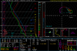
You are really good at keeping up with these systems! What are your thoughts on Wednesday? Red Letter Day?Sounding over Mississippi from the 12z nam while waiting for the 18z. View attachment 117075
Z
Zander98al
Guest
Not quite sure, but a 30% large risk area 4 days out is worrying. still some questions but I think theres more confidence in a bad weather day in the south for tornadoes than in the plains currently, a bit different setup in terms of divergence aloft and placement of things than out last few events in the south.You are really good at keeping up with these systems! What are your thoughts on Wednesday? Red Letter Day?
Z
Zander98al
Guest
Something else to consider, your probably gonna have a cold pool over the Mississippi region available for Wednesdays round of severe weather. Tuesday night through early morning a MCS looks to come through Mississippi and Alabama, kind've a precursor to decent severe events.
NWMSGuy
Member
Good point. Not comparing here but I believe that was also the case back in 2011 for most folks in AL with morning storms before the big show later that afternoon/evening.Something else to consider, your probably gonna have a cold pool over the Mississippi region available for Wednesdays round of severe weather. Tuesday night through early morning a MCS looks to come through Mississippi and Alabama, kind've a precursor to decent severe events.
Z
Zander98al
Guest
Wow. 18z nam really jumped sbcape in Mississippi, STP 7-8+ widespread near the Mississippi river and into Mississippi. Your probably looking at a significant regional tornado outbreak, one second and I'm going to upload some stuff.
Z
Zander98al
Guest
North Mississippi will be the hotbed, 8.5+ surface to 3km lapse rates 3000+ SBCape, upper level divergence SE exit region of the jetstreak.
Z
Zander98al
Guest
tennessee storm
Member
Any moving convection on Wednesday will only lay dow. Outflow boundaries for that afternoon and evening as we plenty time to destabilize …. Don’t be suprise if cape starts go up even more if only slightly as we get closer to event , still like areas se Arkansas / nw miss/ sw Tennessee formtonraod chasing that after noon in the wide open warm sectorSomething else to consider, your probably gonna have a cold pool over the Mississippi region available for Wednesdays round of severe weather. Tuesday night through early morning a MCS looks to come through Mississippi and Alabama, kind've a precursor to decent severe events.

