LOVE my tempest, post the link once you have it set up.Got my Tempest Weather Station today! Trying to get it set up before dark. We'll see.
-
Hello, please take a minute to check out our awesome content, contributed by the wonderful members of our community. We hope you'll add your own thoughts and opinions by making a free account!
You are using an out of date browser. It may not display this or other websites correctly.
You should upgrade or use an alternative browser.
You should upgrade or use an alternative browser.
Tropical Hurricane Isaias
- Thread starter Snowfan
- Start date
Based on radar, thinking N. Myrtle Beach / Little River area for landfall, hard to see a scenario without a sharp wobble this makes landfall in NC. Somewhere between 10-11pm.
NBAcentel
Member
Already seen nearly .5 of rain today from a rain bandNO! Tropical weather is only for Raleigh East back off ok! You will get nada !
B
Brick Tamland
Guest
The clouds looked wicked here around 5:45, swirling around very low. Then the bottom dropped out and it poured rain.
snowlover91
Member
LOVE my tempest, post the link once you have it set up.
Love mine too. This tropical storm will be a good test for it, NWS has me gusting to 60mph with the NE eyewall moving overhead.
NBAcentel
Member
Tornado threat should start ramping up as these supercells embedded in this rain band move on shore through the evening, probably gonna see some tor warnings soon, and that ugly reflectivity From those trees is one hell of a eye sore 

B
Brick Tamland
Guest
Based on radar, thinking N. Myrtle Beach / Little River area for landfall, hard to see a scenario without a sharp wobble this makes landfall in NC. Somewhere between 10-11pm.
The campground my family stays at when we go to N Myrtle has a good webcam. Not sure how much you can see at night, though. The cam is at the bottom of the page at their website.
Welcome to Myrtle Beach Travel Park | Myrtle Beach Travel Park
Our half-mile of beautiful beach, complemented by gentle breezes and sun-kissed waters invite you to a world of carefree comfort and modern conveniences and discover why families continually choose us as their preferred vacation destination.
I bet you end up 50x that muchStill sitting at .05, rain shield fully deployed let's see if it holds
LickWx
Member
Nah that was frontal related not tropical !Already seen nearly .5 of rain today from a rain band
Right on time!Got my Tempest Weather Station today! Trying to get it set up before dark. We'll see.
snowlover91
Member
As of 6:20 the buoy has winds down to 16kts and a pressure of 989mb. I would say Isaias is probably right around 988mb or so right now.

Nah that was frontal related not tropical !
The front is evident from Augusta to Spartanburg, even DC is tropical at this point. AI weather stations or not, whoever gets under these converging is in for major haptic feedback, Fayetteville to Richmond looks like the money shot.
I've got .71" so far today. But less than 45 minutes back I was sitting at .16". One thing is sure, when you get under a tropical rain band it comes down hard.
SimeonNC
Member
Idk how much rain I got up here but there was two good downpours and a few minutes of steady showers.
Sent from my Z983 using Tapatalk
Sent from my Z983 using Tapatalk
Brad P was spot on. This storm was very PATHETIC in Charleston.Brad P catching a lot of hate on FB for calling the storm pathetic. Emergency managers that evacuated down East are trying to get in touch with his network to take that post down.
NBAcentel
Member
Probably gonna see precip really blossom here as the interaction occurs, starting to see hints of that 
LickWx
Member
Who’s Angie ? Tryna put me on?Probably gonna see precip really blossom here as the interaction occurs, starting to see hints of that View attachment 45978
blueheronNC
Member
Of course convection waning before recon gets there. We may never know if it hit hurricane strength.
In Marion
Downeastnc
Member
This drop in the SW eyewall should be enough right....
Time: 23:13:00Z
Coordinates: 32.550N 79.383W
Acft. Static Air Press: 696.7 mb
Acft. Geopotential Hgt: 3,069 m (10,069 ft)
Extrap. Sfc. Press: 991.2 mb (29.27 inHg)
Flt. Lvl. Wind (30s): From 321° at 37 kts (From the NW at 42.6 mph)
Air Temp: 12.4°C (54.3°F)
Dew Pt: 11.2°C (52.2°F)
Peak (10s) Flt. Lvl. Wind: 42 kts (48.3 mph)
SFMR Peak (10s) Sfc. Wind: 65 kts (74.8 mph)
SFMR Rain Rate: 2 mm/hr (0.08 in/hr)
Downeastnc
Member
At least 985mb
Downeastnc
Member
The key here is a storm that is dropping pressure as it comes in both expands and strengthens it's wind field as it comes in and this makes them much more resilient and they hold those winds well inland.....I imagine anyone that gets within 30-40 miles of the center on the west side and 50-70 miles on the east side will get some hurricane force gust....he also has maybe another 3-4 hrs to deepen....
Downeastnc
Member
Another one from the SW "eyewall" its a cane for sure.....
Time: 23:14:00Z
Coordinates: 32.583N 79.333W
Acft. Static Air Press: 696.3 mb
Acft. Geopotential Hgt: 3,066 m (10,059 ft)
Extrap. Sfc. Press: 988.7 mb (29.20 inHg)
Flt. Lvl. Wind (30s): From 324° at 29 kts (From the NW at 33.4 mph)
Air Temp: 13.9°C (57.0°F)
Dew Pt: 11.1°C (52.0°F)
Peak (10s) Flt. Lvl. Wind: 33 kts (38.0 mph)
SFMR Peak (10s) Sfc. Wind: 68 kts (78.3 mph)
SFMR Rain Rate: 1 mm/hr (0.04 in/hr)
Probably gonna see precip really blossom here as the interaction occurs, starting to see hints of that
Tropical band will congeal with the front and work East. Hence those 6” + totals being realized in short order tonight for areas along and just west of 95. And, really what looks like a hybrid transition inland over the NC and VA as Isaias sustains strength, guidance has suggested this for several days.
LickWx
Member
Looks like I may be sitting pretty then just west of 95!Tropical band will congeal with the front and work East. Hence those 6” + totals being realized in short order tonight for areas along and just west of 95. And, really what looks like a hybrid transition inland over the NC and VA as Isaias sustains strength, guidance has suggested this for several days.
View attachment 45979
Sounds like a cane to me
BufordWX
Member
Train of rotating storms getting ready to come on shore.
B
Brick Tamland
Guest
So, when is the action supposed to start around my way? Getting bored with the wait.
Henry2326
Member
Back to minimal hurricane
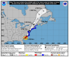
8:00 PM EDT Mon Aug 3
Location: 32.8°N 79.0°W
Moving: NNE at 16 mph
Min pressure: 988 mb
Max sustained: 75 mph
8:00 PM EDT Mon Aug 3
Location: 32.8°N 79.0°W
Moving: NNE at 16 mph
Min pressure: 988 mb
Max sustained: 75 mph
I think this is it. Should say SE Wake.LOVE my tempest, post the link once you have it set up.


BufordWX
Member
Already an observed tornado over Bald Head Island.Train of rotating storms getting ready to come on shore.View attachment 45980


BHS1975
Member
Train of rotating storms getting ready to come on shore.View attachment 45980
Yeah strong couplets.

Sent from my iPhone using Tapatalk
BufordWX
Member
CC drop tooYeah strong couplets.

Sent from my iPhone using Tapatalk

If it was to run I-95, that would give us more rain. Looking at radar, it looks like a North Myrtle Beach hit; as long as it continues the NNE track.
BufordWX
Member
New tornado watch extending further into North Carolina coming soon.
What's considered landfall, when the outer-wall first hits land or when the center passes?
BufordWX
Member
Looks like another tornado on the ground near the border about to pass into South Carolina.
Downeastnc
Member
What's considered landfall, when the outer-wall first hits land or when the center passes?
When the center of the center crosses land....