John1122
Member
Polar Vortex headed for the Great Lakes?

Polar Vortex headed for the Great Lakes?

Winter Uncancel, number 2 or 3....

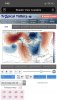
No something a little more like this ?Like this? BrrrView attachment 29173
Look at that ridge building closer to being over Alaska you have to love the trends tonightNo comment View attachment 29183
Not quite yet..still looks ugly to me but general consensus is a brief shot of transient cold air towards the end of the first week in January..EURO with a storm signal tonight towards the end of the runLook at that ridge building closer to being over Alaska you have to love the trends tonight

I’m just not sure the obsession with the -EPO. Not directed at you, Nick. I mean maybe when it’s coupled with a +PNA or a -AO? I just don’t see how it’s that beneficial of a teleconnection by itself. Seems like a recipe for a troughy west coast. Maybe someone can elaborate on this in the morning. I genuinely want to know. The GEFS has a similar look near AK towards the end of the run and you see how much it benefits us..This certainly doesn’t scream ugly to me ... look at that beastly anomalous ridge digging through Alaska ...

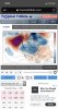
I’m just not sure the obsession with the -EPO. Not directed at you, Nick. I mean maybe when it’s coupled with a +PNA or a -AO? I just don’t see how it’s that beneficial of a teleconnection by itself. Seems like a recipe for a troughy west coast. Maybe someone can elaborate on this in the morning. I genuinely want to know. The GEFS has a similar look near AK towards the end of the run and you see how much it benefits us..View attachment 29188
I’m just not sure the obsession with the -EPO. Not directed at you, Nick. I mean maybe when it’s coupled with a +PNA or a -AO? I just don’t see how it’s that beneficial of a teleconnection by itself. Seems like a recipe for a troughy west coast. Maybe someone can elaborate on this in the morning. I genuinely want to know. The GEFS has a similar look near AK towards the end of the run and you see how much it benefits us..View attachment 29188
Yeah the euro and it’s ensembles are showing the ridge much further east which would have drastic impacts to what the US looks likeI’m just not sure the obsession with the -EPO. Not directed at you, Nick. I mean maybe when it’s coupled with a +PNA or a -AO? I just don’t see how it’s that beneficial of a teleconnection by itself. Seems like a recipe for a troughy west coast. Maybe someone can elaborate on this in the morning. I genuinely want to know. The GEFS has a similar look near AK towards the end of the run and you see how much it benefits us..View attachment 29188
I’m just not sure the obsession with the -EPO. Not directed at you, Nick. I mean maybe when it’s coupled with a +PNA or a -AO? I just don’t see how it’s that beneficial of a teleconnection by itself. Seems like a recipe for a troughy west coast. Maybe someone can elaborate on this in the morning. I genuinely want to know. The GEFS has a similar look near AK towards the end of the run and you see how much it benefits us..View attachment 29188

Signs of 2014 Winter.

 time to cancel winter EPO, hard pattern to break, ugly GOA ridge, last February in a nutshell, deeply negative PNA, Seattle gets everything while we torch

To reiterate from yesterday, we really need to keep a close eye on the North Pacific storm track the next week or so.
Small changes in the placement, amplitude, & orientation of the Okhtosk trough & downstream ridge in the NE Pacific & Alaska will make all the difference here. For the SE US, there's a very fine line between a warm & an extremely cold pattern with little room for in between.
View attachment 29190
Basically the fine line between a wintry pattern and a pattern supportive of severe weather with a flexing SE ridge and shortwaves ejecting out the west
Yep, in terms of sensible impacts anything is on the table atm & one of the two extremes is more likely than the middle of the road solution/ average temps. Even in some of our best wintry -EPO patterns, Florida is often still baking.
I second that in a heartbeat... this boring meh weather is killing me lolWouldn’t mind both, gotta love this upcoming pattern if you love severe and winter weather, either one is a win
Wouldn’t mind both, gotta love this upcoming pattern if you love severe and winter weather, either one is a win
No, it's more of if you love rain or winter weather. Not gonna see many interesting severe events with the roaring subtropical jet.
Dang, Euro close to dropping the hammer.
Should be interesting to watch the North Pacific storm track over the next few weeks. A deeper, equatorward, more persistent, & negatively tilted Sea of Okhtosk trough >>> stronger NE Pacific anticyclonic wave break & potential for a legit -EPO during the 2nd week of January.
View attachment 29165
Now look at the GEFS, notice this trough is faster, lifting, & positively tilted compared to the EPS >>> downstream ridge is more suppressed >>> less -EPO & more -PNA. We should be able to resolve this evolution late next week.
View attachment 29166

No this isn't true at all, a strong subtropical jet doesn't = lackluster severe, there's more to it than that. Actually, the presence of the southern jet is an additional source of barotropic kinetic energy & baroclinic energy that can be converted into eddies, leading to stronger surface cyclones & SRH, etc, the key is its latitudinal position.
A NINA-esque SE US ridge pattern coupled w/ a strong southern jet being deflected northward around the SER is a good pattern for severe.
While that is true, the subtropical jet also floods mid-level moist air which really hurts the EML. Sure you can get severe weather, but the really active outbreaks that people who like tracking severe weather want to see are hampered by messy storm mode and weak lapse rates.
The subtropical jet doesn't flood the continent w/ moist air in the mid-levels, the subtropical jet is actually higher in the upper troposphere than the mid-latitude jet and is roughly in geostrophic balance so it's not advecting anything to begin with.
Im talking about more moist southern stream systems, not the jet itself.
"the subtropical jet can also flood mid-level moist air which really hurts the EML"
There's a huge distinction between the eddies within the jet and the jet itself, which you were clearly talking about in the previous comment although you've subsequently denied it. EMLs rarely reach the southeastern US because they've usually been mixed out even in the most favorable patterns. You also don't want the mid-levels to be so dry that when parcels ascend, they entrain dry air and the updrafts collapse. Coupled w/ strong shear at this time of the year, the presence or lack of an EML is rarely the limiting factor for severe in January-March. Having an EML or the lack thereof is hardly a back breaker for severe weather in general in the SE US. It's sometimes present in the largest outbreaks but again it's not a necessary prerequisite outside the southern plains for getting an outbreak. In any case, the discussion of severe weather outbreak and whether or not this pattern would support one is superfluous here because there's far more needed than a nice synoptic-planetary scale wave pattern and its over a week away.
However, getting back to @Myfrotho704_ 's initial statement, the longwave pattern being shown in the longer term is in fact favorable for some severe weather in the SE US even w/ a strong subtropical jet which is deflected northward around said SER and again this STJ is not actually what's advecting mid-level EMLs into the southern plains.
Good grief, really?
Well, the bolded statement is true because you were at first discussing the STJ and then later you moved the goalposts and said you were talking about the eddies in said jet. There is in fact a pretty big difference between the two, the subtropical jet is a waveguide and is found exclusively in the upper troposphere, the other is obviously the waves themselves which have large depth in the troposphere and may extend throughout most of the column. The eddies may advect EML but again it's really not a necessary ingredient given the time of the year and location. A strong EML + strong shear + weak CAPE often = collapsing updrafts & very disorganized convection, if any. In this sense, the EML may hurt, not enhance deep convection