NBAcentel
Member
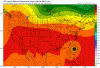
Increased heights vs last run north of this storm, which has nudged it a bit south


The Legacy may hit northern FL.
The high clearly stronger at 12Z, giving the nudge South! Should result in a more W/NW track!
Never say never in weatherYeah this thing isn't coming back west.

I think the only reason I said what I did with that is because I felt someone had to say the crazy thing. This tweet puts things in perspective.Never say never in weather
Lol nopeHour 81 should start to pull away as it feels the weakness in the northeast
Wouldn’t surprise me a bit either. Can’t stop and turn these big storms on a dime.It wouldn't surprise me If this storm ends up back towards Florida at landfall up through middle of Georgia.


If it was left biased yesterday, no one discounted it as it went out to sea....Keep in mind UK left bias.
If it was left biased yesterday, no one discounted it as it went out to sea....