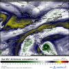
That's crazy. When I saw the eye wall collapse on radar I thought we were going to see this struggle a bit until the overnight. I guess notYep it wants to solidify its eye

Starting to get some lightning in the eyewall too.
Sent from my SM-G975U using Tapatalk


.png")

