NBAcentel
Member
That debris ball tho


Lol, just bring on hurricane season.
It had to be more than 100mph, heck of a video right here, definitely had that violent look


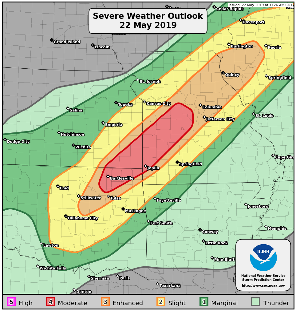
Lol today got upgraded to an enhanced.
I do too but we are on our way back to Houston and gonna set up near Shawnee, Ok to stay south of most of the flooding. No way I wanna be in NE OK today with already flooded roadways and potential for training supercells. We already had a lot of encounters yesterday in south-central KansasMore 700mb warmth/EML advection from Mexico, if a supercell can develop than it would likely produce a tornado, I wonder how bad chaser convergence is going to be today
oh. My. God. Look at that debris ball, 170 mph gtg shear in Missouri
View attachment 19734


another PDS watch???
TORCON is now at a 7 for OKC, Joplin, and Tulsa.