-
Hello, please take a minute to check out our awesome content, contributed by the wonderful members of our community. We hope you'll add your own thoughts and opinions by making a free account!
You are using an out of date browser. It may not display this or other websites correctly.
You should upgrade or use an alternative browser.
You should upgrade or use an alternative browser.
NBAcentel
Member
My thoughts are like yours but the very warm Atlantic may continue to help fuel the SER. But hopefully the stronger Niño finally overcomes it.
Seems like a that bad AK block we had before when we had that SER/ -PNA doesn’t help either
If we can beat back that SER, that isn't an awful look for a system. However, its mid March which likely means temps are a problemI believe I did the 4/2-4/3 composite right. Although @Webberweather53 can correct me here if I'm wrong

And what the EPS is showing at the end of what I can see

I can see some resemblance, but not identical by any means
And the 12z GFS for hr 228

Looks like severe wx for NC/SC/eastern GA based off that look, haven’t looked at precip maps tho

FV agrees
NBAcentel
Member

This is what I meant @GaWx , that ugly ridge around the gulf of Alaska then the very negative PNA
View attachment 17401
You make a good point. But I can’t help but think that the very warm Atlantic off the SE is aiding in strengthening that SER in addition to the ugly block making it easier for the SER to be strong.
Yeah I’m not sure the EPO has any effect on the SER. Big AK block sends cold air this way but doesn’t gueantee it makes it this far south. +PNA is a must. +PNA -EPO combo is a pretty good one. +PNA -EPO -AO -NAO is the dream team combination. My question is does anything in the arctic region (AK Arctic Greenland) move the SER in one direction or another? What’s the main driver here?Seems like a that bad AK block we had before when we had that SER/ -PNA doesn’t help either
NBAcentel
Member
You make a good point. But I can’t help but think that the very warm Atlantic off the SE is aiding in strengthening that SER in addition to the ugly block making it easier for the SER to be strong.
Definitely
My experience it may help the SER but a strong Nino produces a zonal Pac. Which is horrible too.My thoughts are like yours but the very warm Atlantic may continue to help fuel the SER. But hopefully the stronger Niño finally overcomes it.
Ilovesnow28
Member
@GaWx and @Webberweather53 or anyone else thinks that we can have a board wide winter storm catch us off guard with how bad the models been all year... I feel like with the severe weather and with the El nino finally truly starting to take affect March may be a month that could have some wild swings...
NBAcentel
Member
@GaWx and @Webberweather53 or anyone else thinks that we can have a board wide winter storm catch us off guard with how bad the models been all year... I feel like with the severe weather and with the El nino finally truly starting to take affect March may be a month that could have some wild swings...
If a +PNA comes to fruition then yeah someone might have a shot, we could of used one during this winter but with our luck we couldn’t, around this time of the year BL temps start becoming a issue but systems in March can be dynamic, especially the ULLs, anyways +PNA is key to a SE winter storm and cold in my opinion
Brent
Member
The 12Z GFS continues the idea that we won’t have an early spring. This is especially evident in Brent’s area!
Boo lol
The high teens (TN and mtns) to low 20's to near 32 lows elsewhere tonight for most board members in the SE will in most cases be within just a few degrees of the coldest so far this winter. I'm guessing that THE coldest will be tied or maybe even a new coldest set in a few locations. We'll see. Anyway, enjoy the (near) boardwide freeze tonight, folks! You've earned this one. Hopefully, this will quiet the bugs for awhile.
Last edited:
pcbjr
Member
Hot damn ... sarcastically on the "hot" ...

Brent
Member
The high teens (TN and mtns) to low 20's to near 32 lows elsewhere tonight for most board members in the SE will in most cases be within just a few degrees of the coldest so far this winter. I'm guessing that THE coldest will be tied or maybe even a new coldest set in a few locations. We'll see. Anyway, enjoy the (near) boardwide freeze tonight, folks! You've earned this one. Hopefully, this will quiet the bugs for awhile.
Yeah this was our coldest temps of the winter here only day to fail to get above freezing too yesterday
Man this brisk air is refreshing. Drink it in. It will be a while before we can do it again
39 and dropping fast
39 and dropping fast
The 12Z GFS continues the idea that we won’t have an early spring. This is especially evident in Brent’s area!

olhausen
Member
I got down to 13.2 degrees this morning which was my second coldest low of the season. The coldest night was back in January and was 11.4 degrees.
23 this morning, 41.9 this afternoon. Been below 32 since a little before 9pm tonight (well last night now). Hopefully this will curtail any bugs for a while.... not so sure anything thats already bloomed will survive these long nights of below 32 though.
All in? ?? ??
??


??I think the GFS needs recalibrated

BufordWX
Member
My favorite part of that frame is I get snow while the MA and parts of the NE get cold rain.
Snowflowxxl
Member
Can I go ahead and make the thread? Happened in March of 93, can happen now.
RollTide18
Member
Who’s ready for another Spring 2007?
Let me try that again..Climo favored areas in NC will see snow some time between March 17th and the 21st
Ilovesnow28
Member
Like I said yesterday the period after mid month between the 19 thru the 21 needs to be closely monitored
Ilovesnow28
Member
Let's not forget folks there will be a battle ground between the cold and warm air especially with this severe weather coming through the weekend
accu35
Member
Few runs now that gfs/fv3 both have cold middle to.end of month. Maybe something down the road before we finish this month out.
Nomanslandva
Member
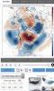
There are a single hand full of EPS members that are interesting out at day 14 so at least indicating a chance later in the month. Here is member 8 for you viewing pleasure")

Thank you for ur service?There are a single hand full of EPS members that are interesting out at day 14 so at least indicating a chance later in the month. Here is member 8 for you viewing pleasure
View attachment 17437
Ilovesnow28
Member
Can you post one by further south and west by chanceThere are a single hand full of EPS members that are interesting out at day 14 so at least indicating a chance later in the month. Here is member 8 for you viewing pleasure
View attachment 17437
Weather.usCan you post one by further south and west by chance
Looking at member 8, Tuscaloosa is shut out.Can you post one by further south and west by chance
https://weather.us/model-charts/euro/alabama/m8_snow-depth-in/20190321-0000z.html
Ilovesnow28
Member
Wow at this stage I can take that but I definitely wouldn't mind driving an hour to Birmingham or even Atlanta to snow chase if that verifiedLooking at member 8, Tuscaloosa is shut out.
https://weather.us/model-charts/euro/alabama/m8_snow-depth-in/20190321-0000z.html
We're 4-5 days out from even considering it a possibility, but that map is fun to look atWow at this stage I can take that but I definitely wouldn't mind driving an hour to Birmingham or even Atlanta to snow chase if that verified
Ilovesnow28
Member
Right but it will be real fun if it catches us off guard and gives everyone from Dallas to the Carolinas 20+ inches so that way we can end the winter on a high noteWe're 4-5 days out from even considering it a possibility, but that map is fun to look at
B
Brick Tamland
Guest
Only two weeks away. I'm sure it'll happen.
ForsythSnow
Moderator
With that upcoming look it makes me skeptical since we were wanting that look earlier in the year. Nice +PNA there but is it too late and will it be too warm? Just have to see. I'm trying not to get sucked into events since I still feel we aren't going to see one big storm but I hope to be wrong.12Z GFS incoming 3/18-9.