Brent
Member
yawn lol
At least when it's cold you can put on as many layers as you want. What do you do when its hot ? Strip naked ?
You would think governments would classify their weather models so people didn't know how inept they wereI get so stinking sick of being tease by the damn models.
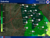
The night shift at FFC must've got into the wine...lmao. What is this?! Flurries across North GA in the 50s and 60s for Saturday and a moon in the south part of the state...lol.
00z says "maybe next year"Blockbuster sustained backend arctic intrusions all the way into March
oopsie daisy
00z
View attachment 11821
18z
View attachment 11822


All those pretty colors are in the wrong place at 0z? What happened to all the pipe bursting boners?? Pants safe! Hug ensembles!Blockbuster sustained backend arctic intrusions all the way into March
oopsie daisy
00z
View attachment 11821
18z
View attachment 11822


RC wanted to wake up to 5 pages!? He’s lucky there is 5 posts!This sums up the runs last night.
He said 5 pages of new material, and this thread sure provided as that post was made 5 pages back! WE DID IT!RC wanted to wake up to 5 pages!? He’s lucky there is 5 posts!

Yep he better wake up quick!Someone wake Brent up. Snow is being reported north of Dallas !

Someone wake Brent up. Snow is being reported north of Dallas !

Who cares about a few sh!tty op runs!? Hug the ensembles!


A Larry Special !Hold the motherpoopin phone!!View attachment 11834

Back to the Future! MCFLY!!!!Since we don't actually have any legitimate threats to look at for the moment, let's reminisce in a big storm that happened OTD in 1955 that actually did not screw over the Triangle and was followed up by a couple more storms which also surprisingly weren't total screw jobs in RDU!
Sadly, this ended up being one of the few legitimately snowy winters of the 1950s, most of the rest of the decade sucked much like the 1990s!
View attachment 11837
View attachment 11839
View attachment 11838
That would be Hi-Larry-ous. (Hilarious) LOLA Larry Special !
Sarah, Sarah, storms are brewing in your eyes....Jimmy, I know Sarah’s your girl, but if she says pre frontal rain, one mo gin!