Jessy89
Member
HWRF is running
 Ominous look continues...
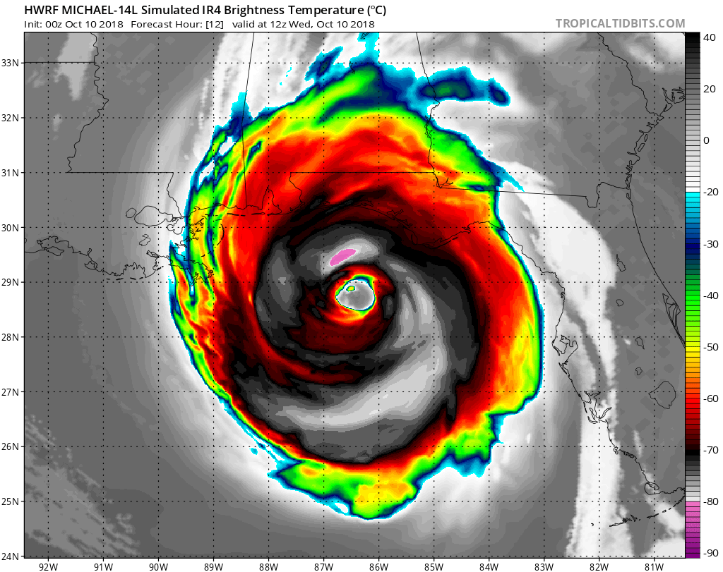


Is it the real thing
i wish recon would make a pass on the Northeastern eyewall right now! Guranteed Cat4 sustained surface winds in there. Maxing out the color scale!Is it the real thing or more of the same? Time will tell...

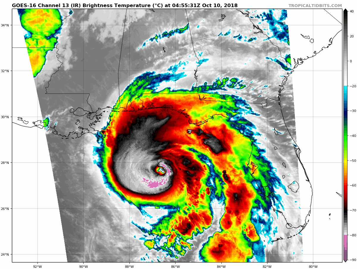
 Hide ya kids. Hide ya wife. Sell the farm. Pinhole eye


HWRF gets this down to 925mb by landfall and HMON has it at 928mb.
So would that support NNW/N little longer?**STEERING MAP UPDATE**
We are going to compare the 00z and 03z Steering maps. I will post the old (0z) vs new(3z).....hint hint....the trof is having a hard time cutting into that western edge of the ridge so far** I know that will change soon though.
OLD 00Z RUN
View attachment 6881
NEW 03Z run
View attachment 6882
That is just flat out amazing how it is exploding like this overnight. That’s just plain nasty.View attachment 6880 Hide ya kids. Hide ya wife. Sell the farm. Pinhole eye
I honestly think yes it does.So would that support NNW/N little longer?
Can this thing keep intensifying like this for the next 12 hours? I mean it has to weaken at some point, right?942.9 mb for the recon pass
Yes. NHC track shifted west toward Pensacola.Is it a Cat 4?
Yes we are officially cat 4 as of now.Is it a Cat 4?
Yes, Michael has actually moved 1/10th of a degree west in the past couple of hoursYes. NHC track shifted west toward Pensacola.
.png")