• Hello, please take a minute to check out our awesome content, contributed by the wonderful members of our community. We hope you'll add your own thoughts and opinions by making a free account!

Tropical Hurricane Isaac

Snowfan

When NW trend?
Member
Joined
Jan 5, 2017
Messages
10,359
Reaction score
9,546
Location
Not telling
Just got designated.
1. A tropical wave located more than 400 miles southeast of the Cabo
Verde Islands is producing a large area of disorganized showers and
thunderstorms. Some slow development of this disturbance is
possible during the next several days while the system moves
westward to west-northwestward across the eastern tropical Atlantic.
* Formation chance through 48 hours...low...10 percent.
* Formation chance through 5 days...medium...40 percent
 
A tropical wave located a few hundred miles southeast of the Cabo
Verde Islands continues to produce a large area of disorganized
showers and thunderstorms. Gradual development of this system is
expected, and it could become a tropical depression late this week
or this weekend while it moves westward to west-northwestward across
the eastern tropical Atlantic.
* Formation chance through 48 hours...low...10 percent.
* Formation chance through 5 days...medium...50 percent.

$$
Forecaster Cangialosi
 
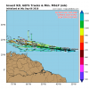
here is the latest track guidance for 92L.. that ECMF if it verifies could be the one to watch as far as getting in the GOM

storm_92.gif
 
A tropical wave accompanied by a broad low pressure system located
a few hundred miles south-southeast of the Cabo Verde Islands is
forecast to move slowly westward to west-northwestward across the
eastern tropical Atlantic for the next several days. Although this
disturbance continues to produce disorganized showers and
thunderstorms, environmental conditions are expected to gradually
become conducive for further development, and a tropical depression
is likely to form by late this week or this weekend.
* Formation chance through 48 hours...low...20 percent.
* Formation chance through 5 days...high...70 percent.
 
A broad low pressure system located a few hundred miles south of
the Cabo Verde Islands is forecast to move slowly westward to
west-northwestward across the eastern tropical Atlantic for the next
several days. Environmental conditions are expected to gradually
become more conducive for development, and a tropical depression is
likely to form by late this week or this weekend.
* Formation chance through 48 hours...low...30 percent.
* Formation chance through 5 days...high...80 perc
 
A broad area of low pressure with disorganized cloudiness and
showers is centered a couple of hundred miles south of the Cabo
Verde Islands. Environmental conditions are forecast to become
conducive for development, and a tropical depression is expected to
form by the end of the week while the system moves west-
northwestward across the tropical Atlantic Ocean.
* Formation chance through 48 hours...medium...40 percent.
* Formation chance through 5 days...high...90 percent.
 
GFS takes this into SW Florida at 360 hours after running near the Northern Caribbean islands
 
Shower activity associated with a broad area of low pressure
centered a couple of hundred miles south-southwest of the Cabo Verde
Islands has become better organized since yesterday. Environmental
conditions are forecast to be conducive for additional development,
and a tropical depression is expected to form by the end of the week
while the system moves west-northwestward across the tropical
Atlantic Ocean.
* Formation chance through 48 hours...medium...50 percent.
* Formation chance through 5 days...high...90 percent.
 
this thing may be a sleeper with Florence dominating the buzz but the 12z GFS has a strengthening hurricane approaching the Caribbean in a week
Yeah this could be a problem down the road. Unfortunately, it's going to be one of those storms that could develop rapidly and take aim at the Caribbean. Where it will go is a week too early to say.
 
Fantasy land GFS turns it north east of the Bahamas after going really close to PR and has yet another blocking high at the end of the run
 
Up to 70/90 now.
1. Shower activity associated with a broad area of low pressure
centered a couple of hundred miles south-southwest of the Cabo Verde
Islands is gradually becoming better organized. Environmental
conditions are forecast to be conducive for additional development,
and a tropical depression is expected to form during the next
couple of days while the system moves west-northwestward across the
tropical Atlantic Ocean.
* Formation chance through 48 hours...high...70 percent.
* Formation chance through 5 days...high...90 percent.
 
another Puerto Rico hurricane on the 18z GFS and then into Hispanola

Looks like it then follows Florence once she's OTS
 
Last edited:
Going to have go watch this one too and the one behind it as well !!
 
The circulation associated with an area of low pressure centered
several hundred miles west-southwest of the Cabo Verde Islands
remains broad and elongated, and the associated shower and
thunderstorm activity has not yet increased in organization.
However, environmental conditions are conducive for development, and
a tropical depression is expected to form within the next day or two
while the system moves slowly westward or west-northwestward across
the tropical Atlantic Ocean.
* Formation chance through 48 hours...high...80 percent.
* Formation chance through 5 days...high...90 percent.
 
Disdain IMBY stuff, but candidly, this little bugger (92 L ... the lower one) has a few oak trees, and me, slightly concerned ...

two_atl_5d0.png
 
Last edited:
This is other storm besides Florence I'm very concerned about. I'm assuming this one will receive the name of "Isaac". As I said last year, "Beware the "I" named storms", we as a country clearly have a bad history with them. (Isodore, Ivan, Ike, Irene, Irma, etc.)
 
While, very understandably, most on this forum have their eyes on Flo and where she goes, it is Isaac that I am beginning to watch very carefully. He looks to be taking the Caribbean path. Some of our most infamous landfalling hurricanes have taken this path before bearing down from the Gulf. In recent years Lili (2002), Gustav (2008), and at least several others have started from a similar position as Isaac is now. What is particularly concerning is the amount of oceanic heat content out ahead of his path. At least the shear is hampering development for the next 3-5 days, per the latest NHC discussion.
 
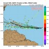
Hwrf bombs this too:eek: approaching the Antilles this is a scary track

received_2187185311556189.png
 

Attachments

  • received_2187185311556189.png
    received_2187185311556189.png
    279.5 KB · Views: 14
Back
Top