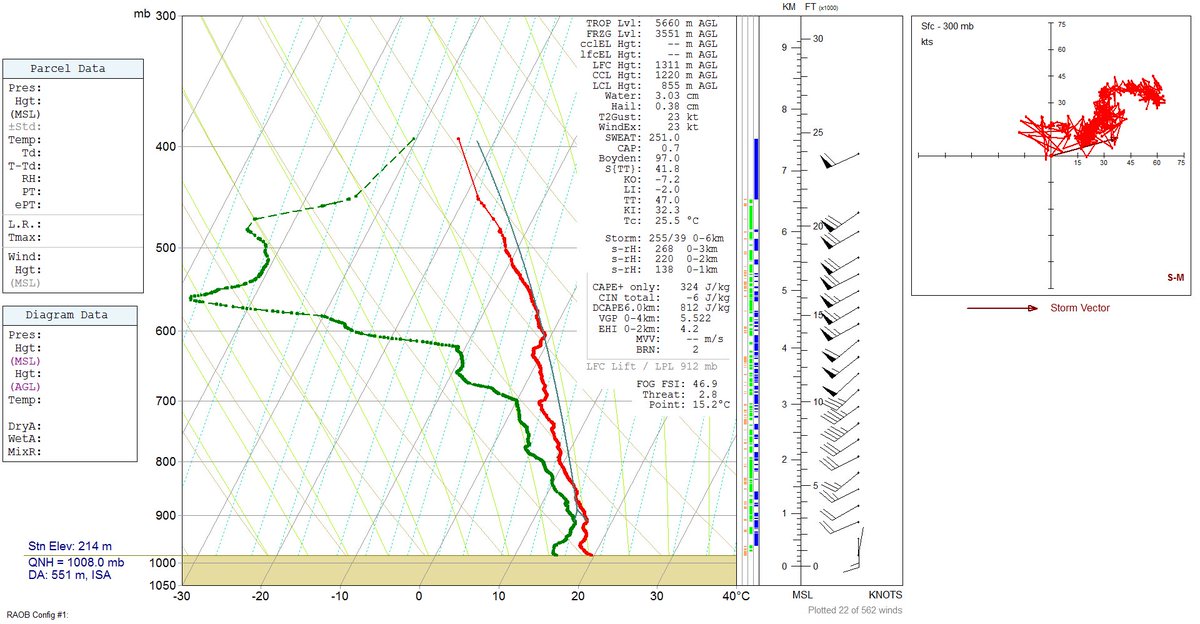
Yeah I'd hate to actually have to you know use the current obs....Lol all the mets on twitter trashing the HRRR and the NAM . What the heck are they gonna use lol
Severe Severe Threat April 5th-7th
- Thread starter Storm5
- Start date
-
Hello, please take a minute to check out our awesome content, contributed by the wonderful members of our community. We hope you'll add your own thoughts and opinions by making a free account!
You are using an out of date browser. It may not display this or other websites correctly.
You should upgrade or use an alternative browser.
You should upgrade or use an alternative browser.

Mesoscale Discussion 0441
NWS Storm Prediction Center Norman OK
1038 AM CDT Wed Apr 05 2017
Areas affected...FL Panhandle...GA...Southwest SC
Concerning...Severe potential...Watch likely
Valid 051538Z - 051715Z
Probability of Watch Issuance...95 percent
SUMMARY...Tornado Watch will be issued by 17z to address increasing
severe threat from the eastern FL Panhandle into SC.
DISCUSSION...Boundary-layer cu field is beginning to deepen from the
eastern FL Panhandle into southeast GA as surface temperatures rise
to near 80F. Latest high-res Vis imagery depicts
clustering/towering CU along a corridor from near MAI to near VDI.
Substantial breaks in cloud cover suggest additional heating can be
expected and thunderstorms will likely evolve over the next few
hours. Given the strength of the wind fields and rising instability
there is increasing concern for discrete supercell formation by
early afternoon. Environmental parameters appear favorable for a
few strong tornadoes across this region, in addition to large hail
and damaging winds. Tornado watch will be issued for parts of this
area by 17z.
Lol, they will use their in house models, which will be horrible considering the differences between them, assuming "in house" models aren't based off of other models or aren't actual other models.Lol all the mets on twitter trashing the HRRR and the NAM . What the heck are they gonna use lol
Atlanta getting non stop rain all morning. Don't see how we get out of cloud cover this afternoon
I don't think people in North Central AL should let their guard down this afternoon just yet...
Atlanta getting non stop rain all morning. Don't see how we get out of cloud cover this afternoon
I sure hope we don't. It's very dark here now just below the city.
http://www.intellicast.com/Local/Wx...oomLevel=8&opacity=1&basemap=0014&layers=0040Atlanta getting non stop rain all morning. Don't see how we get out of cloud cover this afternoon
You can see the cloud cover break down on-going as we speak low cloud tops are quickly moving east
Atlanta getting non stop rain all morning. Don't see how we get out of cloud cover this afternoon
Seems hard to believe, but I think it's possible we will see some sun today. Breaks in the clouds are moving east and should only be a few hours away. But, there is a chance we don't see any breaks. Clouds and storms are back building a bit. Hard to say at this point.
Last edited:
I'm south of the main action atm but I'm really not liking what I'm seeing, when it's not raining the sun is trying to peak out for a period of time for me, gotta think that'll only help fuel things for later here...
Although I took a walk and today had a different feel from Monday here, it felt a lot cooler and stable outside of it being humid.
Although I took a walk and today had a different feel from Monday here, it felt a lot cooler and stable outside of it being humid.
Lol, dewpoint down another degree to 47 at RDU on the back of SE winds at 8 mph. Nice wedging from the SE, importing all of that dry air off the ocean.
CBS 46 is continuing to say that there will be 1 to 2 more rounds of SVR T-STORMS later today for the metro. I'm not so certain that happens with all of the rain we're getting right now. Based on the map that Storm5 shared earlier, it looks as if the CAPE is having trouble over-coming the wedge.
CBS 46 is continuing to say that there will be 1 to 2 more rounds of SVR T-STORMS later today for the metro. I'm not so certain that happens with all of the rain we're getting right now. Based on the map that Storm5 shared earlier, it looks as if the CAPE is having trouble over-coming the wedge.
It's moving up. Once those storms clear east it will start to shoot up

Sent from my iPhone using Tapatalk


