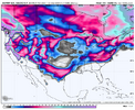
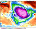
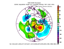
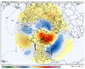
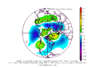
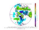
Yeah, that potentially does make sense. If we can time things out right we may really have something later in December into January. Just so the record is clear, I'm not ruling out things setting up shop earlier, but it doesn't look like a slam dunk to me (which it rarely doesLooking at the new Euro monthly for Jan vs the prior run, Jan is much colder. I’m guessing that this is due at least partially to the significant % of potential SSWE’s. This SSWE was too far out to be predicted on the prior monthly run. Note that Dec is about the same, which is consistent with the idea that due to lag that Jan wouid be much more affected.
-
Hello, please take a minute to check out our awesome content, contributed by the wonderful members of our community. We hope you'll add your own thoughts and opinions by making a free account!
You are using an out of date browser. It may not display this or other websites correctly.
You should upgrade or use an alternative browser.
You should upgrade or use an alternative browser.
Wintry Winter 25-26 Winter Battle Zone
- Thread starter SD
- Start date
I'm on whoever is team cold and snow.Webber vs 1300M. This is how you know winter is about to kick off.
accu35
Member
This is entertainment, keep em coming guys
Am I watching Godzilla vs King Kong?
I am going to Gatlinburg December 11th-14th so I am going to be watching the weeks & days leading up to this timeframe like crazy. Doing the Polar express with the family in Bryson City that Friday the 12th. Going to need a big ole Winter storm to roll in so I can relive the entire movie with my family. Seems pretty simple I think. Lol
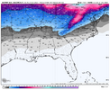

Gonna be in Blowing Rock same weekend, doing the Tweetsie Christmas train ride. So going to be watching closely tooI am going to Gatlinburg December 11th-14th so I am going to be watching the weeks & days leading up to this timeframe like crazy. Doing the Polar express with the family in Bryson City that Friday the 12th. Going to need a big ole Winter storm to roll in so I can relive the entire movie with my family. Seems pretty simple I think. Lol
View attachment 176133
MRKEVIN7575
Member
Im hopeful that we can get a 3-6 week stretch of cold and stormy this winter, perhaps with right mjo progression
lexxnchloe
Member
Rain mixed with sleet here.
Brent
Member
Looks accurate a big snow hole here
- Joined
- Nov 29, 2021
- Messages
- 42
- Reaction score
- 144
Looks accurate a big snow hole here

Just like i predicted. You can take it to the bank when i forecast it and now you’re seeing models verify my forecast. I know you haven’t heard of me much but im the new sheriff in town on this forum.
Sent from my iPhone using Tapatalk
dsaur
Member
I know, I've been a Tech fan since I was a wee tike, but I do hate the actual relatives of their mascot, lol. I try to think of stings as nature's inoculations, and that all that poison fixed something that was out of whack. And it must have really been out of whack to require 20 stings. One was in my pants leg and stung me three hours after the initial attack. Talk about kicking someone when they're down! I'm hoping lows in the 20's will send them underground much deeper, but I don't think one night will do it.Ouch, Tony! Maybe those jackets are mad about last Saturday? But if so, they shouldn’t have taken it out on you of all people!
Webberweather53
Meteorologist
Yep you can see the push towards the western hemisphere (as expected) in early December on the weeklies.
Big, slow lumbering MJO events are pretty on brand for a La Niña winter with a warm Indo-Pacific Warm Pool, as westward propagating Rossby Waves more readily couple w/ the MJO while zonal advection of moist static energy is hampered by the dry anomalies over the central pacific & moist anomalies over Indonesia (which interrupt the zonal MSE tendencies of the MJO),
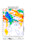
These zonal wind anomalies are particularly impressive & are setting the stage for subsequent MJO events later in winter to eventually change the ENSO base state.
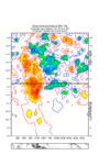
Big, slow lumbering MJO events are pretty on brand for a La Niña winter with a warm Indo-Pacific Warm Pool, as westward propagating Rossby Waves more readily couple w/ the MJO while zonal advection of moist static energy is hampered by the dry anomalies over the central pacific & moist anomalies over Indonesia (which interrupt the zonal MSE tendencies of the MJO),

These zonal wind anomalies are particularly impressive & are setting the stage for subsequent MJO events later in winter to eventually change the ENSO base state.

Webberweather53
Meteorologist
BHS1975
Member
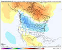
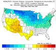
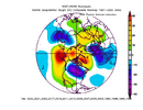
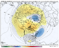
Then torch after?Compare the surface temperature anomalies and 500mb heights for 30 years worth of La Niña Decembers vs the latest Euro weeklies through about mid-month or so.
None of this should be surprising
View attachment 176157
View attachment 176156
View attachment 176158
View attachment 176159
Webberweather53
Meteorologist
Then torch after?
January could be interesting too, especially if we get the December tropospheric pattern to anchor itself into the stratosphere.
I would heavily favor a milder February with a strong +NAM/AO. Oth, sometimes these winters marked by ENSO transition & heavy doses of +TNH like this year can go off-script and leave us cold anyway. Although I still think the atmosphere will have some sort of “hangover” regardless, if La Niña conditions deteriorate more quickly than expected that could change February’s outcome.
December’s overall forecast feels like a lay-up to me by comparison to the rest of the winter and spring
Webberweather53
Meteorologist
tennessee storm
Member
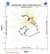
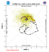
Mjo can also be unpredictable… nothing guaranteedLatest MJO
Slow down in 5
Slow down in 6
Early Dec in 7
Mid Dec in 8
I like slow rides
View attachment 176151
View attachment 176152
Webberweather53
Meteorologist
Even going back to this past month over N America, this year really isn’t going out of its way to deviate that much from the La Nina script & I don’t expect that to change much in December either
A ridge anomaly centered near the Hudson Bay with its axis nosing down into New Mexico or so is very on brand
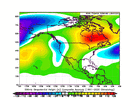
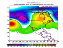
A ridge anomaly centered near the Hudson Bay with its axis nosing down into New Mexico or so is very on brand


Load that P8-1 in late December!Latest MJO
Slow down in 5
Slow down in 6
Early Dec in 7
Mid Dec in 8
I like slow rides
View attachment 176151
View attachment 176152
@Webberweather53 Just for fun what percentage of chance would you give us east of the mountains to see a decent snow before Christmas?
It’s more like Godzilla vs a squirrel. I’ll let you decide who’s who.Am I watching Godzilla vs King Kong?
Didn't see the question asked about early SSW events and any correlation to a prolonged weak PV. This is the chatgpt response lol.
1. Early SSWs = Weaker Mean Vortex Winters
Winters with an early (November–early December) SSW typically show a weaker-than-average stratospheric polar vortex throughout the rest of the season.
Once the vortex is disrupted early, it often fails to fully recover for the remainder of winter.
Example years: 2009–10, 2018–19, 2023–24 (minor) — all featured early or midwinter SSWs followed by persistently weak vortex conditions and stronger planetary wave driving later on.
 2. Frequency of Subsequent SSWs or Vortex Disturbances
Multiple major SSWs in a single winter are rare, regardless of timing (the stratosphere needs several weeks to recover).
But early SSW years often have enhanced minor warmings or continued wave breaking, meaning more disturbed stratospheric conditions overall.
Statistical studies (e.g., Charlton & Polvani 2007, Butler et al. 2017) show that if the first SSW occurs before January, the likelihood of another major SSW in the same season rises slightly — but still remains low (≈15–25%).
So:
Early SSWs don’t make them frequent per se, but they often signal a weaker, more unstable vortex that is more prone to further disturbances.
1. Early SSWs = Weaker Mean Vortex Winters
Winters with an early (November–early December) SSW typically show a weaker-than-average stratospheric polar vortex throughout the rest of the season.
Once the vortex is disrupted early, it often fails to fully recover for the remainder of winter.
Example years: 2009–10, 2018–19, 2023–24 (minor) — all featured early or midwinter SSWs followed by persistently weak vortex conditions and stronger planetary wave driving later on.
Multiple major SSWs in a single winter are rare, regardless of timing (the stratosphere needs several weeks to recover).
But early SSW years often have enhanced minor warmings or continued wave breaking, meaning more disturbed stratospheric conditions overall.
Statistical studies (e.g., Charlton & Polvani 2007, Butler et al. 2017) show that if the first SSW occurs before January, the likelihood of another major SSW in the same season rises slightly — but still remains low (≈15–25%).
So:
Early SSWs don’t make them frequent per se, but they often signal a weaker, more unstable vortex that is more prone to further disturbances.
Euro Weeklies Dec 1-7: today’s run is coldest run yet
Today’s Euro Weeklies run for Dec 1-7 has backed off significantly from yesterday’s run, which was the coldest run yet. It looks like the run from 2 days ago. Also, the subsequent two weeks are warmer than yesterday. All 3 weeks are now near normal in the E US.
Last edited:
Webberweather53
Meteorologist
@Webberweather53 Just for fun what percentage of chance would you give us east of the mountains to see a decent snow before Christmas?
Who knows. It’s hard to beat what we’re setting up for December this year though. We’ve stacked the deck about as much as we could for a cooler and snowier December but that doesn’t always translate in our favor snow-wise. Now we just wait for an actual threat to appear on the horizon.
Webberweather53
Meteorologist
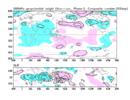
If we continue to follow the Nina script this winter as closely as we have been this fall, odds are the MJO probably will be slowly lumbering through the Indian Ocean & into the Maritime Continent (phase 3-4-5 ish) for the bulk of January. Maybe we return to the West Pac again late in January or February to deliver the knock out blow to La Niña that shows up in the springtime.
Phase 3-4 MJO composites are very close to what the last 30 years of La Niña Januarys look like
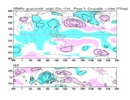
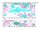
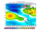
Phase 3-4 MJO composites are very close to what the last 30 years of La Niña Januarys look like


I know people will see this & immediately think warm for the South, but I think this is a solid look & it reflects the beginning stages of what we’ve been talking about with early December for awhile.
Seeing blue over areas of the North tells me a cold air source upcoming is coming from the place we need it the most.. Canada/Arctic region.
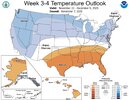
Seeing blue over areas of the North tells me a cold air source upcoming is coming from the place we need it the most.. Canada/Arctic region.

Pretty smart outlook and lines up well with my thoughts for now. Uncertain start to December with more potential the deeper we get in.I know people will see this & immediately think warm for the South, but I think this is a solid look & it reflects the beginning stages of what we’ve been talking about with early December for awhile.
Seeing blue over areas of the North tells me a cold air source upcoming is coming from the place we need it the most.. Canada/Arctic region.
View attachment 176197
I won’t mind having a -PNA for a week. Gotta build the snow pack.I know people will see this & immediately think warm for the South, but I think this is a solid look & it reflects the beginning stages of what we’ve been talking about with early December for awhile.
Seeing blue over areas of the North tells me a cold air source upcoming is coming from the place we need it the most.. Canada/Arctic region.
View attachment 176197
Webberweather53
Meteorologist
Still suspect we will see a transition from a -PNA/-NAO late Nov to +PNA/-NAO/-EPO in early December as the upper-level footprint of the MJO goes from the West Pac (phase 7) to the Western Hemisphere (phase 8). This CPC outlook in week 3-4 is the average of these two patterns.
Very tricky sensible weather forecast in the Carolinas and Mid-Atlantic tho with potential for some wild swings. We may find ourselves in the battle zone between cold CAD nosing in from New England and substantial bouts of milder air trying to push in from the Southern Plains & Lower MS Valley
We should see the -NAO/-EPO persist for the bulk of December and progressively lose the +PNA late in the month as the MJO re-enters the Indian Ocean again late December or so (phase 2). Of course, there’s absolutely nothing wrong with that, especially if we’ve got a respectable amount of snow cover and cold already entrenched over the CONUS. Losing the +PNA may just mean many more opportunities for storms with much better late Dec climatology to boot as @1300m alluded to
NBAcentel
Member
If I was to take my chances with that timeline, it would be as we’re losing the +PNA to score around the SE, overrun that lower level arctic air, especially with the -NAO in place to anchor 50/50 lows and high pressure in the NEStill suspect we will see a transition from a -PNA/-NAO late Nov to +PNA/-NAO/-EPO in early December as the upper-level footprint of the MJO goes from the West Pac (phase 7) to the Western Hemisphere (phase 8). This CPC outlook in week 3-4 is the average of these two patterns.
Very tricky sensible weather forecast in the Carolinas and Mid-Atlantic tho with potential for some wild swings. We may find ourselves in the battle zone between cold CAD nosing in from New England and substantial bouts of milder air trying to push in from the Southern Plains & Lower MS Valley
We should see the -NAO/-EPO persist for the bulk of December and progressively lose the +PNA late in the month as the MJO re-enters the Indian Ocean again late December or so (phase 2). Of course, there’s absolutely nothing wrong with that, especially if we’ve got a respectable amount of snow cover and cold already entrenched over the CONUS. Losing the +PNA may just mean many more opportunities for storms with much better late Dec climatology to boot as @1300m alluded to
We are about to go into an endless wedge cycle
NBAcentel
Member
The wedges are gonna hit different in mid-late dec though once we root some Arctic air into the pattern. But yeah agree with this. For the next 1.5-2 weeks the trough to our NE is nearby, always threats of wedging with that, while Columbia is at 76FWe are about to go into an endless wedge cycle
JHS
Member
I wonder if this will possibly go something like 1998-99 did. If so, someone in NC and SC may be in for a MAJOR icestorm in late Dec or early Jan. Maybe both months just like that winter.
Webberweather53
Meteorologist
If I was to take my chances with that timeline, it would be as we’re losing the +PNA to score around the SE, overrun that lower level arctic air, especially with the -NAO in place to anchor 50/50 lows and high pressure in the NE
Yeah can’t complain about this too much. Even then, I don’t think we would go crazy negative later in Dec into early Jan. More likely to be closer to neutral or weakly negative overall
Sometimes, +PNA patterns like we see earlier in Dec can suppress the storm track a bit too much for most of the board (*cough* early Dec 2000), especially in a Nina winter like this where the subtropical jet isn’t super strong
https://ds.data.jma.go.jp/tcc/tcc/products/clisys/mjo/composite.html
Webberweather53
Meteorologist
We are about to go into an endless wedge cycle
Yep. -PNA/-NAO patterns are CAD printers

