I believe it might be. He’s in my FB from time to time. Very hype driven, I believe, but the maps are legitIs that from snowbird bob?
-
Hello, please take a minute to check out our awesome content, contributed by the wonderful members of our community. We hope you'll add your own thoughts and opinions by making a free account!
You are using an out of date browser. It may not display this or other websites correctly.
You should upgrade or use an alternative browser.
You should upgrade or use an alternative browser.
Wintry Winter 25-26 Winter Battle Zone
- Thread starter SD
- Start date
Drizzle Snizzle
Member
and of course somehow Florida manages to be the only place that is above normal. That has a southeast ridge look to it. Wouldn’t surprise me if the warmth extended into Georgia with cold air further west deep into Texas. Similar to February 2021.Giddy up! All hail the new king! View attachment 175932
Is that from snowbird bob?
Hey Kevin,
This is a control run (18Z of yesterday) of the WxBell CFS being forecasted out 2 months. Even calling this map less than worthless is being kind.
So for Jan, here’s a repost of that 18Z of 11/1 CFS control run:

Keep in mind that these are in C, not F. So, it gives the majority of the middle 1/3 of the US a record obliterating cold Jan.
To show how silly this run is, it has Chicago at an obliterating alltime record breaking cold Jan of 14C/25F BN, which is -1F! The coldest Jan (and any month for that matter) on record back to 1873 is +10.1F (1977). So, this CFS control run is forecasting Chicago to have a Jan that is 11F colder than any month they’ve had during the last 153 years!
Now here’s the very next CFS control run, the 0Z 11/2 run:

Instead of mid-America having a record obliterating cold Jan, it has much warmer than normal in much of the same area! It has Chicago only 3 F AN because the WxBell CFS maps always show a funky cold spot centered on Lake Michigan (funky WxBell CFS algos is another issue for another time that I’ve posted about before). So, it has Chicago at an AN +27F vs -1F on the prior run or 28F warmer lmao!
Last edited:
NBAcentel
Member
Feel like recent ninos have had to much jet extension issues so even a moderate Nino feels like a super, can can never establish a true bridge to Arctic air into the NA during any ninos recently and we get setups that are barely to warm to snow, meanwhile a Nina almost always results in a ridge around Alaska/the Aleutians and brings cold nearby at least, it’s more so we fight the jet being to retracted especially later in winter
NBAcentel
Member
Latest weeklies is nice. Nice suppressed look in early dec 


Webberweather53
Meteorologist
This year trying to do its best 2010 impression


SnowNiner
Member
Feel like recent ninos have had to much jet extension issues so even a moderate Nino feels like a super, can can never establish a true bridge to Arctic air into the NA during any ninos recently and we get setups that are barely to warm to snow, meanwhile a Nina almost always results in a ridge around Alaska/the Aleutians and brings cold nearby at least, it’s more so we fight the jet being to retracted especially later in winter
I thought I read somewhere that weak Nina’s were actually better historically for snow averages for CLT than ninos on average. Maybe that the reason why, ninos just have too much jet although the storm track is further south.
Today’s Euro Weeklies has the ens 10 mb mean zonal wind as low as only +14 to +15 in late Nov (prior runs’ lowest were +18) and is at least tied for the highest % of members of any run so far this season with a very early season major SSW (reversal) at 25%+:


SimeonNC
Member
I'm manifesting/praying that somewhere in NC outside the mountains....preferably the CLT area goes under a snow squall warning at some point this winter.
tennessee storm
Member
To bad it will look very different t next runsLatest weeklies is nice. Nice suppressed look in early dec View attachment 175949View attachment 175950View attachment 175951View attachment 175952
Brent
Member
I thought I read somewhere that weak Nina’s were actually better historically for snow averages for CLT than ninos on average. Maybe that the reason why, ninos just have too much jet although the storm track is further south.
Now that I think about it I believe our biggest snowstorm ever in February 2011 and February 2021 were both in La Nina

I know the last real El Nino I remember we got flooded with Pacific air all winter and it sucked. That was one of the winters with a snow hole here since 21 and all we managed was like an inch the whole winter which is sad for here
Last edited:
tennessee storm
Member
Yeah u r correct Brent … last few El Niño events we had have really sucked …. Take chance with a weak Nina for sureNow that I think about it I believe our biggest snowstorm ever in February 2011 and February 2021 were both in La Nina
I know the last real El Nino I remember we got flooded with Pacific air all winter and it sucked. That was one of the winters with a snow hole here since 21 and all we managed was like an inch the whole winter which is sad for here
NBAcentel
Member
To bad it will look very different t next runs
It’s been the same the last almost 2 weeks now and keeps looking better
Trend could reverse, but last 3 Euro Wk runs show a weakening trend with the Strat PV at 10mb. Fits well with forecasts of developing Greenland blocking

Weekly MJO update from NOAA CPC. We'll see how this evolves, but this looks kind of ideal at the moment for December interests. Strong enough to keep propagating east (Euro is probably too weak with the signal), but not too strong and fast to zip thru the 8-1-2 phases during November.


Dec 9 on today's Euro Wk

30-day avg for Nov 19 to Dec 19 on today's Euro Wk

Can’t be mad at it.
Webberweather53
Meteorologist
This winter looks like it's going to fall in line with what you'd typically expect hemispherically during a cool ENSO/east QBO/solar max December with lots of high-latitude blocking & a weakened NAM/ -AO & -NAO.
Given how early on in the winter the vortex is weakening here and that we have a pretty favorable look for -EPO/+TNH to dominate especially in January-February, I do think we will probably flip the AO/NAO to positive (& possibly strongly so) at some point way down the road, probably in January if I had to guess. That won't necessarily mean an end to winter or snow/ice threats the moment that happens, but the overall flavor any potential systems or windows of opportunity would certainly change from where it looks to be in December.


Given how early on in the winter the vortex is weakening here and that we have a pretty favorable look for -EPO/+TNH to dominate especially in January-February, I do think we will probably flip the AO/NAO to positive (& possibly strongly so) at some point way down the road, probably in January if I had to guess. That won't necessarily mean an end to winter or snow/ice threats the moment that happens, but the overall flavor any potential systems or windows of opportunity would certainly change from where it looks to be in December.
So in this type of scenario do we have a better shot at winter weather in December than both Jan and Feb? Or maybe the things look better in Feb than Jan? I’m used to us putting all our eggs into the Jan basket and giving up on Feb. And December for that matter lolThis winter looks like it's going to fall in line with what you'd typically expect hemispherically during a cool ENSO/east QBO/solar max December with lots of high-latitude blocking & a weakened NAM/ -AO & -NAO.
Given how early on in the winter the vortex is weakening here and that we have a pretty favorable look for -EPO/+TNH to dominate especially in January-February, I do think we will probably flip the AO/NAO to positive (& possibly strongly so) at some point way down the road, probably in January if I had to guess. That won't necessarily mean an end to winter or snow/ice threats the moment that happens, but the overall flavor any potential systems or windows of opportunity would certainly change from where it looks to be in December.
View attachment 175986
View attachment 175987
Webberweather53
Meteorologist
So in this type of scenario do we have a better shot at winter weather in December than both Jan and Feb? Or maybe the things look better in Feb than Jan? I’m used to us putting all our eggs into the Jan basket and giving up on Feb. And December for that matter lol
Imho, tho we've had some good stretches here and there, I would say that December as a whole this year is probably about as favorable as it has looked at this range in a very long time.
January could be intriguing and I wouldn't be shocked if there are at least occasional favorable opportunities intermixed with stretches of SE ridging.
Imho, our best (& possibly only) shot to come away with a good February this winter is if the eastern edge of the Indo-Pacific Warm Pool advances more quickly than expected, which would invigorate convective heating closer to the Central Pacific & possibly help dislodge the Aleutian-Gulf of Alaska ridge eastward/closer to the US West Coast. This is something we've occasionally seen play out in heavy +TNH/-EPO winters like 2013-14 & 2014-15.
This winter looks like it's going to fall in line with what you'd typically expect hemispherically during a cool ENSO/east QBO/solar max December with lots of high-latitude blocking & a weakened NAM/ -AO & -NAO.
Given how early on in the winter the vortex is weakening here and that we have a pretty favorable look for -EPO/+TNH to dominate especially in January-February, I do think we will probably flip the AO/NAO to positive (& possibly strongly so) at some point way down the road, probably in January if I had to guess. That won't necessarily mean an end to winter or snow/ice threats the moment that happens, but the overall flavor any potential systems or windows of opportunity would certainly change from where it looks to be in December.
View attachment 175986
Here's what I've got for those years in December at 500mb (left) and 850mb temperatures, set against 1900-2015


Trend could reverse, but last 3 Euro Wk runs show a weakening trend with the Strat PV at 10mb. Fits well with forecasts of developing Greenland blocking
View attachment 175976
The mean gets down to a mere +10, which compares to +14 to +15 on the prior run and +18 on several runs before that! I estimate 35-40 % of members with a very early season major SSW (10 mb wind reversal), by far the highest yet!
The last times late Nov/early Dec was this weak was 2009-10, 2000-1, and 1996-7 with 2016-7 almost as weak.
The last time there was an actual major SSW (reversal) in late Nov or early Dec was way back on 12/7/1987! The last time there was one at any point in Nov or Dec was on 12/29/2001. Before that there was 12/16/1998, the aforementioned 12/7/1987, the legendary 12/31/1984, 12/3/1981, 11/24/1968, 12/7/1965, and 11/30/1958.
So, it having been a whopping 24 years since the last Nov or Dec major SSW meaning we’re extremely overdue. Prior to the current 24 year drought, the longest on record between early season majors was 13 years followed by 11 years. The current average return period is 8 years.
Regarding these 8 early major SSWs, how many were after allowing for a lag period followed by a notable long cold period in a good portion of the E US?
-12/29/2001: no notable cold
-12/16/1998: cold 1-3 weeks later
-12/7/1987: cold 3-6 weeks later including intense cold 4-5 weeks later
-12/31/1984: cold 2-6 weeks later including extreme cold 3 weeks later
-12/3/1981: cold 1-7 weeks later including extreme cold 5 weeks later
-11/24/1968: cold 2-7 weeks later
-12/7/1965: cold 5-9 weeks later including extreme cold 7 weeks later
-11/30/1958: cold 1-6 weeks later
So, 7 of the 8 early season major SSWs were followed by cold domination starting mainly 1-3 weeks later and lasting for 2-6 weeks with a one week period of intense cold in 1/2 the cases.
A good question would be how did the rest of those winters go on to perform?The mean gets down to a mere +10, which compares to +14 to +15 on the prior run and +18 on several runs before that! I estimate 35-40 % of members with a very early season major SSW (10 mb wind reversal), by far the highest yet!
The last times late Nov/early Dec was this weak was 2009-10, 2000-1, and 1996-7 with 2016-7 almost as weak.
The last time there was an actual major SSW (reversal) in late Nov or early Dec was way back on 12/7/1987! The last time there was one at any point in Nov or Dec was on 12/29/2001. Before that there was 12/16/1998, the aforementioned 12/7/1987, the legendary 12/31/1984, 12/3/1981, 11/24/1968, 12/7/1965, and 11/30/1958.
So, it having been a whopping 24 years since the last Nov or Dec major SSW meaning we’re extremely overdue. Prior to the current 24 year drought, the longest on record between early season majors was 13 years followed by 11 years. The current average return period is 8 years.
Regarding these 8 early major SSWs, how many were after allowing for a lag period followed by a notable long cold period in a good portion of the E US?
-12/29/2001: no notable cold
-12/16/1998: cold 1-3 weeks later
-12/7/1987: cold 3-6 weeks later including intense cold 4-5 weeks later
-12/31/1984: cold 2-6 weeks later including extreme cold 3 weeks later
-12/3/1981: cold 1-7 weeks later including extreme cold 5 weeks later
-11/24/1968: cold 2-7 weeks later
-12/7/1965: cold 5-9 weeks later including extreme cold 7 weeks later
-11/30/1958: cold 1-6 weeks later
So, 7 of the 8 early season major SSWs were followed by cold domination starting mainly 1-3 weeks later and lasting for 2-6 weeks with a one week period of intense cold in 1/2 the cases.
Webberweather53
Meteorologist
A good question would be how did the rest of those winters go on to perform?
Outside of 1998, we had some good to even really good stretches those winters.
Even after no real cold in Dec 2001, we found a way to crank out a big dog w/ Jan 2-3 2002 producing 12"+ in RDU.
Also had the big early Jan 1988 event following the early Dec 1987 SSWE, epic cold snap in Jan 1985 (nearly -10F at RDU), huge snow event (12-18") in the mountains and foothills in 1981 with "snow jam" in Jan 1982. 1968-69 had a pair of historic big dogs in Feb 1969 (especially the mid Feb 1969 storm). 1965-66 went berserk in Jan 1966, Dec 1958 had a giant snow event in early December w/ 18" in Smithfield & still is the last 1 foot+ snow event in Fayetteville.
Thank you! My expectation is for a cold snap at some point after a SSW. Given the strong correlation there with the early events mentioned, it made me wonder how the rest of those winter turned out. It's good to see there were somw bangers in there.Outside of 1998, we had some good to even really good stretches those winters.
Even after no real cold in Dec 2001, we found a way to crank out a big dog w/ Jan 2-3 2002 producing 12"+ in RDU.
Also had the big early Jan 1988 event following the early Dec 1987 SSWE, epic cold snap in Jan 1985 (nearly -10F at RDU), huge snow event (12-18") in the mountains and foothills in 1981 with "snow jam" in Jan 1982. 1968-69 had a pair of historic big dogs in Feb 1969 (especially the mid Feb 1969 storm). 1965-66 went berserk in Jan 1966, Dec 1958 had a giant snow event in early December w/ 18" in Smithfield & still is the last 1 foot+ snow event in Fayetteville.
Outside of 1998, we had some good to even really good stretches those winters.
Even after no real cold in Dec 2001, we found a way to crank out a big dog w/ Jan 2-3 2002 producing 12"+ in RDU.
Also had the big early Jan 1988 event following the early Dec 1987 SSWE, epic cold snap in Jan 1985 (nearly -10F at RDU), huge snow event (12-18") in the mountains and foothills in 1981 with "snow jam" in Jan 1982. 1968-69 had a pair of historic big dogs in Feb 1969 (especially the mid Feb 1969 storm). 1965-66 went berserk in Jan 1966, Dec 1958 had a giant snow event in early December w/ 18" in Smithfield & still is the last 1 foot+ snow event in Fayetteville.
Not to be left out, late Dec-early Jan 1998-9 actually did have a 2 week wintry stretch of notable cold that started a week after the SSWE along with several wintry precip events that included a major icestorm on Christmas Eve in much of the South, including Greensboro/Raleigh/Charlotte:

Thousands of Southerners left in dark by ice storm
Southerners enjoyed an unusual gift for Christmas Day _ snow. But it came with a price, as hundreds of thousands were without electricity.
 www.tampabay.com
Winter Storm Event – Products | North Carolina State Climate Office
 products.climate.ncsu.edu
@Rain Cold
Then a second icestorm occurred Jan 2-3, 1999!
Winter Storm Event – Products | North Carolina State Climate Office
products.climate.ncsu.edu
Last edited:
I feel like things really got shook up last year in a good way. Idk how to explain it but it seems like it was a turning point of sorts. Could be wrong but I think we are gonna see some really good winters coming up. Plus, we are just due. It’s gotta switch back in our favor eventually. Now’s a good time.Thank you! My expectation is for a cold snap at some point after a SSW. Given the strong correlation there with the early events mentioned, it made me wonder how the rest of those winter turned out. It's good to see there were somw bangers in there.
tennessee storm
Member
Later January 1999 featured one hell big severe wx event also for the MidsouthNot to be left out, late Dec-early Jan 1998-9 actually did have a 2 week wintry stretch of notable cold that started a week after the SSWE along with several wintry precip events that included a major icestorm on Christmas Eve in much of the South, including Greensboro/Raleigh/Charlotte:
Thousands of Southerners left in dark by ice storm
Southerners enjoyed an unusual gift for Christmas Day _ snow. But it came with a price, as hundreds of thousands were without electricity.
Winter Storm Event – Products | North Carolina State Climate Office
@Rain Cold
Then a second icestorm occurred Jan 2-3, 1999!
Winter Storm Event – Products | North Carolina State Climate Office
MRKEVIN7575
Member
No winter is the same. Everyone is different than previous years. Analogs are really all we have to go by to try to get a comparison. Our latitude makes it more interesting for sure!
Man I hope so!I feel like things really got shook up last year in a good way. Idk how to explain it but it seems like it was a turning point of sorts. Could be wrong but I think we are gonna see some really good winters coming up. Plus, we are just due. It’s gotta switch back in our favor eventually. Now’s a good time.
That was a memorable storm for me because it was the first time I saw snow falling and on the ground on Christmas Day. In Raleigh there were a few token flakes but to the east in Smithfield where I ate Christmas dinner with the girl I was dating at the time and her family around two inches of snow fell. Even further east there were blizzard warnings on the North Carolina coast. A friend of mine who is a weather enthusiast like many of the people here rode to Wilmington and got a Christmas snowstorm/blizzard to remember. I had thought about going but that would have gotten me in hot water with the girlfriend. Good times!Not to be left out, late Dec-early Jan 1998-9 actually did have a 2 week wintry stretch of notable cold that started a week after the SSWE along with several wintry precip events that included a major icestorm on Christmas Eve in much of the South, including Greensboro/Raleigh/Charlotte:
Thousands of Southerners left in dark by ice storm
Southerners enjoyed an unusual gift for Christmas Day _ snow. But it came with a price, as hundreds of thousands were without electricity.
Winter Storm Event – Products | North Carolina State Climate Office
@Rain Cold
Then a second icestorm occurred Jan 2-3, 1999!
Winter Storm Event – Products | North Carolina State Climate Office
Webberweather53
Meteorologist
The negative nao showing up simultaneously with the weakening of the stratospheric polar vortex at the end of November into December is likely going to pay dividends right off the bat if the warming event can reach the lower stratosphere (100 hPa).


The preceding tropospheric NAM/AO/NAO state is a critical factor for determining if a stratospheric warming event can couple to the troposphere, as Black & McDaniel (2004) showed a few decades ago (link below).
I.e. if the AO/NAO is negative while a sudden stratospheric warming event is happening, it is much more likely to couple to the troposphere and the surface impacts tend to be stronger and more immediate
https://journals.ametsoc.org/view/journals/clim/17/20/1520-0442_2004_017_3990_dcsotn_2.0.co_2.xml
Yeah, that's what happened in Nov-Dec 2000. Not an official SSW, but weak at both 100mb and 10mb, and -NAO in Dec 2000The negative nao showing up simultaneously with the weakening of the stratospheric polar vortex at the end of November into December is likely going to pay dividends right off the bat if the warming event can reach the lower stratosphere (100 hPa).
View attachment 176010
View attachment 176009
The preceding tropospheric NAM/AO/NAO state is a critical factor for determining if a stratospheric warming event can couple to the troposphere, as Black & McDaniel (2004) showed a few decades ago (link below).
I.e. if the AO/NAO is negative while a sudden stratospheric warming event is happening, it is much more likely to couple to the troposphere and the surface impacts tend to be stronger and more immediate
https://journals.ametsoc.org/view/journals/clim/17/20/1520-0442_2004_017_3990_dcsotn_2.0.co_2.xml

Good blog post from Simon Lee where he talks about the importance of the 100mb level in the tropospheric / stratospheric coupling layer...and how the e-folding timescale / persistence of blocking is longer in the troposphere / lower stratosphere than it is in the upper stratosphere (though a little longer in mid-winter compared to early) - https://simonleewx.com/2023/11/23/the-importance-of-the-polar-vortex-at-100-hpa/

dsaur
Member
I can believe the snow map. I've got industrial strength webs going up to catch birds again. Went thru one on my riding mower and it caught my forehead and snapped my head back before it slid off my forehead, thru my hair, and let me loose. It didn't break. That right there has to be worth a half inch of snow over 30 days. With a low of 29 forecast for Monday, I think the spiders are fattening up on birds. Plus I got stung at least 20 times when I got into a yellow jacket nest the other day. Rabid yellow jackets, cable slinging spiders...the natural portents are intriguing.Latest weeklies is nice. Nice suppressed look in early dec View attachment 175949View attachment 175950View attachment 175951View attachment 175952
Plus I got stung at least 20 times when I got into a yellow jacket nest the other day. Rabid yellow jackets, cable slinging spiders...the natural portents are intriguing.
Ouch, Tony! Maybe those jackets are mad about last Saturday? But if so, they shouldn’t have taken it out on you of all people!
We have a slowdown of the MJO in Phase 5

But that was forecasted and may be good news depending on how you want to view Dec-Jan. I think the JMA has a good middle of the road forecast here of the MJO getting into lower amp Phase 7 by mid-Nov.

Similar on the Euro Wk as it shows a slow trek in Phase 7 thereafter into early Dec.

A good target in my mind would be a slow trek thru phases 7-8-1-2-3 from late Nov to early-mid Jan. We had that type of slow trek in Dec-Jan 2021-2022 (Nina with very similar -QBO structure as this winter / low amp MJO toward the end), albeit a little later then (early Dec to late Jan)


But that was forecasted and may be good news depending on how you want to view Dec-Jan. I think the JMA has a good middle of the road forecast here of the MJO getting into lower amp Phase 7 by mid-Nov.
Similar on the Euro Wk as it shows a slow trek in Phase 7 thereafter into early Dec.
A good target in my mind would be a slow trek thru phases 7-8-1-2-3 from late Nov to early-mid Jan. We had that type of slow trek in Dec-Jan 2021-2022 (Nina with very similar -QBO structure as this winter / low amp MJO toward the end), albeit a little later then (early Dec to late Jan)
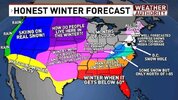
packfan98
Moderator
BAM Weather had a free webinar today. I couldn't listen to it, but here's their forecast.


