• Hello, please take a minute to check out our awesome content, contributed by the wonderful members of our community. We hope you'll add your own thoughts and opinions by making a free account!

Wintry Valentines Weekend Potential ?

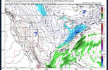
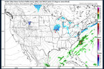
End of 18Z Euro op. (90) vs 12Z (96): backs things up a bit (precip, cold air push, H5 trough axis, etc). I wonder what later panels would have shown. The 18Z EPS will later give us hints of that

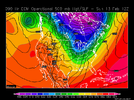
12Z Euro H5 at 96: note that the southern end of the H5 trough axis was over E AL on 12Z run but is back west near AL/MS border on the 18Z run for same time. That means that it is a bit warmer in the SE on the 18Z vs 12Z run ahead of the trough at 2M/850:
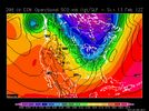
ecmop_12_h500_na_h_0096.png


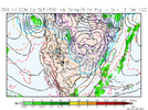
18Z Euro H5 at 90:
ecmop_18_h500_na_h_0090.png


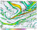
12Z Euro precip/850 at 96:

ecmop_12_p850ts_na_h_0096.png

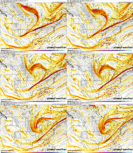
18Z Euro precip/850 at 90: focus on now much more precip is in SW Gulf on 18Z run: it clearly has slowed down vs 12Z
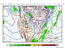
ecmop_18_p850ts_na_h_0090.png
 
Last edited:
Yeah everything was just slower in general on the euro, not great tho considering we need the ULT snow Sunday morning or Monday night, not
Midday
 
End of 18Z Euro op. (90) vs 12Z (96): backs things up a bit (precip, cold air push, H5 trough axis, etc). I wonder what later panels would have shown. The 18Z EPS will later give us hints of that

12Z Euro H5 at 96: note that the southern end of the H5 trough axis was over E AL on 12Z run but is back west near AL/MS border on the 18Z run for same time. That means that it is a bit warmer in the SE on the 18Z vs 12Z run ahead of the trough at 2M/850:
View attachment 113227


18Z Euro H5 at 90:
View attachment 113228


12Z Euro precip/850 at 96:

View attachment 113229

18Z Euro precip/850 at 90: focus on now much more precip is in SW Gulf on 18Z run: it clearly has slowed down vs 12Z
View attachment 113230
Would that allow a little more time for more energy to dive south on the backside of the trough?

Sent from my SM-A115U1 using Tapatalk
 
Yeah everything was just slower in general on the euro, not great tho considering we need the ULT snow Sunday morning or Monday night, not
Midday

Same with the 18Z EPS. The delay also extends into later forecast timeframes.
 
00z FV3 at hr 60
900e63c8738ab23507907cfa1c2999fe.jpg


Sent from my SM-A115U1 using Tapatalk
 
Sooooo the 0z 12k NAM has basically no QPF. Not even a warm rain.


Sent from my iPhone using Tapatalk
 
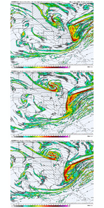
We're still in full "middle of a trend" mode on the GFS. I'd like to see a run or two without that leading shortwave trending faster- i mean what does the end game of this trend look like?

View attachment 113254
Those southern waves have been hanging back for the last 4 weeks, and this one is hauling east like its?are on ?
 
We're still in full "middle of a trend" mode on the GFS. I'd like to see a run or two without that leading shortwave trending faster- i mean what does the end game of this trend look like?

View attachment 113254

The Southern Stream trend completely goes against seasonal trends so far this winter.. although, the northern stream backing SW trend with the northern stream has been basically spot on in prior systems so far this season.

If that southern Stream keeps "booking" east, wouldn't surprise me a new s/w imbedded in the southern flow ends up being the "player".
 
Clipper showing up on the nam seems to be showing up more on the GFS and GEFS for AFTER the upper level trough mess .. might be a 1-2 punch for some localized spots 1F251AFB-8A38-471C-9299-4A65A8D34E2D.jpegE60105FA-18E2-41F3-99E0-934761C96DB3.jpeg
 
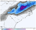
The 06z GFS extended the accumulating snow further SW to include parts of AL and MS
a7ead071d7b235f761d84b6677de1edc.gif


Sent from my SM-A115U1 using Tapatalk
Looks like it took what little the NC Piedmont was getting and sent it your way! I'm glad your in the mix now. Here's to a great day of model runs for all of us!
 
Looks like it took what little the NC Piedmont was getting and sent it your way! I'm glad your in the mix now. Here's to a great day of model runs for all of us!

Yes. It would be nice though to get that 4-6 inches that parts of Virginia could get according to this run. Still hopefully if not a home run maybe a base hit or two.


Sent from my iPad using Tapatalk
 
GSP still waiting on some ensemble support (GEFS). Says the the GFS is an outlier atm but bears watching. That Lee side frotog on the 06z this morning look tasty ?
 
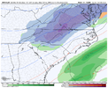
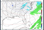
World Famous New short range RDPS, matches up exactly with the 0z Euro from last night. This is as far out as she goes:
prateptype.conus.png

GSP still waiting on some ensemble support (GEFS). Says the the GFS is an outlier atm but bears watching. That Lee side frotog on the 06z this morning look tasty ?
GFS is on a deserted Island at the moment. Hopefully today we can swing this all in a positive direction.
This is the last shot for the season IMBY. I'm pretty convinced. Yes it can snow in late March/early April here. But the odds of that happening are significantly reduced 2022 as we want have enough time to work out of the end of Feb pattern shuffle and Climo puts the foot on our throat as March unfolds.
 
World Famous New short range RDPS, matches up exactly with the 0z Euro from last night. This is as far out as she goes:
prateptype.conus.png


GFS is on a deserted Island at the moment. Hopefully today we can swing this all in a positive direction.
This is the last shot for the season IMBY. I'm pretty convinced. Yes it can snow in late March/early April here. But the odds of that happening are significantly reduced 2022 as we want have enough time to work out of the end of Feb pattern shuffle and Climo puts the foot on our throat as March unfolds.
I am starting to lean this way too. Its been exhausting and in all honesty not a very enjoyable winter even though I have seen snow. I always want more then I get is the real problem. Oh well. Good luck!
 
Back
Top