• Hello, please take a minute to check out our awesome content, contributed by the wonderful members of our community. We hope you'll add your own thoughts and opinions by making a free account!

Tropical TS Jerry

GaWx

Member
Joined
Jan 5, 2017
Messages
13,133
Reaction score
30,769
Location
SAV, GA
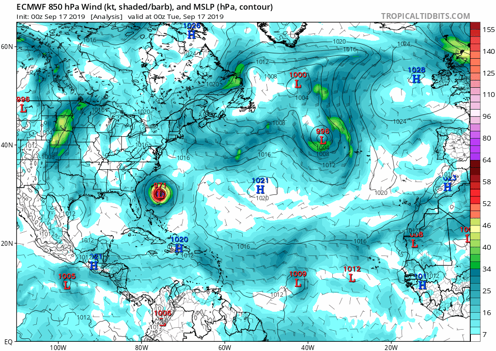
Lol, I just noticed we don’t even have a 97L thread. Just in case this does the totally unexpected and threaten the CONUS and because I read some chatter elsewhere (whether warranted or not), I think there should be a thread. 97L is located in the MDR near 40W.

Here are my thoughts fwiw. There are just a few (~10%) of 12Z EPS member outliers to the left that threaten the CONUS, which is more than the one member that the 0Z had. But based on what the EPS has shown at times for Humberto (25-30% of members with CONUS threats on 3 runs), this is nothing. In addition, all non-UKMET major operational dynamic models recurve it east of the CONUS. Remember with Humberto that ALL of the major operationals threatened the US early for a good number of runs. Yes, the UKMET is over to the left near the PR day 6, but it also is very much subject to a left bias and even it turns it sharply north day 7. Furthermore, climo by this late in the season becomes our friend from that position. So, I’m going with an “appears to me to be safe” feeling for at least the time being for the CONUS. That doesn’t mean I’ll keep feeling this way and that I won’t watch, of course! But I’m honestly not worried about this one right now. We need some rest!
 
18z ICON....SAYS 97L may be a problem....


View attachment 23619

I very highly doubt it based on this run because just about every operational run of the major models has something similar at this timeframe. All of these runs have the E coast ridge then at its strongest at this time. Then every model then starts breaking it down soon after, including the 12Z ICON since it goes out further. The problem with the 18Z ICON is that it only goes out 120. I'd bet heavy money that had this run gone out further, the same would have occurred with no threat to the CONUS later in the run. As the ridge would break down, it would easily allow the TC to recurve well offshore the E US. Imo, this is not a setup for a CONUS hit.

I'm currently going with 90% chance of no hit or even bare miss from this and that's if it even ever becomes a TC.
 
Last edited:
I very highly doubt it based on this run because just about every operational run of the major models has something similar at this timeframe. All of these runs have the E coast ridge then at its strongest at this time. Then every model then starts breaking it down soon after, including the 12Z ICON since it goes out further. The problem with the 18Z ICON is that it only goes out 120. I'd bet heavy money that had this run gone out further, the same would have occurred with no threat to the CONUS later in the run. As the ridge would break down, it would easily allow the TC to recurve well offshore the E US.

I'm currently going with 90% chance of no hit or even bare miss from this and that's if it even ever becomes a TC.

Frames 105 to 120, shows a west path in the 18z, versus a northwest path in the 12z.


icon_mslp_wind_atl_fh105-120.gif
 
Frames 105 to 120, shows a west path in the 18z, versus a northwest path in the 12z.


View attachment 23620

The 12Z UKMET is also moving west through day 6 and then even it takes a sharp north turn as the ridge gives way to a recurve. I'm very confident this would have turned on the 18Z ICON by day 7. The evidence is there and I've presented my case. Let's see what the 0Z shows. If someone were to offer me winnings of, say, $10, for a $50 bet against a CONUS hit or near miss, I'd lay the $50 in a heartbeat as that would seem to be a pretty easy $10 to win. Would anyone else here do that?

Edit: Happy Hour GEFS: only 1 of 21 members hits the CONUS (NE US) with a legit TC. None of the others are even that close. That should tell us something.

Here's the 12Z UKMET:
ukm2.2019092312.168.lant.troplant.prp.fcst.gentracker.png
 
Last edited:
The 90 hour 18Z Euro (end of run) is almost right on top of the 0Z Euro's 108, which went on to recurve pretty easily east of the CONUS. It then came close to Bermuda. Let's see what the 18Z EPS shows. But the problem there is that they go out only 144. So, they'll probably not tell us a whole heck of a lot. We'll have to wait for the 0Z for that.

Regardless, until if and when the consensus of operationals actually shows a threat to the CONUS, I expect to go with no hit.
 
00Z ICON HAS IT TURNED NORTH AND MAYBE OUT TO SEA BUT DEPENDING ON THE THE TROUGH AND RIDGE MAY CAN GET FATHER NORTH..

ALSO LOOK AT THE THREE (3) YES THREE (3) OTHER L's IT THE ATLANTIC

Capture.JPG
 
D10 on the EPS gets a little murky to say the least.... with a spread showing a potential all over the place. It really started at 120 when 2 camps started splitting, some north but many continue west slowly. May be a long way to go with this one and one that IF/when it develops may get a better idea from models. That Atlantic ridge says trouble if something is out there
1568721158782.png

1568721130273.png
 
D10 on the EPS gets a little murky to say the least.... with a spread showing a potential all over the place. It really started at 120 when 2 camps started splitting, some north but many continue west slowly. May be a long way to go with this one and one that IF/when it develops may get a better idea from models. That Atlantic ridge says trouble if something is out there
View attachment 23632

View attachment 23631

Looks to me like nothing gets close if the EPS is right. Unless the big ridge centered over the AL/MS builds east, there will be a trough/weakness favored just off the east coast. It will also send any home grown systems into TX or Mexico. In other words, no drought relief at all.
 
The 0Z/6Z model consensus, including GFS/Euro ensembles, tells me that although the CONUS isn’t safe yet, a recurve E of the CONUS remains heavily favored. Though it is further left than the 12Z, the 0Z UKMET is a left outlier of the dynamic models and it has a left bias, especially when it is a left outlier. Let’s see whether or not that non-UKMET recurve trend continues with the 12Z consensus.
 
Here is the left outlier (of the dynamic operationals) 0Z UKMET, which is on the E edge of Hispaniola at the end of the run:
66957D67-BF58-4252-BCB3-097B320FD480.png
 
This looks fun.
144756_5day_cone_no_line_and_wind.png
 
Day 5-6 there is a favorable ridge for conus hit around SE Canada but then a couple of troughs swing through and weaken it allowing TD10 to escape. We shall see, the timing of the troughs are always suspect but it seems like this year, so far, these TS's have tracked further east than initially thought.

ecmwf-ens_z500a_atl_fh120-240.gif
 
Storms usually end up further west...wouldn’t it be something if this one came within 50 miles of the SC coast only to go out to sea. How many of you would quit
 
11 am NHC discussion......basically they went with the Euro....I probably would have split the baby, considering how good the icon and Ukie were in the last round.

The track guidance is in relatively good agreement
through 72 hours, and brings the cyclone near the northern Leeward
Islands in about 3 days. By late in the period, the cyclone is
expected to reach the western periphery of the ridge, and there is
increasing spread among the guidance. The global model ensemble
means are along the right side of the envelope while the HWRF and
UKMET are along the left side. The NHC track lies close the
consensus aids, which is also in good agreement with the latest
ECMWF.
 
Day 5-6 there is a favorable ridge for conus hit around SE Canada but then a couple of troughs swing through and weaken it allowing TD10 to escape. We shall see, the timing of the troughs are always suspect but it seems like this year, so far, these TS's have tracked further east than initially thought.

View attachment 23642

If the current location were 500 miles further west and heading for the E Caribbean or even if the 0Z UKMET weren’t such a left outlier of the dynamic models, it would already be a scary setup for the CONUS. As it is though, it is not a worry for me at this time but rather just a “to be monitored” to make sure model consensus remains safely offshore.
 
12z GFS ends up dropping this storm I think thanks to how strong and large Humberto gets. It looks like it ends up helping to elongate the circulation.

Edit: Maybe spoke too soon lol. It might try starting at 102.
 
12Z UKMET: fish storm way east of the prior two runs

TROPICAL DEPRESSION 97L ANALYSED POSITION : 12.9N 44.1W
ATCF IDENTIFIER : AL972019
LEAD CENTRAL MAXIMUM WIND
VERIFYING TIME TIME POSITION PRESSURE (MB) SPEED (KNOTS)
-------------- ---- -------- ------------- -------------
1200UTC 17.09.2019 0 12.9N 44.1W 1009 23
0000UTC 18.09.2019 12 14.1N 46.0W 1008 25
1200UTC 18.09.2019 24 14.9N 48.0W 1006 30
0000UTC 19.09.2019 36 15.8N 50.6W 1004 31
1200UTC 19.09.2019 48 16.7N 53.7W 1002 37
0000UTC 20.09.2019 60 17.8N 56.5W 1003 42
1200UTC 20.09.2019 72 18.8N 59.5W 1005 41
0000UTC 21.09.2019 84 20.6N 62.3W 1006 40
1200UTC 21.09.2019 96 22.7N 64.4W 1007 36
0000UTC 22.09.2019 108 25.0N 65.0W 1005 36
1200UTC 22.09.2019 120 27.4N 64.2W 996 49
0000UTC 23.09.2019 132 30.1N 62.0W 974 79
1200UTC 23.09.2019 144 34.0N 60.1W 958 85
 
From 1960-2018, there were 33 T.S.+'s that were first declared a T.D.+ east of 55W and south of 20N within the interval of 9/15-9/25.

Here are the formation dates:
9/19/1963, 9/16/1965, 9/21/1966**, 9/20/1969, 9/21/1971, 9/18/1975, 9/22/1975, 9/21/1981, 9/15/1984, 9/16/1985**, 9/19/1988, 9/16/1989, 9/21/1990, 9/21/1994, 9/24/1996, 9/15/1998**, 9/19/1998, 9/21/1998, 9/21/2000, 9/25/2000, 9/21/2002**, 9/25/2003, 9/16/2004, 9/19/2004, 9/17/2005, 9/25/2007, 9/20/2010, 9/20/2011, 9/24/2011, 9/18/2015, 9/19/2016, 9/16/2017, and 9/22/2018

** = the 4 that later hit the CONUS

So, 4 of these 33 later hit the CONUS or 12% of them. The rest either missed or dissipated in the open ocean. A decent number actually dissipated.

The 4 that hit:
1. Inez (1966): 9/21 genesis ~10N, 35W; hit FL Keys
2. Gloria (1985): 9/16 genesis ~13N, 24W; hit NC OB, NE US
3. Georges (1998): 9/15 genesis ~10N, 25W; hit FL Keys, MS/AL/FL Panhandle
4. Lili (2002): 9/21 genesis ~10N, 45W; hit LA

Will TD #10 be the 5th since 1960 and add to the 12% that hit? I still highly doubt it and this feeling is supported by the 12Z ICON, UKMET, GFS, Legacy, and CMC. But I'll obviously continue to watch since this is far from a done deal being this far out.
 
Last edited:
12Z UKMET: fish storm way east of the prior two runs

TROPICAL DEPRESSION 97L ANALYSED POSITION : 12.9N 44.1W
ATCF IDENTIFIER : AL972019
LEAD CENTRAL MAXIMUM WIND
VERIFYING TIME TIME POSITION PRESSURE (MB) SPEED (KNOTS)
-------------- ---- -------- ------------- -------------
1200UTC 17.09.2019 0 12.9N 44.1W 1009 23
0000UTC 18.09.2019 12 14.1N 46.0W 1008 25
1200UTC 18.09.2019 24 14.9N 48.0W 1006 30
0000UTC 19.09.2019 36 15.8N 50.6W 1004 31
1200UTC 19.09.2019 48 16.7N 53.7W 1002 37
0000UTC 20.09.2019 60 17.8N 56.5W 1003 42
1200UTC 20.09.2019 72 18.8N 59.5W 1005 41
0000UTC 21.09.2019 84 20.6N 62.3W 1006 40
1200UTC 21.09.2019 96 22.7N 64.4W 1007 36
0000UTC 22.09.2019 108 25.0N 65.0W 1005 36
1200UTC 22.09.2019 120 27.4N 64.2W 996 49
0000UTC 23.09.2019 132 30.1N 62.0W 974 79
1200UTC 23.09.2019 144 34.0N 60.1W 958 85
Icon 12z went east too...
 
From 1960-2018, there were 33 T.S.+'s that were first declared a T.D.+ east of 55W and south of 20N within the interval of 9/15-9/25.

Here are the formation dates:
9/19/1963, 9/16/1965, 9/21/1966**, 9/20/1969, 9/21/1971, 9/18/1975, 9/22/1975, 9/21/1981, 9/15/1984, 9/16/1985**, 9/19/1988, 9/16/1989, 9/21/1990, 9/21/1994, 9/24/1996, 9/15/1998**, 9/19/1998, 9/21/1998, 9/21/2000, 9/25/2000, 9/21/2002**, 9/25/2003, 9/16/2004, 9/19/2004, 9/17/2005, 9/25/2007, 9/20/2010, 9/20/2011, 9/24/2011, 9/18/2015, 9/19/2016, 9/16/2017, and 9/22/2018

** = the 4 that later hit the CONUS

So, 4 of these 33 later hit the CONUS or 12% of them. The rest either missed or dissipated in the open ocean. A decent number actually dissipated.

The 4 that hit:
1. Inez (1966): 9/21 genesis ~10N, 35W; hit FL Keys
2. Gloria (1985): 9/16 genesis ~13N, 24W; hit NC OB, NE US
3. Georges (1998): 9/15 genesis ~10N, 25W; hit FL Keys, MS/AL/FL Panhandle
4. Lili (2002): 9/21 genesis ~10N, 45W; hit LA

Will TD #10 be the 5th since 1960 and add to the 12% that hit? I still highly doubt it and this feeling is supported by the 12Z ICON, UKMET, GFS, Legacy, and CMC. But I'll obviously continue to watch since this is far from a done deal being this far out.

When you think about it, 12% seems like high odds actually. Are the odds higher SW of this location?

Edit: I guess my thought was it seems like TS's miss more than they hit so not surprised it's 12%. But on graphic below it looks like the current position actually is maybe 50/50 on a conus hit based on climatology.
 
Last edited:
Here are all the TS's within 50miles of TD10's location. Good number of conus hits actually.

Screen Shot 2019-09-17 at 1.01.47 PM.png
 
When you think about it, 12% seems like high odds actually. Are the odds higher SW of this location?

Yeah, ~1 in 8 isn't exactly tiny. I bet they'd be higher W of the TD 10 genesis location (say within 55W-60 W, 10-20N).
 
Here are all the TS's within 50miles of TD10's location. Good number of conus hits actually.

View attachment 23647

Nice map! I count 9 CONUS hits. Do you know the total number of storms on your map? My very rough guess is 27. So, that would be 1 in 3 storm that hit, a pretty large % as you suggested. But, it is important to keep in mind that my ~1 in 8 CONUS hit stat is for only 9/15-25 geneses in that area. And there were no hits for geneses 9/26+ east of 55W and south of 20N. I'd bet that most on your map are for earlier geneses, which would have a higher chance to get to the CONUS. Of the 9 hits on your map, I think I see only 2 that had geneses within 9/15-25: Gloria of 1985 and Georges of 1998. So, unless I'm missing something, 7 of your map's 9 hits were from geneses earlier than 9/15.
 
Last edited:
12Z GEFS show no CONUS hits from the few members that show actual full fledged TCs from what I can best tell.
 
Back
Top