• Hello, please take a minute to check out our awesome content, contributed by the wonderful members of our community. We hope you'll add your own thoughts and opinions by making a free account!

Tropical TS Gonzalo

BufordWX

Hometown: Buford, GA
Member
Joined
Dec 6, 2018
Messages
3,795
Reaction score
11,149
Location
Norman, OK
NHC watching a tropical wave now designated as Invest 99L in the eastern Atlantic for possible development into a tropical depression or tropical storm over the next few days.

2. Showers and thunderstorms have increased and become a little better
organized in association with a low pressure system located about
midway between the west coast of Africa and the Lesser Antilles.
Environmental conditions are expected to be somewhat conducive for
development, and a tropical depression could form during the next
couple of days while the low moves westward at around 10 mph over
the tropical Atlantic. By the weekend, however, less favorable
conditions should limit additional development.
* Formation chance through 48 hours...medium...40 percent.

* Formation chance through 5 days...medium...40 percent.
568B10DF-D3B4-4412-8277-E0EAC23C4091.png
 
Showers and thunderstorms associated with the low pressure area
located about midway between the west coast of Africa and the
Lesser Antilles continue to get better organized, and a tropical
depression appears to be forming. If current trends continue,
advisories could be initiated on this system this afternoon.
Regardless of development during the next couple of days, less
favorable conditions should limit additional development of the
system by the weekend.
* Formation chance through 48 hours...high...90 percent.
* Formation chance through 5 days...high...90 percent.
Now at 90/90
 
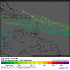
The HWRF *really* likes this oneView attachment 44667

We all know that the HWRF really "likes" a lot of things and has a too strong bias. So, the HWRF 'liking" something 4-5 days out does not typically mean much to me on its own. Occasionally the HWRF gets these right but more often when the other models somewhat agree. So, I suppose this could end up being strong but hopefully not as that's the last thing these islands need to deal with obviously.

Hopefully this season will continue to be dominated by weak systems and that any strong ones don't bother us on land.
 
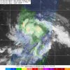
TD 7 has formed.
000
WTNT32 KNHC 212035
TCPAT2

BULLETIN
Tropical Depression Seven Advisory Number 1
NWS National Hurricane Center Miami FL AL072020
500 PM AST Tue Jul 21 2020

...TROPICAL DEPRESSION FORMS OVER THE CENTRAL TROPICAL ATLANTIC...


SUMMARY OF 500 PM AST...2100 UTC...INFORMATION
----------------------------------------------
LOCATION...9.8N 40.4W
ABOUT 1185 MI...1905 KM WSW OF THE CABO VERDE ISLANDS
ABOUT 1420 MI...2285 KM E OF THE SOUTHERN WINDWARD ISLANDS
MAXIMUM SUSTAINED WINDS...35 MPH...55 KM/H
PRESENT MOVEMENT...WNW OR 300 DEGREES AT 8 MPH...13 KM/H
MINIMUM CENTRAL PRESSURE...1009 MB...29.80 INCHES


WATCHES AND WARNINGS
--------------------
There are no coastal watches or warnings in effect.


DISCUSSION AND OUTLOOK
----------------------
At 500 PM AST (2100 UTC), the center of Tropical Depression Seven
was located near latitude 9.8 North, longitude 40.4 West. The
depression is moving toward the west-northwest near 8 mph (13 km/h).
A turn toward the west with an increase in forward speed is
expected tonight and Wednesday, and that motion should continue
through Friday.

Maximum sustained winds are near 35 mph (55 km/h) with higher gusts.
Strengthening is forecast during the next couple of days, and the
depression is expected to become a tropical storm tonight or
Wednesday.

The estimated minimum central pressure is 1009 mb (29.80 inches).


HAZARDS AFFECTING LAND
----------------------
None.


NEXT ADVISORY
-------------
Next complete advisory at 1100 PM AST.

$$
Forecaster Beven
 
Back
Top