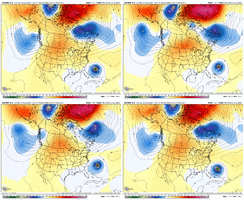
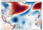
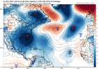
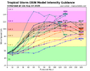
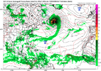
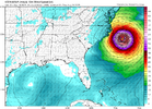
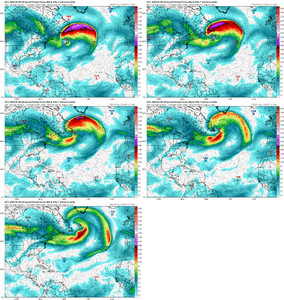
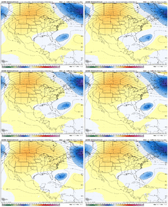
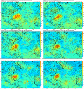
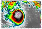
It's still too early to be definite about Erin but I think the escape hatch is still open for it to go out to sea. It does look like the low pressure over the Midwest on previous model runs seems to be disappearing however which would account for the shifts to the west which have been seen recently. When all is said and done I think Erin may come close enough to bring tropical storm force winds to the Outer Banks, some rough seas and dangerous rip currents. It will be a closer call than many of us thought earlier.
-
Hello, please take a minute to check out our awesome content, contributed by the wonderful members of our community. We hope you'll add your own thoughts and opinions by making a free account!
You are using an out of date browser. It may not display this or other websites correctly.
You should upgrade or use an alternative browser.
You should upgrade or use an alternative browser.
Tropical TS Erin
- Thread starter SD
- Start date
Brent
Member
It's still too early to be definite about Erin but I think the escape hatch is still open for it to go out to sea. It does look like the low pressure over the Midwest on previous model runs seems to be disappearing however which would account for the shifts to the west which have been seen recently. When all is said and done I think Erin may come close enough to bring tropical storm force winds to the Outer Banks, some rough seas and dangerous rip currents. It will be a closer call than many of us thought earlier.
Yeah I still haven't seen an actual model or more than a couple rogue ensembles show a landfall at all but it's definitely gonna be closer than I thought
Also remember the NHC has models we don't see or used to anyway
Still a long ways out in modeling form! For those on the coast I think we would all prefer an OTS option away from any land, I just think it’s irresponsible to speak in absolutes more than a few days out! If the highs are any stronger than forecasted and the storm goes through RI I think there is a chance for more westerly flow. Not definite but possible.Yeah I still haven't seen an actual model or more than a couple rogue ensembles show a landfall at all but it's definitely gonna be closer than I thought
Also remember the NHC has models we don't see or used to anyway
Brent
Member
Still a long ways out in modeling form! For those on the coast I think we would all prefer an OTS option away from any land, I just think it’s irresponsible to speak in absolutes more than a few days out! If the highs are any stronger than forecasted and the storm goes through RI I think there is a chance for more westerly flow. Not definite but possible.
Yeah I mean errors can still be hundreds of miles a week out...
We've seen how much the Euro has been all over the place too which is usually highly respected in the met community
fish storm unless something big changes
weakness between US and Bermuda is just too pronounced. if there was potential for the hole to be filled then more ensemble members would be picking up on it
should wrack up a lot of energy from the tropics to transfer to the poles
weakness between US and Bermuda is just too pronounced. if there was potential for the hole to be filled then more ensemble members would be picking up on it
should wrack up a lot of energy from the tropics to transfer to the poles
I’d been near 10% chance of landfall (mainly somewhere on the E coast) and was going to reduce it. However, I remain there for now in deference to the somewhat scarier 6Z GEFS, which has 3 (10%) members landfall. If the 12Z GEFS goes back the other way, I may then go below 10%.
Didn’t the ensembles shift a little west? Once again likely OTS!fish storm unless something big changes
weakness between US and Bermuda is just too pronounced. if there was potential for the hole to be filled then more ensemble members would be picking up on it
should wrack up a lot of energy from the tropics to transfer to the poles
Henry2326
Member
Yall just throwing dice....lol. 7 days before near the east coast...just too far out. The thing has to intenify or not. Just not enough reliable data until 3-5 days out. Heck the flooding impact to the east coast could be the story. We can only speculate and watch in wonder as it develops.
Henry2326
Member
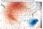
Everything matters.....unsure if it matters. there will be some shifts, some may look ominous, but ridge over the four corners will synoptically favor lower heights in the east coast and an opening
View attachment 174238
Shaggy
Member
Henry2326
Member
You’re the yellow tag but if it doesn’t matter why did you mention it?unsure if it matters. there will be some shifts, some may look ominous, but ridge over the four corners will synoptically favor lower heights in the east coast and an opening
View attachment 174238
Henry2326
Member
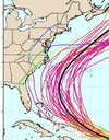
Shaggy- what version is this? EPS or GEFS IN THE PIC? Trying to determine if they both have the same 2 outliers-Gefs did and the eps doesn't go out far enough but has some western tracks as well
View attachment 174239
Henry2326
Member
Shaggy
Member
GefsShaggy- what version is this? EPS or GEFS IN THE PIC? Trying to determine if they both have the same 2 outliers-
i think that it's fair to mention that there will be shifts, there always are, and some will trickle west and get everyone excited. the 6z GFS did that. despite it though there were only one or two landfalls. almost all storms still got captured and hurled northeast in this particular model run. in the grand scheme i don't think it matters in meaningfully changing the chance of a landfall. i'll concede there's still plenty of time and the atlantic is filled with the graveyard of meteorologists who have spoken too categorically before. but personally after growing up in wilmington, i'd consider myself to have a working 6th sense about which storms to worry about and so far erin isn't ringing that bellYou’re the yellow tag but if it doesn’t matter why did you mention it?
lexxnchloe
Member
Yea, definitely no bell ringing. More East shifts seem most likely rather than west.i think that it's fair to mention that there will be shifts, there always are, and some will trickle west and get everyone excited. the 6z GFS did that. despite it though there were only one or two landfalls. almost all storms still got captured and hurled northeast in this particular model run. in the grand scheme i don't think it matters in meaningfully changing the chance of a landfall. i'll concede there's still plenty of time and the atlantic is filled with the graveyard of meteorologists who have spoken too categorically before. but personally after growing up in wilmington, i'd consider myself to have a working 6th sense about which storms to worry about and so far erin isn't ringing that bell
Henry2326
Member
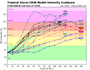
11am NHC
" the new forecast is near the intensity consensus, and there is guidance that suggest the possibility Erin could be stronger than currently forecast."
"......due to the spread in the track guidance by 120 h and beyond, there is still a greater than normal uncertainty about the impacts Erin may bring to portions of the Bahamas, the east coast, and Bermuda in the long range."
My take on this message: we don't know past 120 h. It could be cat4/5 and it could impact land somewhere.

I will mention that a western solution doesn’t get me excited, I’m in the other camp who hopes it’s an OTS solution where no land mass interaction is the favorable solution. I just think it’s fair to consider all possibilities a week or more out in regards to giving people a fair warning of what could happen even if at low %. It’s still far enough out for those along the coast to keep a brow raised!i think that it's fair to mention that there will be shifts, there always are, and some will trickle west and get everyone excited. the 6z GFS did that. despite it though there were only one or two landfalls. almost all storms still got captured and hurled northeast in this particular model run. in the grand scheme i don't think it matters in meaningfully changing the chance of a landfall. i'll concede there's still plenty of time and the atlantic is filled with the graveyard of meteorologists who have spoken too categorically before. but personally after growing up in wilmington, i'd consider myself to have a working 6th sense about which storms to worry about and so far erin isn't ringing that bell
12Z UKMET: similar to last two with recurve at 71.9W:
TROPICAL STORM ERIN ANALYSED POSITION : 16.6N 49.1W
ATCF IDENTIFIER : AL052025
LEAD CENTRAL MAXIMUM WIND
VERIFYING TIME TIME POSITION PRESSURE (MB) SPEED (KNOTS)
-------------- ---- -------- ------------- -------------
1200UTC 14.08.2025 0 16.6N 49.1W 1005 33
0000UTC 15.08.2025 12 17.5N 51.8W 1006 33
1200UTC 15.08.2025 24 18.5N 55.5W 1004 34
0000UTC 16.08.2025 36 19.2N 58.9W 1003 35
1200UTC 16.08.2025 48 19.7N 62.3W 999 36
0000UTC 17.08.2025 60 20.1N 65.0W 996 37
1200UTC 17.08.2025 72 20.8N 67.3W 993 41
0000UTC 18.08.2025 84 22.0N 68.9W 990 44
1200UTC 18.08.2025 96 23.8N 70.3W 988 49
0000UTC 19.08.2025 108 26.0N 71.2W 985 50
1200UTC 19.08.2025 120 28.3N 71.7W 981 52
0000UTC 20.08.2025 132 30.5N 71.9W 979 52
1200UTC 20.08.2025 144 32.6N 71.0W 976 59
0000UTC 21.08.2025 156 34.6N 68.7W 970 66
1200UTC 21.08.2025 168 36.4N 65.0W 969 63
lexxnchloe
Member
Henry2326
Member
Henry2326
Member
Way east of Icon. This is Icon at 30.8N 75.4W if I'm looking at it correctly.12Z UKMET: similar to last two with recurve at 71.9W:
TROPICAL STORM ERIN ANALYSED POSITION : 16.6N 49.1W
ATCF IDENTIFIER : AL052025
LEAD CENTRAL MAXIMUM WIND
VERIFYING TIME TIME POSITION PRESSURE (MB) SPEED (KNOTS)
-------------- ---- -------- ------------- -------------
1200UTC 14.08.2025 0 16.6N 49.1W 1005 33
0000UTC 15.08.2025 12 17.5N 51.8W 1006 33
1200UTC 15.08.2025 24 18.5N 55.5W 1004 34
0000UTC 16.08.2025 36 19.2N 58.9W 1003 35
1200UTC 16.08.2025 48 19.7N 62.3W 999 36
0000UTC 17.08.2025 60 20.1N 65.0W 996 37
1200UTC 17.08.2025 72 20.8N 67.3W 993 41
0000UTC 18.08.2025 84 22.0N 68.9W 990 44
1200UTC 18.08.2025 96 23.8N 70.3W 988 49
0000UTC 19.08.2025 108 26.0N 71.2W 985 50
1200UTC 19.08.2025 120 28.3N 71.7W 981 52
0000UTC 20.08.2025 132 30.5N 71.9W 979 52
1200UTC 20.08.2025 144 32.6N 71.0W 976 59
0000UTC 21.08.2025 156 34.6N 68.7W 970 66
1200UTC 21.08.2025 168 36.4N 65.0W 969 63
But in line with GFS.
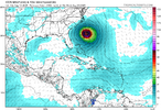
Id be interested to see how many systems made landfall on the EC and progressed inland with a ridge center in the rockies area. I'm sure there were some coastal scrapers but this isn't a climo favored drive the center west to US1 or farther setup right nowunsure if it matters. there will be some shifts, some may look ominous, but ridge over the four corners will synoptically favor lower heights in the east coast and an opening
View attachment 174238
12z Euro misses safely east...not nearly the fireworks that yesterday's run provided.
Definitely agree it's most likely a scraper with a hard turn at least to the north somewhere, but there are ways that hard turn can still be uncomfortably close to the coast (ala the ICON). Of course, the ICON is far more likely to show an erroneous solution than a right one, so until the Euro suite trends that way, the out-to-sea idea remains the most likely scenario (despite the overall trend west over the past day or so). That said, if the storm continues to stay weak and doesn't gain latitude as quickly as modeled, that could change.Id be interested to see how many systems made landfall on the EC and progressed inland with a ridge center in the rockies area. I'm sure there were some coastal scrapers but this isn't a climo favored drive the center west to US1 or farther setup right now
And even the Euro has consistently been initializing the storm too far north.
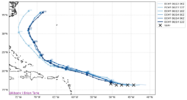
I’ve always wondered how big of a difference the relatively small initialization errors make. Obviously they compound as the run goes but how much so?Definitely agree it's most likely a scraper with a hard turn at least to the north somewhere, but there are ways that hard turn can still be uncomfortably close to the coast (ala the ICON). Of course, the ICON is far more likely to show an erroneous solution than a right one, so until the Euro suite trends that way, the out to sea idea remains the most likely scenario. That said, if the storm continues to stay weak and doesn't gain latitude as quickly as modeled, that could change.
And even the Euro has consistently been initializing the storm too far north.
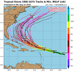
View attachment 174254
I think it's entirely situationally dependent. If those small initialization errors result in the system missing an important interaction with another piece of vorticity/land mass/etc. then it could compound into a much larger error, while if none of those things change, then it probably would be minimally impactful.I’ve always wondered how big of a difference the relatively small initialization errors make. Obviously they compound as the run goes but how much so?
The NHC and many of the models have Erin moving in a northerly direction about the time it reaches 70 degrees longitude. This may be as close as Erin gets to the eastern United States unless ridging can build more to the east of where it is currently located. This will move Erin close enough to present some rough seas and dangerous rip currents along some of the beaches but will keep the high winds away from these areas.
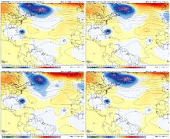
EC AI is starting to hint at this and the 18z ICON is really doing it, but it buries the ULL / trough so far east in the Atlantic it actually is the mechanism now that could act to retrograde / pump the western Atlantic ridge up. Synoptically, this is a complex pattern that may have some wintertime twists to it.
Henry2326
Member
YES.
Henry2326
Member
EC AI is starting to hint at this and the 18z ICON is really doing it, but it buries the ULL / trough so far east in the Atlantic it actually is the mechanism now that could act to retrograde / pump the western Atlantic ridge up. Synoptically, this is a complex pattern that may have some wintertime twists to it.
View attachment 174257
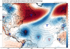
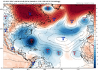
YES.....AI has been saying it on 8/7 and 8/9.
Henry2326
Member
Brent
Member
Almost a hurricane now. Water only gets warmer from here

