NCSNOW
Member
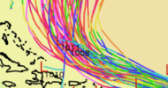
If Puerto Rico gets into the potential track for Erin then all bets are off as far as it missing the US east coast. As of now the NHS has it in the edge of the cone but it the southward trend continues, then we may be dealing with something that has more impact than just some rough seas and dangerous rip currents along the beaches.New 11AM. First time that PR is in the cone
View attachment 174167

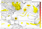
Even the AI is much further east with the recurve now. I suppose if Erin(probably isnt a storm right now) were to just become a clear area it might cruise west but with this pattern in the ATL(a massive trof from the NC coast to the Azores) there is no way this hits any land except only a very very small chance it hits Bermuda.Gotta be careful trusting every south move as if it signals a greater chance at a east coast strike. All this will do is threaten the islands if that trend should continue. As long as an open door like this remains, it's gonna go OTS regardless if it is just north of Cuba or near Bermuda unless it just grinds itself to pieces over PR or the mountains.
View attachment 174175

Yep. This can get as far south as you want it to but with the western extent of the Atlantic ridge near bermuda it can only go so far west before it either A. Stops B. Turns north.Gotta be careful trusting every south move as if it signals a greater chance at a east coast strike. All this will do is threaten the islands if that trend should continue. As long as an open door like this remains, it's gonna go OTS regardless if it is just north of Cuba or near Bermuda unless it just grinds itself to pieces over PR or the mountains.
View attachment 174175
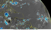
There's a chance that this does not make it at all. It could just fall completely apart.It has lost its core structure from this morning. This could change the outlook if it drifts further south.
View attachment 174183
The circulation is well defined. It will surviveThere's a chance that this does not make it at all. It could just fall completely apart.
0z GFS is very close to a direct hit on Bermuda
That train behind it.....
That train behind it.....
Yup I'm telling y'all just be patient... Erin is just the beginning even if it does go OTS
View attachment 174194
View attachment 174195
View attachment 174196
If the upper low and downstream trough trends flatter / further north, the sharp northward turn may be delayed/less and allow the Atlantic ridge to extend further westward.

Intensity forecasting is kinda like shaking a magic 8 ball...From another board regarding 6Z tropical models: peaks as a MH on 3 of 4
“06z, August 13, hurricane model blend, Erin
--- Model peak intensity ---
HWRF = 944mb/112kt
HMON = 979mb/95kt
HAFS-A = 943mb/119kt
HAFS-B = 939mb/121kt”
Intensity forecasting is kinda like shaking a magic 8 ball...
Indeed. That’s why I’m showing the 4 together rather than just one (treating it like a small ensemble). And I’m not showing the track as tropical models though not great are better with strength than track, which I prefer globals for. Also, tropicals seem to be a bit better with strength than globals, which are pretty bad with that.
In recent memory.....as Michael was exploding, the models were showing 970ish.I think the models can do ok with intensity if there are things like strong shear or dry air but when conditions are generally favorable they seem to miss a lot both ways to strong or not strong enough etc.
while i know what you mean, should be noted that this was 7 years ago and models have indeed improved a little and newer hurricane models have been introduced since then- in some cases probably to better prognosticate storms like michaelIn recent memory.....as Michael was exploding, the models were showing 970ish.
I hope they all go out to sea. We don't need more rain in NC.Yup I'm telling y'all just be patient... Erin is just the beginning even if it does go OTS
One more trend like that and it will make landfall in the Outer Banks.12Z Euro: it doesn’t recurve til 75W and thus comes within 150 miles of NC! The OB are directly affected by its NW side:
View attachment 174203
This will be something we need to watch out for..
Sent from my iPhone using Tapatalk
