• Hello, please take a minute to check out our awesome content, contributed by the wonderful members of our community. We hope you'll add your own thoughts and opinions by making a free account!

Tropical TS Arthur

Hope it doesn't get stronger than a tropical storm and stays away from the NC coast. I'm heading to Nags Head the first weekend of June. And with the virus and things being closed, the hotels and restaurants don't need anything else to close them down now.
 
100/100

Data from the Air Force Hurricane Hunters and satellite images
indicate that the low pressure system located just off the coast of
east-central Florida has become better defined today. In addition,
the associated showers and thunderstorms continue to gradually
organize. If these trends continues, advisories will likely be
initiated on this system as a tropical or subtropical depression
later today.
Later in the weekend and early next week, the system
is expected to move generally northeastward over the western
Atlantic near or east of the Carolinas.
 
TD 1 is coming

AL, 01, 2020051618, , BEST, 0, 280N, 788W, 30, 1008, TD, 34, NEQ, 0, 0, 0, 0, 1012, 150, 40, 40, 0, L, 0, , 0, 0, INVEST, M, 0, , 0, 0, 0, 0, genesis-num, 001, TRANSITIONED, alA02020 to al012020,
 
Let's hope this storm stays more OTS than inland. As others have already pointed out, with the virus still on everyone's minds, a storm going up the coast or inland would be another issue to worry about over there. Interesting to see our first system form halfway into May though.
 
Let's hope this storm stays more OTS than inland. As others have already pointed out, with the virus still on everyone's minds, a storm going up the coast or inland would be another issue to worry about over there. Interesting to see our first system form halfway into May though.

I was thinking the same thing. And with the OBX just starting to open up again, this is the last thing they need for their tourism dollars.
 
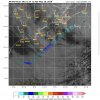
FWIW the HWRF model is not looking friendly to the outer banks. I don’t know how much stock to put into it though. Personally, I think this will just miss a landfall there, but there will still be some effects.E52BC744-3F4A-4A95-BF75-436581667FD3.png
 
Looking at recon they look to be finding 40-45kt winds. 3 am update might warrant a subtropical storm and pressures down to 1006 on the last pass. Also looks more healthy on IR.
 
Let's hope this storm stays more OTS than inland. As others have already pointed out, with the virus still on everyone's minds, a storm going up the coast or inland would be another issue to worry about over there. Interesting to see our first system form halfway into May though.

What's crazy is I think this is the 5th or 6th season in a row with a storm before June 1

Every year since 2015

Ten named storms out of the last 14 seasons before June 1

The update will be at 11 and will probably be Arthur
 
Last edited:
I've been trying to figure out all day if I can fix the title but I'm tired of trying :p
 
Over the last hour Arthur looks like it’s trying to fill in it’s western side while also growing stronger.

1 hour ago
DF8F9AA4-30C2-4EB5-9D4D-651FF5C9333F.jpeg

Now
EFB6486B-6BF2-4C66-ABD3-C838FD3E63FE.jpeg
 
Recon out early this morning let’s see what they find.
 
Back
Top