-
Hello, please take a minute to check out our awesome content, contributed by the wonderful members of our community. We hope you'll add your own thoughts and opinions by making a free account!
You are using an out of date browser. It may not display this or other websites correctly.
You should upgrade or use an alternative browser.
You should upgrade or use an alternative browser.
Tropical Tropical Storm Milton
- Thread starter SD
- Start date
Henry2326
Member
Im worried about the angle it comes it. It could push into already devastated areas I land as well the already beaten coast.But creeping north
Henry2326
Member
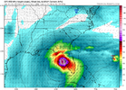
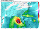
Yeah the 12z GFS would be a hit near Tampa at a 90’ angle. That area experienced a significant storm surge last week from Helene moving parallel to the coast.Im worried about the angle it comes it. It could push into already devastated areas I land as well the already beaten coast.
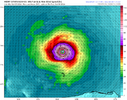
12Z UK: between Naples and Ft Myers Wed (similar timing to GFS/Icon and much faster than CMC), which is N of 0Z’s S of Naples but is still way S of GFS’ just N of Tampa and a little S of Icon/CMC Pt Charlotte; remains furthest S of these 4; reminder: UK was furthest SE for Ian several days out and did best fwiw:
TROPICAL DEPRESSION 92L ANALYSED POSITION : 21.9N 95.2W
ATCF IDENTIFIER : AL922024
LEAD CENTRAL MAXIMUM WIND
VERIFYING TIME TIME POSITION PRESSURE (MB) SPEED (KNOTS)
-------------- ---- -------- ------------- -------------
1200UTC 05.10.2024 0 21.9N 95.2W 1008 25
0000UTC 06.10.2024 12 22.7N 94.5W 1007 24
1200UTC 06.10.2024 24 23.3N 94.5W 1006 26
0000UTC 07.10.2024 36 22.8N 93.1W 1004 30
1200UTC 07.10.2024 48 21.9N 91.9W 1001 32
0000UTC 08.10.2024 60 22.3N 89.7W 998 30
1200UTC 08.10.2024 72 23.1N 87.4W 995 34
0000UTC 09.10.2024 84 24.5N 85.5W 993 38
1200UTC 09.10.2024 96 25.9N 82.8W 993 38
0000UTC 10.10.2024 108 27.9N 79.6W 994 52
1200UTC 10.10.2024 120 29.2N 75.9W 991 61
0000UTC 11.10.2024 132 29.5N 70.4W 995 50
1200UTC 11.10.2024 144 30.0N 64.5W 1003 43
0000UTC 12.10.2024 156 CEASED TRACKING
Last edited:
Webberweather53
Meteorologist
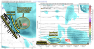
The models are in full on catch-up mode w/ former 92L, now TD 14 (& soon-to-be Milton) here.
I think the reason for that has to do w/ the northerly low-level barrier jet that's on the western side of the circulation adjacent to the Sierra Madre Oriental Mountains. This northerly low-level barrier jet helps spin-up cyclonic relative vorticity over TD-14's circulation, hastening the tropical cyclogenesis process.
That feature is not exactly easy for NWP models to resolve (because the terrain there over the Sierra Madre is smoothed out & they have insufficient vertical resolution).

Webberweather53
Meteorologist
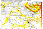
I wouldn’t be shocked if model consensus nudges closer to Tampa here in a few cycles or so. The models are still playing catch up to organizational trends and a stronger storm is gonna get pulled further north by the more SWly flow aloft
Brent
Member
I wouldn’t be shocked if model consensus nudges closer to Tampa here in a few cycles or so. The models are still playing catch up to organizational trends and a stronger storm is gonna get pulled further north by the more SWly flow aloft
Yeah I have a bad feeling about Tampa. This could be their nightmare scenario
Brent
Member
Tropical Storm Milton Tropical Cyclone Update
NWS National Hurricane Center Miami FL AL142024
1225 PM CDT Sat Oct 05 2024
...TROPICAL DEPRESSION BECOMES TROPICAL STORM MILTON...
...FORECAST TO STRENGTHEN AND BRING THE RISK OF LIFE-THREATENING
IMPACTS TO PORTIONS OF THE WEST COAST OF FLORIDA NEXT WEEK...
Recent satellite wind data indicate that the depression has
strengthened into Tropical Storm Milton. The maximum sustained
winds are estimated to be 40 mph (65 km/h) with higher gusts.
SUMMARY OF 1225 PM CDT...1725 UTC...INFORMATION
---------------------------------------------------
LOCATION...22.3N 95.3W
ABOUT 220 MI...355 KM NNE OF VERACRUZ MEXICO
ABOUT 365 MI...590 KM WNW OF PROGRESO MEXICO
MAXIMUM SUSTAINED WINDS...40 MPH...65 KM/H
PRESENT MOVEMENT...NNE OR 15 DEGREES AT 3 MPH...6 KM/H
MINIMUM CENTRAL PRESSURE...1006 MB...29.71 INCHES
$$
Forecaster Brown/Kelly
lexxnchloe
Member
12Z UK: between Naples and Ft Myers Wed (similar timing to GFS/Icon and much faster than CMC), which is N of 0Z’s S of Naples but is still way S of GFS’ just N of Tampa and a little S of Icon/CMC Pt Charlotte; remains furthest S of these 4; reminder: UK was furthest SE for Ian several days out and did best fwiw:
TROPICAL DEPRESSION 92L ANALYSED POSITION : 21.9N 95.2W
ATCF IDENTIFIER : AL922024
LEAD CENTRAL MAXIMUM WIND
VERIFYING TIME TIME POSITION PRESSURE (MB) SPEED (KNOTS)
-------------- ---- -------- ------------- -------------
1200UTC 05.10.2024 0 21.9N 95.2W 1008 25
0000UTC 06.10.2024 12 22.7N 94.5W 1007 24
1200UTC 06.10.2024 24 23.3N 94.5W 1006 26
0000UTC 07.10.2024 36 22.8N 93.1W 1004 30
1200UTC 07.10.2024 48 21.9N 91.9W 1001 32
0000UTC 08.10.2024 60 22.3N 89.7W 998 30
1200UTC 08.10.2024 72 23.1N 87.4W 995 34
0000UTC 09.10.2024 84 24.5N 85.5W 993 38
1200UTC 09.10.2024 96 25.9N 82.8W 993 38
0000UTC 10.10.2024 108 27.9N 79.6W 994 52
1200UTC 10.10.2024 120 29.2N 75.9W 991 61
0000UTC 11.10.2024 132 29.5N 70.4W 995 50
1200UTC 11.10.2024 144 30.0N 64.5W 1003 43
0000UTC 12.10.2024 156 CEASED TRACKING
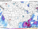
As of now I think a Tampa to just south of Orlando to cape canavral line.
12Z Euro: a bit stronger (970s) and furthest N of all Euro runs so far (near GFS) with it just N of Tampa Wed evening (a bit slower than 0Z’s Pt Charlotte)
Summary of 5 at 12Z: all Wed except CMC Fri
GFS/Euro just N of Tampa
Icon/CMC Pt Charlotte
UK between Ft Myers and Naples
Summary of 5 at 12Z: all Wed except CMC Fri
GFS/Euro just N of Tampa
Icon/CMC Pt Charlotte
UK between Ft Myers and Naples
Last edited:
If you are in FL I would definitely be prepared for hurricane in and around Tampa. Moving ENE. Possibly a Major at landfall too. Crazy how fast things can change in weather.
Brent
Member
Milton replaced Michael...

