Brent
Member
18z GFS hurricane for S FL then New Orleans Memorial Day weekend
Well its consistent with something Still seems forever away though
Well its consistent with something
Still seems forever away though Still seems forever away thoughConsistent with inconsistency .. here, then gone, then back ...18z GFS hurricane for S FL then New Orleans Memorial Day weekend
Well its consistent with something
Consistent with inconsistency .. here, then gone, then back ...
Lord I hope we're not living this until October ...
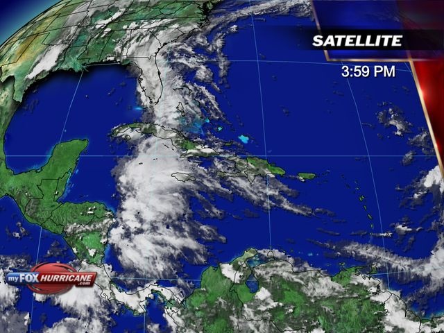
Still seems too early for this crapThanks for the update. Larry!There is now near unanimous agreement in the models that there will be a tropical low forming in the NW Caribbean about 7 days from now or around 5/24. (This compares to those GFS runs on their own around a week ago that were forming it there around 5/18-19 and turning it into an unrealistic for May cat 2 H later hitting FL on many runs.)
From there, the models have it move northward to or near FL around day 10 (near 5/27). Most models bring it to TS strength then though GFS runs have a cat 1 H. I think TS strength would be more realistic in late May. FL is clearly at risk for a TS.


Yeah, the euro and CMC coming on board makes it more likely for a system to form due to agreement. However, seems the FV3 is the worst at the moment, as it has a cat 4 sitting off the coast of LA, which I believe to be next to impossible.There is now near unanimous agreement in the models that there will be a tropical low forming in the NW Caribbean about 7 days from now or around 5/24. (This compares to those GFS runs on their own around a week ago that were forming it there around 5/18-19 and turning it into an unrealistic for May cat 2 H later hitting FL on many runs.)
From there, the models have it move northward to or near FL around day 10 (near 5/27). Most models bring it to TS strength then though GFS runs have a cat 1 H. I think TS strength would be more realistic in late May. FL is clearly at risk for a TS.
Yeah, the euro and CMC coming on board makes it more likely for a system to form due to agreement. However, seems the FV3 is the worst at the moment, as it has a cat 4 sitting off the coast of LA, which I believe to be next to impossible.
Didn't mean to suggest an endorsement, but since it's out there ...
So far, in my most humble opinion, that model hasn't made much sense at all from the day it went public; it's still in an experimental stage and from what I can tell "blends" the GFS into its output, which would explain a lot; that circles back to a discussion a few days ago about its resolution. Bottom line - it's out there and probably worth a look, but it's not what this humble soul is relying on ...I know and it isn't bad to post it so we can later look back at how nutty the model is.
How could the FV3 even be doing that with the N GOM not even all that warm? It doesn't make any sense.


Last year the CMC stepped up quite a bit and they euro stepped down, often missing storm formation entirely. I wouldn't put the Euro too high since its not been its best lately. However because everything is agreeing on a strong tropical low, we could see something. The FV3 is going to have to be watched throughout the season just to see how it reacts to different areas of the Atlantic. I'm sure it's going to be bad unless they correct it.The FV3 “upgraded” GFS looks far worse so far this season than the one it replaces. In four runs it has gone from a category 4 into Texas, a cat 4 Louisiana hit, a run that doesn’t even develop and now the 18z run where the low heads into the GOM, gets forced west then wsw into the BOC for a landfall in Mexico. This inconsistency, not to mention the absurd intensity it shows on multiple runs, is pitiful.
My greatest concern is during hurricane season when social media posters will plaster images of the FV3 everywhere and cause undue concern. It was bad enough last year with the upgraded gfs, this year will be far worse I’m afraid.
Last year the Euro, CMC and German combo were very reliable for TC genesis and track with the Euro leading the way. I wouldn’t bother looking at the FV3 unless you need a good laugh; it’s clueless and trash for TC intensity and genesis.
Last year the CMC stepped up quite a bit and they euro stepped down, often missing storm formation entirely. I wouldn't put the Euro too high since its not been its best lately. However because everything is agreeing on a strong tropical low, we could see something. The FV3 is going to have to be watched throughout the season just to see how it reacts to different areas of the Atlantic. I'm sure it's going to be bad unless they correct it.

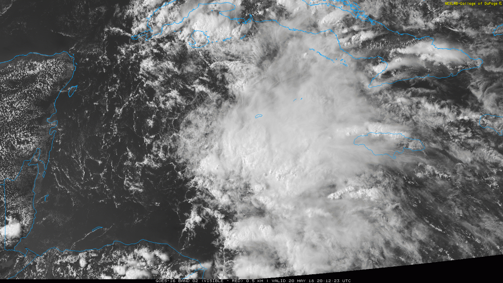
12z Euro and cmc are similar0z Euro is closer to Louisiana than Florida lol
Just south of New Orleans at 216 while the gfs is actually east of Florida barely
Rain will be the big story I imagineThe earliest on record TS to hit the US Gulf coast W of FL is 5/30's Arlene, which hit LA with 45 mph winds/1000 mb in 1959. So, this has a chance to make history.
Yeah, looks like one of those slow moving, wondering lows that wants to flood everyone lol.Euro just stalls it along the TX/LA border region for days through the end of the run talk about flooding
Whatever comes of this will cause some major flooding.0z Euro again doing the very slow motion towards Texas by day 10... rain gets pretty far west towards me