• Hello, please take a minute to check out our awesome content, contributed by the wonderful members of our community. We hope you'll add your own thoughts and opinions by making a free account!

Severe Severe Weather Threat for 6/20/19

B

Brick Tamland

Guest
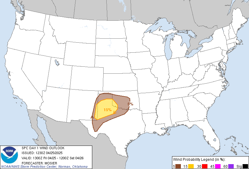
Almost all of NC and SC are under an enhanced risk today for severe storms. Parts of GA and VA, too. Looks like the biggest threat we have had in a while.
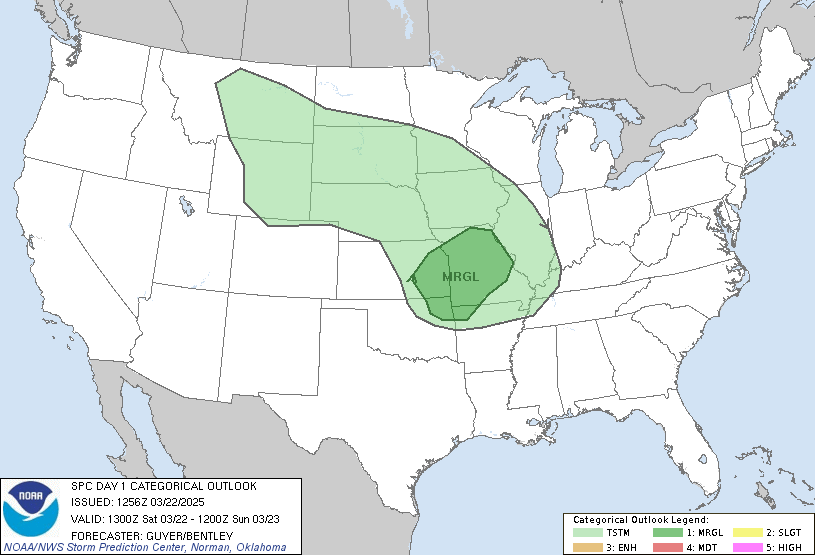
day1otlk_1300.gif


day1probotlk_1300_wind.gif
 
3km NAM shows a nasty MCS/bowing segment forming this afternoon and traversing a good chunk of NC.

1561036766555.png

1561036775699.png

Meanwhile the HRRR is much different with more of a scattered showers/storms look for NC and more bowing segments in SC.

1561036801520.png
 
The battle of the short range models today. NAM really looks bad for NC.
 
Once storms actually form I believe we will get a good picture of what we’re looking at. These types of set ups it’s just all about the nowcasting where these bowing segments line up. Not good that we’re getting all this good sun and humidity before hand..
 
The battle of the short range models today. NAM really looks bad for NC.

Yeah NAM would be really bad especially for wind damage if something like that verified. The HRRR wouldn't be quite as bad but would still be rough for the stronger cells. This is a scenario where you have to look more at the ingredients on the table and see the potential for things to get pretty rough which is what the SPC is doing. There should be plenty of instability to work with too.
 
After analyzing morning model data.. I believe the worst of the Severe Storms will be over South Carolina, especially central and eastern parts‼️ Sun is out in full force.
 
After analyzing morning model data.. I believe the worst of the Severe Storms will be over South Carolina, especially central and eastern parts‼️ Sun is out in full force.

Sunny over most of Central NC as well right now. Cat is loving it.


Instability looks to be growing each model run across Central NC no?
 
The damaging wind threat definitely seems like it'll be highest mainly east of I-85 & GSP-CLT in the Carolinas today, in addition to the amount of time the cold pools from neighboring storms will have to mature & merge, there's also considerably more CAPE in the coastal plain and eastern piedmont, right over the areas w/ 45% risk of wind damage.

I guess we'll see what happens but I definitely think I'm on the outside looking in here in Charlotte.
sbcp.gif
 
Sunny over most of Central NC as well right now. Cat is loving it.


Instability looks to be growing each model run across Central NC no?

Full sun, muggy, and it's already windy this morning. Feels like a stormy day.
 
1561047308067.png
Mesoscale Discussion 1159
NWS Storm Prediction Center Norman OK
1102 AM CDT Thu Jun 20 2019

Areas affected...southeast Alabama...central and southern Georgia
and South Carolina

Concerning...Severe potential...Watch likely

Valid 201602Z - 201800Z

Probability of Watch Issuance...80 percent

SUMMARY...Thunderstorms are expected to develop by 17-18Z over a
large part of the Southeast U.S. and increase in coverage and
intensity during the afternoon, posing a risk for damaging wind and
hail. A WW will probably be needed for a portion of this region by
17Z.

DISCUSSION...A moist warm sector resides over a large part of the
southeast U.S. with dewpoints around 70F and temperatures climbing
through the mid 80s F as of 16Z. Latest objective analysis indicate
MLCAPE around 1500-2000 J/kg and further destabilization will occur
as the surface layer continues to warm. Water vapor imagery shows a
progressive shortwave trough moving through the TN Valley, with an
MCV also indicated over southeast TN/northern GA. A low-level
confluence zone is forecast to evolve well inland from the coast
from southern AL through southern GA. The combination of forcing for
ascent associated with the MCV and progressive shortwave trough,
surface layer destabilization and subtle boundaries, should promote
warm sector initiation by early afternoon. While deep-layer wind
profiles are unidirectional west southwesterly with small 0-1 km
hodographs, a belt of 50 kt mid-level winds within the base of the
trough is resulting in 30-35 kt effective bulk shear. This
environment should support both multicell and some supercell
structures with discrete modes eventually evolving into lines and
clusters capable of damaging wind and hail.
 
1561048088915.png
Mesoscale Discussion 1160
NWS Storm Prediction Center Norman OK
1123 AM CDT Thu Jun 20 2019

Areas affected...North Carolina...Virginia...Maryland and Delaware

Concerning...Severe potential...Watch likely

Valid 201623Z - 201830Z

Probability of Watch Issuance...80 percent

SUMMARY...Thunderstorms are expected to develop during the early
afternoon posing a risk for damaging wind and hail. A severe
thunderstorm watch will probably be needed by 18-19Z.

DISCUSSION...The warm sector continues to destabilize over a large
part of the Mid Atlantic region from North Carolina through VA and
MD. Surface dewpoints around 70F and temperatures warming through
the mid to upper 80s have boosted MLCAPE to 1500-2000 J/kg. WV
imagery shows the primary shortwave trough over the TN Valley, but
with an MCV moving through the southern Appalachians. These features
are progressive, and the accompanying forcing for ascent along with
boundary layer destabilization should result in an increase in
thunderstorm coverage and intensity this afternoon. Wind profiles
are unidirectional west southwesterly with 30-40 kt deep-layer flow,
but modest 0-6 km shear generally less than 35 kt. This environment
will support mostly multicell modes, but mid-level updraft rotation
will also be possible in some storms. Activity may evolve into
clusters and line segments with time posing a risk for damaging wind
and hail through the afternoon into early evening.
 
Going to be quite an active afternoon I'm afraid. Models usually struggle with initiation of storms on days like this but usually those remnant MCV's running into an unstable airmass like this really get cranking by 3-5pm just based on past experience. SC looks primed to see some explosive upscale growth this afternoon too but there are massive differences between the HRRR and 3km NAM. The HRRR focuses the storms forming in Eastern NC/SC with a scattered nature and little organization while the 3km NAM is showing several multi-cellular clusters forming. I tend to lean towards the 3km NAM idea given the thermodynamic environment and overall setup but we will see.
 
Going to be quite an active afternoon I'm afraid. Models usually struggle with initiation of storms on days like this but usually those remnant MCV's running into an unstable airmass like this really get cranking by 3-5pm just based on past experience. SC looks primed to see some explosive upscale growth this afternoon too but there are massive differences between the HRRR and 3km NAM. The HRRR focuses the storms forming in Eastern NC/SC with a scattered nature and little organization while the 3km NAM is showing several multi-cellular clusters forming. I tend to lean towards the 3km NAM idea given the thermodynamic environment and overall setup but we will see.

What's the latest NAM look like?
 
Back
Top