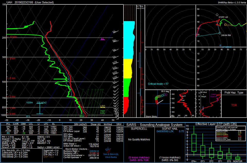
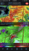
• Hello, please take a minute to check out our awesome content, contributed by the wonderful members of our community. We hope you'll add your own thoughts and opinions by making a free account!

Severe Severe Weather Potential February 23rd

Still looking like mostly a QLCS with embedded supercells to me. For a more significant supercell threat Id definitley like to see 500mb winds intercect the boundary at a sharper angle. Id also like to see a more veered flow from 850mb to 500mb which in this case its nearly unidirectional. The positive tilt trough helps and hurts. On one instance it helps keep junk convection down. On the other it keeps forcing and height falls generally behind the front and limiting prefrontal convection where there is less linear forcing.

Edit: Looking at some better maps, winds from 850-500mb are not as unidirectional as I thought, so that helps there if you want more supercelluar action.
 
Last edited:
Parameters lining up like the HRRR has been showing. Things should really start popping in next couple hours. Could be a show.
 
Makes me wonder, EML on nam 3km disappeared last night, sure that means less capping but it also means a lot more convection instead of more discrete storms, still this is a pretty bad sounding, if you are chasing I’d watch for hail, that HGZ is not to bad with this fatter CAPE sounding along with some drying in there, other than that everything is on track D8BA0824-8231-49B5-9C9D-93412F5C9DA3.jpeg
 
Neither WRF is very impressive, QLCS with embedded supercells with little convection out front.

Edit: HRRR is not really impressive either, showing about the same.
 
WRFs and latest HRRR.

uh25_max.us_se.png


uh25_max.us_se.png


uh25_max.us_se.png
 
Back
Top