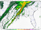
Spc has outlined parts of the region in a mgnl risk
-
Hello, please take a minute to check out our awesome content, contributed by the wonderful members of our community. We hope you'll add your own thoughts and opinions by making a free account!
You are using an out of date browser. It may not display this or other websites correctly.
You should upgrade or use an alternative browser.
You should upgrade or use an alternative browser.
Severe Severe Weather 2/3-2/4
- Thread starter SD
- Start date

Z
Zander98al
Guest
Nws bham mentioned a maritime front jogging north with this system, comes at peak heating, should be max sunlight ahead of the ragged line/ renegade cells. Should be atleast a slight risk in this area for tommorow.
Z
Zander98al
Guest
12z CAMs still show less of a line and more of a supercell potential maybe even more so than before 

Z
Zander98al
Guest
15z RAP coming more in sync to the other close range models lapse rates seem to be better than the last event we had in my neck of the woods. Sfc to 3km is still in question. Nearing 7.0 lapse in each other layer. Cape may still rise some more. Seems like RAP is undergoing thermodynamics compared to HRRR. 
Z
Zander98al
Guest
Actually it's looking to be almost a 50/50 from what I'm seeing. Shear isn't super high. And cape is slowly creeping up higher to meet the higher shear that's in places. I feel like this event is being slept on a bit. But then again it really started to get going since the. 48 mark range when HRRR starting picking it up.I have not kept up with the severe threat, is this a high shear low cape situation or are we talking more of a medium type setup for Winter?
HSVweather
Member

Z
Zander98al
Guest
Think the ceiling for this event is a enchanced. Quite surprised at the evolution from a line to a renegade/ broken semi line look. And then possibly to a squall line as it evolves later in the day. HRRR updrafts are nothing to scoff at. Where the red streaks are will probably be the enchanced area I'f we even see one. 18z model runs come out shortly. Will have a look at them as soon as they run.
Z
Zander98al
Guest
18z is more impressive than the 12z. Ouch. Parameters are getting on up there. If cape increases by just 500j it's looking like a pretty bad day. 18z increased SRH helicity a good bit more. Starting to look like a dangerous setup. That's really flying under the radar.


Attachments
Z
Zander98al
Guest
going to go ahead and say it. There may be a few long track supercells tommorow. Lapse rates still aren't super impressive though ?
Z
Zander98al
Guest
The veering of the winds from surface upwards is pretty dang good.
Z
Zander98al
Guest
Short range HRRR models have upticked shear and cape through 9 in the morning compared to the 18z LR HRRR run. Broad warm sector developing across east MS and most of AL. 

accu35
Member
- Joined
- Jan 5, 2017
- Messages
- 8,282
- Reaction score
- 9,665
This is getting a bit concerning for my areaShort range HRRR models have upticked shear and cape through 9 in the morning compared to the 18z LR HRRR run. Broad warm sector developing across east MS and most of AL. View attachment 112469View attachment 112470
Z
Zander98al
Guest
00z HRRR currently coming out now. Based off the last hours of the past few runs 22z and 23z helicity has increased and were almost reaching 1000sb cape for the left half of Alabama by 10 and 11 o clock. With convection intiating in south MS by that time frame.This is getting a bit concerning for my area
Z
Zander98al
Guest
Z
Zander98al
Guest
00z hrrr looks a good bit messier.
Still very high shear! Hints of renegade cells as well.

Still very high shear! Hints of renegade cells as well.
HSVweather
Member
accu35
Member
- Joined
- Jan 5, 2017
- Messages
- 8,282
- Reaction score
- 9,665
What time is this event for Alabama?
HSVweather
Member
What time is this event for Alabama?

Looks like a 11am to 6pm based on 00z HRRR