• Hello, please take a minute to check out our awesome content, contributed by the wonderful members of our community. We hope you'll add your own thoughts and opinions by making a free account!

Severe Severe potential April 13th-15th Palm Sunday Weekend

Joined
Jan 5, 2017
Messages
741
Reaction score
1,458
Location
Odenville Alabama
This appears to be the next time period to watch for severe thunderstorms. Models have been consistent in showing that something (potentially potent) may be in store for this time period. It's still about a week out but let's see how this one evolves.
 
WOOF
J.P. Dice:
We need to focus on Sunday for the possibility of severe weather. I know we have some possibilities of thunderstorms this week, but Sunday is the day to watch.
If JP Dice says we need to then we need to. He is one not to bark up that tree to often

Sent from my Pixel 2 using Tapatalk
 
This is still a concerning look, classic closed low with a decently strong/broad trough, anticyclonic flow from a Bermuda high in the Atlantic combined with a developing low pressure likely means moisture/dews will be there, also looks like there will be a decent low level jet, I agree with what @Darklordsuperstorm said, there will likely be more instability, gfs has horrible resolution and generally spreads out precipitation over a area, reducing instability becuase of its own issue, SR models can pick up instability wayyyyy easier and other mesoscale factors, for now this is a setup that could possibly be as bad as that one weeks ago, also a heads up that climo supports way more instability then it did back in early March 9D6332D6-CEC6-40C2-B3E4-419FBD93B865.jpeg
 
This is still a concerning look, classic closed low with a decently strong/broad trough, anticyclonic flow from a Bermuda high in the Atlantic combined with a developing low pressure likely means moisture/dews will be there, also looks like there will be a decent low level jet, I agree with what @Darklordsuperstorm said, there will likely be more instability, gfs has horrible resolution and generally spreads out precipitation over a area, reducing instability becuase of its own issue, SR models can pick up instability wayyyyy easier and other mesoscale factors, for now this is a setup that could possibly be as bad as that one weeks ago, also a heads up that climo supports way more instability then it did back in early March View attachment 18678
Your little red circle would be a enhanced risk zone you think?
 
This is still a concerning look, classic closed low with a decently strong/broad trough, anticyclonic flow from a Bermuda high in the Atlantic combined with a developing low pressure likely means moisture/dews will be there, also looks like there will be a decent low level jet, I agree with what @Darklordsuperstorm said, there will likely be more instability, gfs has horrible resolution and generally spreads out precipitation over a area, reducing instability becuase of its own issue, SR models can pick up instability wayyyyy easier and other mesoscale factors, for now this is a setup that could possibly be as bad as that one weeks ago, also a heads up that climo supports way more instability then it did back in early March View attachment 18678
Looks to be the worst setup this year for the south in terms of severe weather. EURO has the low almost below 1000mb which would be considered deep. If this thing gets below 1000mb mid april that's a red flag.
 
Your little red circle would be a enhanced risk zone you think?

At this time yeah due to better instability at daytime, (18z is just after lunchtime) still nocturnal threats become more prevalent as time moves along later in the spring/summer
 
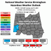
And From SPC
Day 6 (Saturday) General model consensus is that rich low-level
moisture with near 70 F dewpoints will advect northward into the
warm sector over the lower MS Valley in advance of a southern-stream
shortwave trough. This environment may become favorable for a more
significant severe event by later Saturday from southeast TX to the
lower MS Valley, then continuing into the Gulf Coast states Sunday
(day 7). If models continue to demonstrate consistency in this
scenario, a categorical risk area will need to be introduced in
later updates.
Good gosh. You don't see many categorical risk days that far out.
 
If the Euro holds serve tonight I expect that SPC will have an area outlooked in day 4-8 tomorrow
Even if its off a little bit they still may put a risk area. The general consensus of all the models is that the low is in the same general location maybe not the same intensity though. I'm guessing that's why they are already talking about it and that after every model run its consistently looked the same for a day or two now. Even james spann is sounding the alarm some. I'm waiting for the setup to get into Cips analog range to see what events its most similar too and severe threat from those similar analogs.
 
Back
Top