-
Hello, please take a minute to check out our awesome content, contributed by the wonderful members of our community. We hope you'll add your own thoughts and opinions by making a free account!
You are using an out of date browser. It may not display this or other websites correctly.
You should upgrade or use an alternative browser.
You should upgrade or use an alternative browser.
Wintry Potential Dec 13-14 Ice Threat
- Thread starter Webberweather53
- Start date
Probably the most realistic map I've seen all-day

SimeonNC
Member
Ofc the 32 degree line is over the Northern Mecklenburg area.Surface wet bulb map as of 1z. The northern & far western piedmont of NC certainly seems primed for a light glaze w/ wet bulbs in the upper 20s-near 30F, probably going to be too warm near the NC-SC border & points south.
View attachment 27905
Up to 40 degrees now lol, failwedge
It’s the same system, not ice, but instead severe weather, long range hrrr went boom with it, shows a meso low, with supercells along the cold front, meso low is likely enhancing low level shear, only limiting thing is low level instability, cold air aloft to would support hail


Blue_Ridge_Escarpment
Member
smast16
Member
Now down to 28 /18. Wind has gone calm. I think I'm primed for a little sparkle in the trees.Still 30/18 with a slight NE breeze and thin veil of high level clouds.
Webberweather53
Meteorologist
My final call for this event in NC. Temps look like they're gonna be too warm in Charlotte for any significant ZR accrual, same can not be said for the northwestern piedmont. With light winds and ice accumulations near or up to 0.25", may see some widely scattered power outages in the far NW piedmont.

31.4/23 WB= 28.5
Webberweather53
Meteorologist
31.4/23 WB= 28.5
Yikes, you're already below freezing before any precip has moved in.
My final call map aswell, which was the same map I posted yesterday, still looks good, maybe more ice into those areas near SW NC since cold air can get trapped in those areas, same for areas more west of this axis of ice into the mountains

Scooter
Member
Just outside of High Point in northern Davidson County

38/21 here = 32 WB
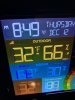
40/25= wet bulb of 35. Fail! Next!
Here comes the moisture 
MichaelJ
Member
Uh oh, now 31/23 here and clear skies with 6% cloud cover
drfranklin
Member
- Joined
- Dec 1, 2016
- Messages
- 474
- Reaction score
- 687
39.1/28
Last edited:
28 over 22. I see those to my west have dew points in the teens up in the mtns.
Jefferson is 27 over 19.
Reports of some sleet mixing in around Clemson. It’s heading your way soon, Mack and Jimmy.
