-
Hello, please take a minute to check out our awesome content, contributed by the wonderful members of our community. We hope you'll add your own thoughts and opinions by making a free account!
You are using an out of date browser. It may not display this or other websites correctly.
You should upgrade or use an alternative browser.
You should upgrade or use an alternative browser.
Pattern Outside of the SE thread
- Thread starter SD
- Start date
Brent
Member
Everyone pretty much going 1-3 here with maybe a spot up to 6. They aren't buying the widespread big totals
BufordWX
Member
A lot of talk about how much snow that does fall will melt. Even with some of the negative factors (warm ground, temperatures just above freezing) there are some factors making me think that we may see more accumulation.Everyone pretty much going 1-3 here with maybe a spot up to 6. They aren't buying the widespread big totals
First one is that there will be bands of snow where it will be HEAVY and that could overpower the warm ground temperatures. If we end up with bigger totals thats how its gonna happen. Second is that most of this is coming through after sunset so we wont have sun angle working aginst us which should help a little.
Brent
Member
A lot of talk about how much snow that does fall will melt. Even with some of the negative factors (warm ground, temperatures just above freezing) there are some factors making me think that we may see more accumulation.
First one is that there will be bands of snow where it will be HEAVY and that could overpower the warm ground temperatures. If we end up with bigger totals thats how its gonna happen. Second is that most of this is coming through after sunset so we wont have sun angle working aginst us which should help a little.
Yeah time of day may be what ultimately saves us here tbh or dooms us depending on your point of view ?
I mean I've seen these same setups before have someone way overperform
BufordWX
Member
Brent
Member
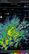
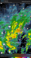
Starting to see more reports of winter precipitation West of OKC. Heavier returns also developing.View attachment 146214
If the hi res models are right here tomorrow morning is gonna be a mess ? that seems to be a trend slower to end here. The peak is definitely gonna be way after midnight I think
Brent
Member
BufordWX
Member
BufordWX
Member
Getting a mix of everything right now. Some rain, some sleet, and some wet flakes.
BufordWX
Member
BufordWX
Member
BufordWX
Member
Drizzle Snizzle
Member
I sure wish I was in in NW AR. Looks like they will be the big winners.
Radar looking good boys
Brent
Member
I sure wish I was in in NW AR. Looks like they will be the big winners.
They always win over there.... More elevation. It's mostly the hills above the cities that will probably see the warning criteria snow most likely
It's gonna be late here like I thought but I see no reason we won't at least meet expectations. I got a feeling around daybreak it may be raging
That band looks amazing near you Brent!
Brent
Member
That band looks amazing near you Brent!
Yeah but we're still too warm
Man what could have been with this one ? I mean it's still gonna be a win I think but yeah
Just be glad you got a ULL to work with!Yeah but we're still too warm
Man what could have been with this one ? I mean it's still gonna be a win I think but yeah
Brent
Member
Just be glad you got a ULL to work with!post pictures
Oh don't worry once it starts I'll be on it
And yeah I know it's been a rough winter
Brent
Member
Airport mixing at 39 degrees ?
Drizzle Snizzle
Member
Is it even supposed to get down to freezing tonight ?Airport mixing at 39 degrees ?
Brent
Member
Is it even supposed to get down to freezing tonight ?
Not really or very briefly. The roads are probably gonna stay wet tbh unless we get super heavy rates
This is about as borderline as it gets for an accumulating snow here lol
Drizzle Snizzle
Member
Sunshine and upper 40s tomorrow afternoon ? I have a feeling whatever falls won't be on the ground tomorrow night.Not really or very briefly. The roads are probably gonna stay wet tbh unless we get super heavy rates
Brent
Member
Sunshine and upper 40s tomorrow afternoon ? I have a feeling whatever falls won't be on the ground tomorrow night.
Yeah well see about that but I definitely expect a lot of melting as soon as it ends tomorrow
Schools haven't even closed yet ? although the morning is gonna be a problem for sure
BufordWX
Member
Brent
Member
What a disgusting joke. I never want to talk about this winter ever again
I wouldn't get your hopes up Tennessee. Warm air destroyed us here
I wouldn't get your hopes up Tennessee. Warm air destroyed us here
What happened?What a disgusting joke. I never want to talk about this winter ever again
I wouldn't get your hopes up Tennessee. Warm air destroyed us here
Brent
Member
What happened?
Didn't change over soon enough. I mean it's trying to snow now but it was supposed to snow 4 hours ago
I’ll trade you weather. It’s pouring rain here this morning. We’ll prob go 4+ today no problemDidn't change over soon enough. I mean it's trying to snow now but it was supposed to snow 4 hours ago
?I’ll trade you weather. It’s pouring rain here this morning. We’ll prob go 4+ today no problem
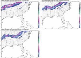
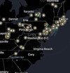
That was a heck of a snow band that set up over the mid Atlantic last night. A lot of busted forecasts
It just don’t snow like it should anymoreThat was a heck of a snow band that set up over the mid Atlantic last night. A lot of busted forecasts
Brent
Member
Brent said “f**k it. If it won’t snow I’ll get on a plane.” I hear ya buddy!!Found snow... in Coloradoquickly melting in Denver already View attachment 146669
Anybody got concerts lined up for the summer ??
I got Sevendust and Green Day booked
I got Sevendust and Green Day booked
Oh, and AC/DC when they come to the states! Yes I know they are 75 years old. But my favorite band of all timeAnybody got concerts lined up for the summer ??
I got Sevendust and Green Day booked
Brent
Member

