• Hello, please take a minute to check out our awesome content, contributed by the wonderful members of our community. We hope you'll add your own thoughts and opinions by making a free account!

Pattern Outside of the SE thread

Made it to an intra-hour 92*F at DFW yesterday with mostly sunny skies.

Got a good pop of wind (35-40+ MPH gusts), and even a rogue t'storm or two in a few spots, around 1am or so with a outflow boundary from an remnant QLCS in West Texas. Should have a better shot at more widespread activitiy tomorrow.
 
Currently 90*F at DFW as of 3pm.

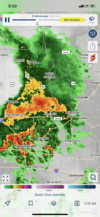
Also watching the storms just to the NE, to see if any of the outflow boundaries will trigger activity over the Metroplex later this afternoon.
 
Currently 90*F at DFW as of 3pm.

Also watching the storms just to the NE, to see if any of the outflow boundaries will trigger activity over the Metroplex later this afternoon.

Intra-hour high of 93*F before the outflow boundary blew through and dropped temps into the 70s.
 
Ooooof! And nothing in June yet either A0C27CF7-A805-453D-B198-D951E6EC58BC.png?
 
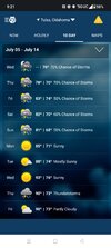
90s as far as the eye can see in the extended forecast.

Summer is officially here!

DFW might have gotten 89'd today due to early initiation of t'storms (fairly decent coverage).

Getting a nice hit right now here.
 
DFW made it to 97*F yesterday.

Even have the conditional possibility for 100*F today, entirely dependent on how convection plays out.
 
And we're back to our regularly scheduled program!

Made it to 91*F at DFW, and a heat advisory is in effect through Friday evening.
 
Another 99*F for the books at DFW, unless a sneaky spike to 100*F happens within the next hour.
 
5:20 ish sunrise, already losing 2 seconds of daylight today! ☃️C4AC27E2-8DEA-4A97-A05F-09015C71CE55.jpeg
 
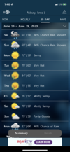
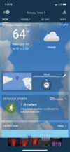
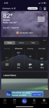
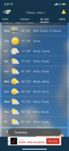
Beautiful day in Iowa! Much need break in heat and drought! 64, windy, heavy drizzle! F7A18A5A-2955-4C8E-888A-A70C0E4BBF27.png
 

101*F was the official high at DFW yesterday, making it the hottest day of the year.

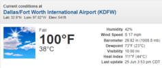
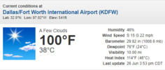
Perhaps the most impressive part about this heat wave is that were getting temps 100*F or greater while dewpoints hold in the low/mid 70s through peak heating. It's not often that happens, especially this far NW from the Gulf / swamp land (though maybe in Houston / Louisiana / Arkansas / Mississipi)...

With gulf temps at 85 degrees with a death ridge sitting on top there's not gonna be any mixing.
 
With gulf temps at 85 degrees with a death ridge sitting on top there's not gonna be any mixing.

True, although I will say last year Gulf temps were similar but the dewpoints would often mix out.

The big difference is there was severe drought conditions and a ton of Saharan dust in the atmosphere as well.
 
Last edited:
True, although I will say last year Gulf temps were similar but the dewpoints would often mix out.

The big difference is there were severe drought conditions and a ton of Saharan dust in the atmosphere as well.
Saharan dust will be down in a El Niño pattern. Shear should keep it away.
 
I just can't understand for the life of me why FWD is being pedantic about an Excessive Heat Warning, especially given HOU has issued one despite relatively less oppressive ambient temps and heat indices.
 
Last edited:
I just can't understand for the life of me why FWD is being pedantic about a Excessive Heat Warning, especially given HOU has issued one despite relatively less oppressive ambient temps and heat indices.

They must have saw my post, as they finally pulled the trigger...
:lol:
 
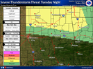
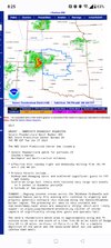
Besides the heat(which actually wasn't bad here today but will be getting terrible again tomorrow and especially Wednesday) I'm having flashbacks to last weekend... Some of the models have another powerful wind event nearby tomorrow night. The last of the power was finally restored today I believe

image3 (1).png
 
Back
Top