-
Hello, please take a minute to check out our awesome content, contributed by the wonderful members of our community. We hope you'll add your own thoughts and opinions by making a free account!
You are using an out of date browser. It may not display this or other websites correctly.
You should upgrade or use an alternative browser.
You should upgrade or use an alternative browser.
Ostrich December
- Thread starter SETNwx
- Start date


Montanasnow30
Member
I definitely willTake pics !
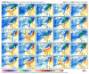
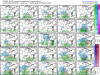
Weatherbell doesn’t have individual vort members, but I have MSLP, 2m Temp Anomaly, and Precip.I'd like to see the vort maps from 7/23/33. They have to be either shearing the wave so much the is a lack of strong waa or displaced well south
Attachments
-
 58C52C65-9815-4D1B-9A52-694F0F438192.png176.8 KB · Views: 32
 -
 BC6C3784-73EE-4E48-A699-53083158EF45.png174.7 KB · Views: 36
 -
 4A0A690A-ED67-4BB3-837B-7952D6F5EA24.png186.1 KB · Views: 34
 -
 BCDE619D-CE92-4C07-881F-1E2D4F00E8E8.png187.1 KB · Views: 35
 -
 33E466E7-502B-47C6-80E6-9234222B3253.png178.7 KB · Views: 31
 -
 40060624-118C-4647-9136-85D3D0678F62.png180 KB · Views: 27
Gotta love the members firing up a low in the NE gulf ?Weatherbell doesn’t have individual vort members, but I have MSLP, 2m Temp Anomaly, and Precip.
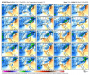
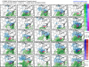
February 2014 was a good example of how we can get a good storm with a +EPO. I only wish we could get a lot more ridging over the Great Lakes.Setup reminds me of Feb 2014 event. Though, I am looking through my snow weenie goggles and squinting....
View attachment 57048View attachment 57049
February 2014 was a good example of how we can get a good storm with a +EPO. I only wish we could get a lot more ridging over the Great Lakes.
EPS is getting there

If only we could find a way to remove the low in Kentucky we would have to upgrade the server .png")
SnowNiner
Member
Setup reminds me of Feb 2014 event. Though, I am looking through my snow weenie goggles and squinting....
View attachment 57048View attachment 57049
You could probably make the argument that this setup is better....really nice Atlantic blocking with a very stout 50/50 (assuming its real) locked in place. We just need it a touch further south and many could get token winter weather. I still say if this set up manifests in January we'd snow. But that's looking through my weenie binoculars. lol.
iGRXY
Member

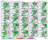
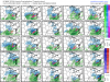
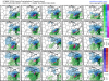
This is not a accumulation map or anything like that. Just a as of today if a winter storm were to occur where I think has the best chance as of right now. Obviously blue would be some onset snow to IP/ZR except for the elevations above 3500 ft where it likely stay mostly snow. Purple is where I think an ICE storm is likely to occur as of today. Think if you live in these areas you need to be on alert for some kind of winter weather than can obviously trend one way or the other.
Honestly this could be more then a token weather event NW of 85 if we indeed got stronger confluence, the problem though is low trackYou could probably make the argument that this setup is better....really nice Atlantic blocking with a very stout 50/50 (assuming its real) locked in place. We just need it a touch further south and many could get token winter weather. I still say if this set up manifests in January we'd snow. But that's looking through my weenie binoculars. lol.
Last edited:
Webberweather53
Meteorologist
You could probably make the argument that this setup is better....really nice Atlantic blocking with a very stout 50/50 (assuming its real) locked in place. We just need it a touch further south and many could get token winter weather. I still say if this set up manifests in January we'd snow. But that's looking through my weenie binoculars. lol.
The actual air mass that was injected into the pattern prior to that event in February 2014 was much colder, and also we had a little overrunning event the day prior that put significant snow on the ground across parts of the south, further helping to lock-in the low-level cold air.
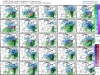
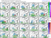
Probably the two best solutions on the EPS..
I don't think these account for zr/ip


I don't think these account for zr/ip
Wild "pre event" to the bigger storm that came 12-18 hours later. That little event overperformed big time for areas that didn't end up getting much at all with the next storm.The actual air mass that was injected into the pattern prior to that event in February 2014 was much colder, and also we had a little overrunning event the day prior that put significant snow on the ground across parts of the south, further helping to lock-in the low-level cold air.
View attachment 57061
Down here we got a couple inches on the 11th, a sleet/freezing rain day on the 12th, and a good ULL snow on the 13th that stuck to the ZR the day before. Good run.The actual air mass that was injected into the pattern prior to that event in February 2014 was much colder, and also we had a little overrunning event the day prior that put significant snow on the ground across parts of the south, further helping to lock-in the low-level cold air.
View attachment 57061
SnowNiner
Member
The actual air mass that was injected into the pattern prior to that event in February 2014 was much colder, and also we had a little overrunning event the day prior that put significant snow on the ground across parts of the south, further helping to lock-in the low-level cold air.
View attachment 57061
Yes that's true. I do remember now it being plenty cold at the start of that storm. At H5 it's relatively similar with the AK vortex. I'm not sure why it was so much colder. I remember it being in the mid 20s at onset IIRC.
members
Attachments
-
 AC262E8B-6575-4819-AE38-7C2A1FA702E5.png232.6 KB · Views: 45
 -
 D18C82C6-9758-44F5-947A-B80500A86F37.png231.6 KB · Views: 46
 -
 A0982A24-ACE3-4214-8349-C1298A7C4BAF.png217.6 KB · Views: 42
 -
 B3A58A10-0387-4744-93E9-D0723747C1AF.png225.8 KB · Views: 40
 -
 E9A1A0C7-9D92-4CF6-A750-39C71D8A5D56.png228.5 KB · Views: 39
 -
 03475248-87A4-498E-BF76-DBB85ED871FE.png216.5 KB · Views: 36
Yeah, I recall that overrunning system kind of came out of nowhere. New Bern ended up getting 10” from that, 2.5” more than I got from the “main event” storm up in Greensboro (granted, my 7.5” was much higher impact with a lot of sleet and freezing rain in addition to snow). I don’t recall any of the modeling showing so much snow in SE NC.Wild "pre event" to the bigger storm that came 12-18 hours later. That little event overperformed big time for areas that didn't end up getting much at all with the next storm.
FamouslyHot
Member
It's because it's not late enough in the season for as much cold air to be available, and the higher latitudes haven't been faring too well. We have similar setup of h5, but it's relative to a much warmer baseline. Looks like the coming weeks will do well to build up the cold up north.Yes that's true. I do remember now it being plenty cold at the start of that storm. At H5 it's relatively similar with the AK vortex. I'm not sure why it was so much colder. I remember it being in the mid 20s at onset IIRC.
The actual air mass that was injected into the pattern prior to that event in February 2014 was much colder, and also we had a little overrunning event the day prior that put significant snow on the ground across parts of the south, further helping to lock-in the low-level cold air.
View attachment 57061
Yeah, that was an awesome airmass. I remember it started snowing at 1pm in the afternoon in mid-February at 20F and stuck to the roads immediately. Pretty amazing.
The irony is that while we don’t have as much cold air available as we would in January and February. We also are approaching the shortest days of the year as well the angle being the lowest it gets. You’d think we’d be able to muster up something this month.
Sent from my iPhone using Tapatalk
Sent from my iPhone using Tapatalk