
-
Hello, please take a minute to check out our awesome content, contributed by the wonderful members of our community. We hope you'll add your own thoughts and opinions by making a free account!
You are using an out of date browser. It may not display this or other websites correctly.
You should upgrade or use an alternative browser.
You should upgrade or use an alternative browser.
Pattern Octorchber
- Thread starter SD
- Start date


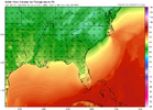
I swear I'm gonna miss the NAM



LukeBarrette
im north of 90% of people on here so yeah
Meteorology Student
Member
2024 Supporter
2017-2023 Supporter
Right after the Virginia Tech game in Blacksburg
 .
.I will be there and would stay the night for that

Get ready to lose storms to DC in the D3-4 range many times this winter! NE trend baby!!!This is an insane trend we are seeing in the short range. View attachment 198906

It will create its own cold air! October 2014 redux!


I'm on mission / still anticipating a Halloween / late Oct Hit job/ Big ticket east coast storm ( not Cane/ but extratropical/ Noreaster type with some tropical influence ). Don't see one yet. We shall see. Did see the ole CFS throw its first digital flakes of the season here in NW NC late 1st week NOV.
Euro and ICON try to get a coastal going this weekend. Actually close to a big deal eastern sections
NCSNOW started hinting at this idea in Sept for this autumn. There’s a strong correlation between very strong El Niños and having one significant to historic U.S. E coast storm in Oct. What I didn’t realize til today is that ALL 9 of the other very strong El Niño Octobers had one:
1877: Hatteras had 1002 mb on 10/27 along with significant rainfall and strong NE winds caused by gradient between a sub 1000 mb low offshore and a 1022 mb high over Quebec. Norfolk got 2.71” of rain. The low was TS #7 then to the S moving OTS:
1888: TS#7 went up the coast 10/11-12
1957: a strong nor’easter (995 mb) went up the coast 10/5-6 giving Hatteras 4.62” of rain:
1965: TS # 9 formed 10/16 NW Bahamas and hit NE FL 10/19 producing a whopping 8.3” of rain at CHS:
1972: very strong nor’easter went up coast NC-NE 10/5-8 with strong winds and heavy rains (>4” NYC, nearly 4” Hatteras):
1982: strong winds/heavy rain (3.64” of rain Hatteras) from nor’easter 10/23-26 due to strong gradient between 1004 mb low Hatteras and 1030 mb high NE US. I experienced this in DC and still clearly recall it:
1991: “Perfect Storm” 10/30-11/1H #8 (Boston rain 2.69”):
1997: nor’easter 10/18-20 (Hatteras rain 1.4”):
2015: strong front pushed by 1045 mb SE Canadian high gets hung up along E coast with ~stationary upper low SE US and MH Joaquin ~stationary Bahamas interacting in a way few have ever seen resulting in >17”/historic flooding CHS Oct 1-4:
———————————————
So, all 9 very strong El Niño had one impactful to historic US E coast storm in Oct! Are the 12Z UKMET, Euro, Euro-AIFS, and Icon sniffing out something real next week for 2026’s turn? Based on NCSNOW’s intuition and the history noted above, I wouldn’t at this point discount at least the possibility of something notable happening near the E coast next week.
Last edited:

Raleighwxauthority
Member
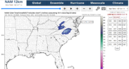
First call for possible snow on 10-18:
Raleigh: 2-4"
Charlotte: 1-3"
Asheville: 3-6"
Albemarle: Trace- Dusting (I think they get dry slotted)
Wilmington: 4-8"
Stay tuned for more updates! I hope to see more models hop on board with this event.
Raleigh: 2-4"
Charlotte: 1-3"
Asheville: 3-6"
Albemarle: Trace- Dusting (I think they get dry slotted)
Wilmington: 4-8"
Stay tuned for more updates! I hope to see more models hop on board with this event.
Attachments
Raleighwxauthority
Member
I think this is a sleeper event that could catch a lot of people off-guard.

It can’t be ruled out for the high peaks yet
I mean as 2014 showed, anything is possible, but I will believe it when I see it, LOL. I believe the earliest measureable snowfall for Raleigh is November 6th, for reference (not sure about sub-measurable).
Certainly is possible for the mountains, though!
Certainly is possible for the mountains, though!
Raleighwxauthority
Member
What are you thinking for snow totals?It can’t be ruled out for the high peaks yet