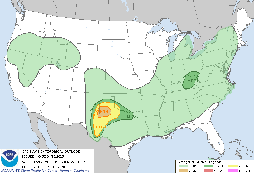
Given what’s been occurring out west and the slight risks issued for the S/E for today and tomorrow. Wind damage and tornadoes possible.
-
Hello, please take a minute to check out our awesome content, contributed by the wonderful members of our community. We hope you'll add your own thoughts and opinions by making a free account!
You are using an out of date browser. It may not display this or other websites correctly.
You should upgrade or use an alternative browser.
You should upgrade or use an alternative browser.
Severe October 21-22nd Severe Weather
- Thread starter BirdManDoomW
- Start date
SPC notes supercells possible central NC/SC Piedmont with the slight risk risk for Raleigh eastward tomorrow. Marginal Risk surrounds this area. Tornado odds increased to 5%.
NBAcentel
Member
Lots of SRH, cape is just the only questionable thing
How strong does everyone think the Dallas tornado was? EF3?
Still over 116,000 homes/businesses without power in Dallas.
Well the highs in the 60s and 6-9 AM fropa , screams severe wx imby!?
NBAcentel
Member
Well the highs in the 60s and 6-9 AM fropa , screams severe wx imby!?
I-77 East NC/SC threat mostly
Brent
Member
How strong does everyone think the Dallas tornado was? EF3?
seems to be the consensus of people here yeah maybe maybe high end EF2\
EF1 confirmed probably less than 10 miles to my south already
Last edited:
B
Brick Tamland
Guest
Well the highs in the 60s and 6-9 AM fropa , screams severe wx imby!?
Ha ha! Good one! Wink, wink.

Brent
Member
NoSnowATL
Member
Well the highs in the 60s and 6-9 AM fropa , screams severe wx imby!

Yep, going to be long night!

Sent from my iPhone using Tapatalk
Downeastnc
Member
SPC highlighting a surface low potential tomorrow and how that plays into NC tor threat.....if that low forms chances of a few decent tornados goes up and I wouldnt be surprised to see a EHC area with 10% tor in NC if it happens....
However, instability will remain rather weak
from southeast VA northward where heating will not be as strong and
midlevel lapse rates will remain poor. Where stronger heating is
forecast across parts of central/southern NC southward into northern
FL, MLCAPE values may reach as high as 1500-2000 J/kg in a narrow
corridor ahead of the front. Some forecast guidance suggests a weak
secondary surface low may develop in the VA/NC Piedmont vicinity
during the late morning. If this occurs, backed low level winds will
develop ahead of the cold front across parts of mainly
central/eastern NC into southeast VA. As a result, this could
locally increase tornado potential across this area.
I will try i77 tomorrow but don’t plan going on any further East so they better develop overhead or eastern foothills.
Here is my call map. I think development takes place a little further south-west after 8am like the NAM showes (Boone to Charlotte) with a bit of a skip in terms of severe for AVL and GSP. Maybe 1 tornado gets going from the activity out ahead and some wind damages from the line. Further north east I think Winston-Salem to VA Piedmont and OBX could see scattered tornadoes. RDU is in a bit of a gray area or gradient with little activity to some nearby in the vicinity. 

Cad Wedge NC
Member
Be sure to post a video of your intercept....I will try i77 tomorrow but don’t plan going on any further East so they better develop overhead or eastern foothills.
S
snowcool776
Guest
S
snowcool776
Guest
SPC highlighting a surface low potential tomorrow and how that plays into NC tor threat.....if that low forms chances of a few decent tornados goes up and I wouldnt be surprised to see a EHC area with 10% tor in NC if it happens....
However, instability will remain rather weak
from southeast VA northward where heating will not be as strong and
midlevel lapse rates will remain poor. Where stronger heating is
forecast across parts of central/southern NC southward into northern
FL, MLCAPE values may reach as high as 1500-2000 J/kg in a narrow
corridor ahead of the front. Some forecast guidance suggests a weak
secondary surface low may develop in the VA/NC Piedmont vicinity
during the late morning. If this occurs, backed low level winds will
develop ahead of the cold front across parts of mainly
central/eastern NC into southeast VA. As a result, this could
locally increase tornado potential across this area.

If this is what the SPC is forecasting, this could be what it looks like tomorrow.
NOTE: This is not official. Keep in mind that this could change at any time.
@metwannabe this might interest you if you live near the VA border.
Cary_Snow95
Member
Is there a threat for hail tomorrow?
NoSnowATL
Member
View attachment 24767
If this is what the SPC is forecasting, this could be what it looks like tomorrow.
NOTE: This is not official. Keep in mind that this could change at any time.
@metwannabe this might interest you if you live near the VA border.

Does this look familiar?
Sent from my iPhone using Tapatalk
NoSnowATL
Member

Does this look familiar?
Sent from my iPhone using Tapatalk
Same week last year! Spooky
Sent from my iPhone using Tapatalk
Downeastnc
Member
HI Res models are pretty meh for tomorrow......
Yea that’s weird... Happy to see my name on above post.Same week last year! Spooky
Sent from my iPhone using Tapatalk
0z hrrr is interesting with some UH streaksHI Res models are pretty meh for tomorrow......

Sent from my SM-G975U using Tapatalk
Not really. Tornado or wind threat.Is there a threat for hail tomorrow?
NBAcentel
Member
While thermodynamics ain’t impressive, wind shear is, more of a HSLC setup, hrrr shows this, even with Garbo cape, it shows some suercells getting going near lake Norman/I-77 East with only 300-700 jkg of cape, but low LCLs and strong wind profiles, only thing is tho is that wind profiles actually support more linear stuff altho sfc winds may back from the SE 


NBAcentel
Member
Wow that’s crazy lol, almost the same exact zonesSame week last year! Spooky
Sent from my iPhone using Tapatalk
S
snowcool776
Guest
REALITY:Wow that’s crazy lol, almost the same exact zones

Guess no ENH risk for NC!
Short range models still not overly excited about this threat and with all the low clouds, drizzle and light showers around I have a hard time seeing enough instability to get much going today. If all that breaks and the sun pops then maybe, since wind profiles still seem decent
B
Brick Tamland
Guest
Short range models still not overly excited about this threat and with all the low clouds, drizzle and light showers around I have a hard time seeing enough instability to get much going today. If all that breaks and the sun pops then maybe, since wind profiles still seem decent
I was coming on to post the same thing. Just seems too overcast right now for anything to pop off.
B
Brick Tamland
Guest
Matthew East just posted this on Facebook. Wonder how long this line will hold together.
11:45am Tuesday: Line of heavier showers with gusty winds from near Hickory to Shelby moving quickly eastward. Winds could gust to 45mph with this activity. Live weather updates on Spectrum News. #ncwx #cltwx #wncwx

11:45am Tuesday: Line of heavier showers with gusty winds from near Hickory to Shelby moving quickly eastward. Winds could gust to 45mph with this activity. Live weather updates on Spectrum News. #ncwx #cltwx #wncwx

S
snowcool776
Guest
Short range models still not overly excited about this threat and with all the low clouds, drizzle and light showers around I have a hard time seeing enough instability to get much going today. If all that breaks and the sun pops then maybe, since wind profiles still seem decent
Looks like its gonna happen. New meteorologist now in the WRAL Weather center.
S
snowcool776
Guest
Matthew East just posted this on Facebook. Wonder how long this line will hold together.
11:45am Tuesday: Line of heavier showers with gusty winds from near Hickory to Shelby moving quickly eastward. Winds could gust to 45mph with this activity. Live weather updates on Spectrum News. #ncwx #cltwx #wncwx
View attachment 24784
S
snowcool776
Guest
1630Z update: No more slight risk!


Okay here’s my review of the line as it passed i77 in Yadkin/Iredell. No gusts to 45mph. A few white out conditions as 3 or 5 gusts pushed 30mph with heavy rain. Lots of water tho with good rates. No thunder or lightning anywhere.
S
snowcool776
Guest
So, no lightning?Okay here’s my review of the line as it passed i77 in Yadkin/Iredell. No gusts to 45mph. A few white out conditions as 3 or 5 gusts pushed 30mph with heavy rain. Lots of water tho with good rates. No thunder or lightning anywhere.
S
snowcool776
Guest
Where's the video?Okay here’s my review of the line as it passed i77 in Yadkin/Iredell. No gusts to 45mph. A few white out conditions as 3 or 5 gusts pushed 30mph with heavy rain. Lots of water tho with good rates. No thunder or lightning anywhere.
Nada. Good rain maker with heavy rain for 10mins.So, no lightning?
No video didn’t see any rotation mega tornadoes to document as was originally planned.
S
snowcool776
Guest
Well, they took down the slight risk, so that should clear things up.Nada. Good rain maker with heavy rain for 10mins.


